Old Maps of Santa Monica, California for Metal Detecting
Plan your next treasure hunt with 52 historic maps of Santa Monica. Find old homesites, ghost towns, trails, and gathering spots that may be lost to time — perfect for identifying promising metal detecting locations.
- Locate forgotten sites: Uncover places like long-lost settlements, abandoned rail lines, or gathering spots.
- Plan better hunts: Use map overlays combined with LiDAR or satellite views to narrow in on historically rich areas.
- Made for detectorists: Thousands of hobbyists use these maps to discover relics, coins, and hidden history.
Use these historic maps to boost your research and find new opportunities beneath the surface of Santa Monica.
Santa Monica, CA maps
(52)- 1894 Map of Los Angeles
 1894 Los Angeles1894 Print · USGSLos Angeles was a growing rail hub at the end of the nineteenth century, balancing its agricultural heritage with new mountain resorts. Researchers can trace early neighborhoods like Boyle Heights, find the National Soldiers Home, or follow the Mt. Lowe Hotel incline.
 - 1896 Map of Redondo
 1896 Redondo1896 Print · USGSThe Los Angeles coastline and South Bay are captured here in the mid-1890s, when large ranchos still shaped the landscape between the sea and the city. Researchers can trace the early footprints of Inglewood, the military history of the Drum Barracks, and the vanished marshes of Nigger Slough.9 unique versions available
 - 1896 Map of Santa Monica
 1896 Santa Monica1896 Print · USGSBefore the film industry arrived, this area was a patchwork of Spanish ranchos and emerging rail towns during the late nineteenth century. You can trace early landmarks like the National Soldiers Home, the fledgling streets of Hollywood, and the sprawling Ex Mission San Fernando boundary.
 - 1898 Map of Santa Monica
 1898 Santa Monica1898 Print · USGSCoastal Los Angeles and the San Fernando Valley appear here in the 1890s, when Spanish ranchos still defined the land alongside emerging rail towns. Researchers can trace the early streets of Hollywood, the rail junction at Burbank, and the grounds of the National Soldiers Home.
 - 1900 Map of Los Angeles
 1900 Los Angeles1900 Print · USGSGreater Los Angeles was a mosaic of expansive ranchos and emerging rail towns at the turn of the century. You can trace the early footprints of Hollywood, locate the historic Soldiers Home, and follow the mountain rails to the Echo Mountain Mt. Lowe Hotel.4 unique versions available
 - 1901 Map of Southern California Sheet No. 1
 1901 Southern California Sheet No. 11901 Print · USGSGreater Los Angeles at the dawn of the twentieth century is a landscape of growing citrus towns and a burgeoning rail network. Genealogists and historians can trace the early gridded streets of Hollywood and Pasadena or locate landmarks like Bear Lake and the Cahuilla Indian Reservation.6 unique versions available
 - 1902 Map of Santa Monica
 1902 Santa Monica1902 Print · USGSThe Los Angeles basin is shown here just as the old rancho boundaries began to give way to early suburban developments like Hollywood and Santa Monica. Genealogists and historians can trace the early rail networks, the grounds of the Soldiers Home, and vanished place names like Sherman and Tropico.4 unique versions available
 - 1903 Map of Calabasas
 1903 Calabasas1903 Print · USGSThe northern reaches of the Santa Monica Mountains and the western San Fernando Valley are shown here at the turn of the century. Genealogists and historians can trace early ranch boundaries like Encino and Las Virgenes, or locate the original sites of Grape Arbor and the Chatsworth Park Branch railroad.8 unique versions available
 - 1903 Map of Camulos
 1903 Camulos1903 Print · USGSSouthern California at the dawn of the twentieth century shows a landscape of ranchos and early rail towns. Trace the old routes through Simi and Camulos, or locate vanished stops like Ternez Siding and the coastal piers at Port Los Angeles.5 unique versions available
 - 1904 Map of Southern California Sheet No. 1, 1905 Print
 1904 Southern California Sheet No. 11905 Print · USGSSouthern California at the dawn of the twentieth century shows a landscape of citrus groves and coastal towns connected by rail. Genealogists and historians can trace early settlements like San Juan Capistrano, find remote sites like the Rose Mine, and study the original water systems of the Santa Ana River.2 unique versions available
 - 1920 Map of Santa Monica
 1920 Santa Monica1920 Print · USGSThe Los Angeles basin and San Fernando Valley are captured here just after the war as agriculture gives way to early suburban sprawl. Genealogists and historians can trace the early grids of Beverly Hills, Sawtelle, and Van Nuys alongside the sprawling Salt Lake Oil Fields.
 - 1921 Map of Santa Monica
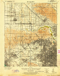 1921 Santa Monica1921 Print · USGSLos Angeles and the San Fernando Valley are captured here just as the suburban boom began to accelerate. Genealogists and researchers can trace the rail-connected origins of Lankershim, Universal City, and the Salt Lake Oil Fields.3 unique versions available
 - 1923 Map of Venice
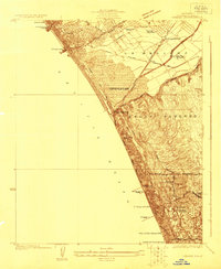 1923 Venice1923 Print · USGSThe Los Angeles coastline was a mix of seaside resorts and industrial pioneers in the early twenties. Genealogists and historians can trace early residential blocks in Venice or locate vanished landmarks like the Del Rey Gun Club and the Standard Oil Refinery.
 - 1924 Map of Venice
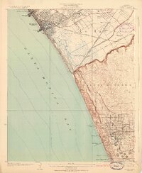 1924 Venice1924 Print · USGSThe Los Angeles coastline in the mid-twenties shows a rapidly developing landscape of seaside piers and industrial refineries. Trace early transit routes along the Pacific Electric railway and locate vanished landmarks like the Motordrome or the Recreation Gun Club.3 unique versions available
 - 1925 Map of Sawtelle
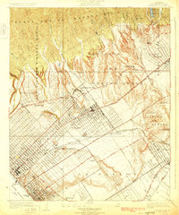 1925 Sawtelle1925 Print · USGSWest Los Angeles in the mid-twenties shows a landscape of grand ranchos and early suburban grids. You can trace the Pacific Electric rail lines connecting Sawtelle and Beverley Hills or locate the sprawling Soldiers Home and its cemetery.2 unique versions available
 - 1928 Map of Topanga Canyon
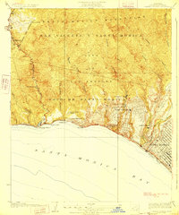 1928 Topanga Canyon1928 Print · USGSAlong the Los Angeles coast in the late twenties, the shoreline was a string of ranch lands and early social colonies. Trace the development of Pacific Palisades and Castellammare or find early landmarks like Trippet Ranch and the Pacific Palisades Auto Camp.3 unique versions available
 - 1934 Map of Sawtelle
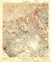 1934 Sawtelle1934 Print · USGSWest Los Angeles and Santa Monica undergo a period of rapid suburban and institutional expansion during the early thirties. Local researchers can trace the development of UCLA, the expansive Soldiers Home, and the legendary Fox Studio grounds.3 unique versions available
 - 1934 Map of Venice
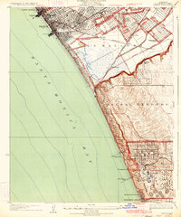 1934 Venice1934 Print · USGSThe Los Angeles coast in the mid-1930s reveals a landscape of tidal lagoons and burgeoning seaside industries. Researchers can trace the early rail network of the Pacific Electric, the footprint of Loyola University, and the massive Standard Oil Co Refinery.3 unique versions available
 - 1943 Map of San Pedro
 1943 San Pedro1943 Print · USGSThe South Bay and Los Angeles Harbor area appear here during the Second World War, showing a landscape of burgeoning industry and aviation. Trace wartime infrastructure and local landmarks like Hughes Airport, Terminal Island, and Inglewood Park Cem.
 - 1944 Map of Calabasas
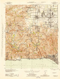 1944 Calabasas1944 Print · USGSMid-century Los Angeles County unfolds here, showing the grid of the San Fernando Valley meeting the Santa Monica Mountains. Trace old ranch boundaries at Platt Ranch or locate early landmarks like the Will Rogers Memorial and Topanga Lookout.
 - 1944 Map of Redondo
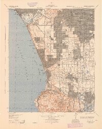 1944 Redondo1944 Print · USGSCoastal Los Angeles at the height of the Second World War shows a landscape defined by expanding refineries, rail lines, and beach towns. Genealogists and historians can trace the foundations of South Bay industry through the Standard Oil Co Refinery, Inglewood Park Cemetery, and the early Pacific Electric routes.
 - 1949 Map of Los Angeles
 1949 Los Angeles1949 Print · USGSSouthern California and the South Coast appear at the onset of the post-war boom, from the Channel Islands to the Mojave Desert. Trace early aviation sites like Lockheed Air Terminal and mining history at the Redrock Quicksilver Mine and Redrover Mine.2 unique versions available
 - 1949 Map of Long Beach
 1949 Long Beach1949 Print · USGSSouthern California at the start of the post-war boom shows the rapid development of the Los Angeles basin and the South Bay. Genealogists and historians can trace the evolution of early suburbs like Gardena and Lynwood or the coastal defenses at Ft MacArthur Lower Reservation.2 unique versions available
 - 1950 Map of Beverly Hills, 1952 Print
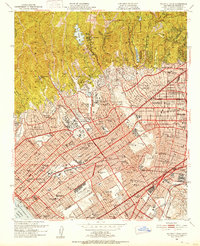 1950 Beverly Hills1952 Print · USGSBeverly Hills and the Westside are captured during a period of rapid post-war expansion along the base of the Santa Monica Mountains. Researchers can trace the legacy of the Soldiers Home, the early campus of UCLA, and the Pacific Electric rail lines.4 unique versions available
 - 1950 Map of Venice, 1952 Print
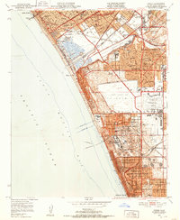 1950 Venice1952 Print · USGSThe Westside and South Bay are captured here during the post-war building boom, showing the early footprint of Los Angeles International Airport. Researchers can trace the era's infrastructure through the Pacific Electric lines, old schools like Venice High Sch, and the now-defunct Culver City Airport.2 unique versions available
Showing maps 1-25 of 52
Top cities near Santa Monica
- Los Angeles historical maps
- Glendale historical maps
- Torrance historical maps
- Simi Valley historical maps
- Inglewood historical maps
- Burbank historical maps
See more
Top neighborhoods of Santa Monica
Frequently asked questions
- What are the different types of historical maps available for Santa Monica?
- What is the oldest map of Santa Monica?
- Where can I purchase historical maps of Santa Monica for my home or office?
- Where can I download high-res historical maps of Santa Monica?
- Are there historical topographic maps available for Santa Monica?
- Is there historical aerial imagery available for Santa Monica?
- Where are historical maps of Santa Monica sourced from?