2020s Maps of Woodacre, California
Explore 1 historic maps of Woodacre from the 2020s. These maps offer a rare glimpse into what life looked like during the 2020s — showing old roads, neighborhoods, homes, and landmarks that have changed or disappeared over time.
Whether you're researching your family's past, planning a metal detecting trip, or studying how Woodacre's landscape evolved across the 2020s, these high-resolution maps are a powerful tool for exploring the history of this region.
- Focus on a specific era: All maps on this page are from the 2020s, giving you a focused view of this time period.
- See what’s changed: Compare century-old streets, trails, and buildings to today's modern landscape using overlays and satellite layers.
- Research with precision: Use these maps for genealogy, historical research, land use analysis, or educational projects.
- View, download, or print: Maps are fully viewable online in high resolution, and can be downloaded or printed for your own records.
Start exploring Woodacre's history through authentic maps from the 2020s. This is your window into the past.
Woodacre, CA maps
(1)- 2021 Map of San Geronimo, 2021 Print
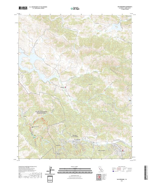 2021 San Geronimo2021 Print · USGSThe San Geronimo Valley and Nicasio ranchlands are documented here in the early twenty-first century as they maintain their rural character. Researchers can find precise locations for Taylor Cem, the small settlement of Jewell, and the peaks of Big Rock Ridge.
End of results
Showing maps 1-1 of 1
Top cities near Woodacre
- San Francisco historical maps
- Richmond historical maps
- Petaluma historical maps
- San Rafael historical maps
- Novato historical maps
- Mill Valley historical maps
See more
Frequently asked questions
- What are the different types of historical maps available for Woodacre?
- What is the oldest map of Woodacre?
- Where can I purchase historical maps of Woodacre for my home or office?
- Where can I download high-res historical maps of Woodacre?
- Are there historical topographic maps available for Woodacre?
- Is there historical aerial imagery available for Woodacre?
- Where are historical maps of Woodacre sourced from?