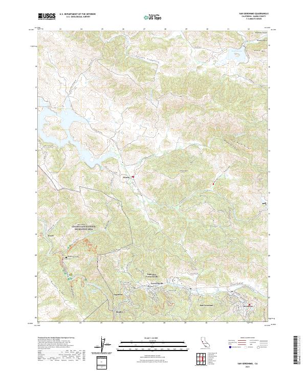
2021 Map of San Geronimo
USGS Topo · Published 2021About this map
Nicasio sits at the heart of this coastal valley landscape, where the intersections of Nicasio Valley Rd and Point Reyes Petaluma Rd define a historic ranching and dairy hub. To the south, the San Geronimo Valley settlements of Woodacre, San Geronimo, and Lagunitas-Forest Knolls follow the course of San Geronimo Cr through a series of wooded ridges. The map highlights the extensive protected lands within the Golden Gate National Recreation Area, including the heights of Barnabe Mtn and the narrow corridor of Devils Gulch.
Find a feature on this map
94 named features on this map. Tap any name to fly to it.
Don’t see what you’re looking for? This feature index may not catch every label — zoom into the map to look around manually.
Map Details
Editions of this 2021 San Geronimo Map
This is the sole edition of this map. No revisions or reprints were ever made.
Other maps of this area

1897 · Tamalpais
USGS Topo · 1:62,500

1914 · Petaluma
USGS Topo · 1:62,500

1916 · Point Reyes
USGS Topo · 1:48,000

1918 · Point Reyes
USGS Topo · 1:62,500

1941 · Tamalpais
USGS Topo · 1:62,500

1942 · Petaluma
USGS Topo · 1:62,500

1947 · Santa Rosa
USGS Topo · 1:250,000

1947 · San Francisco
USGS Topo · 1:250,000

1948 · San Francisco
USGS Topo · 1:250,000

1949 · Santa Rosa
USGS Topo · 1:250,000