
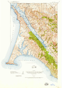
1916 Map of Point Reyes
USGS Topo · Published 1916About this map
Tomales Bay and the jagged peninsula of Punta de los Reyes anchor this survey of West Marin during the mid-1910s. The landscape is a network of coastal ranching and maritime infrastructure, featuring numerous family-named landmarks such as Adams Ranch, Glenn Ranch, and Muddy Hollow Ranch. The importance of water-based transport and regional commerce is evident through sites like Lairds Landing, Blakes Landing, and the Paper Mill near Olema.
Find a feature on this map
79 named features on this map. Tap any name to fly to it.
Don’t see what you’re looking for? This feature index may not catch every label — zoom into the map to look around manually.
Map Details
Editions of this 1916 Point Reyes Map
2 editions found
Other maps of this area

1897 · Tamalpais
USGS Topo · 1:62,500

1914 · Petaluma
USGS Topo · 1:62,500

1916 · Santa Rosa
USGS Topo · 1:62,500

1918 · Point Reyes
USGS Topo · 1:62,500

1935 · Sebastopol
USGS Topo · 1:48,000

1941 · Tamalpais
USGS Topo · 1:62,500

1942 · Sebastopol
USGS Topo · 1:62,500

1942 · Petaluma
USGS Topo · 1:62,500

1942 · Bodega Head
USGS Topo · 1:24,000

1944 · Santa Rosa
USGS Topo · 1:62,500