
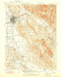
1944 Map of Santa Rosa
USGS Topo · Published 1944About this map
Santa Rosa serves as the focal point of this 1944 revision, where the dense grid of the city meets the radiating agricultural valleys of Sonoma County. The landscape is defined by its early land grants, including San Miguel and Cabeza de Santa Rosa, which still influenced property patterns during the mid-century. Transportation is dominated by the Northwestern Pacific railroad, connecting established towns like Kenwood, Glen Ellen, and Cotati.
Find a feature on this map
78 named features on this map. Tap any name to fly to it.
Don’t see what you’re looking for? This feature index may not catch every label — zoom into the map to look around manually.
Map Details
Editions of this 1944 Santa Rosa Map
2 editions found
Other maps of this area

1902 · Napa
USGS Topo · 1:125,000

1914 · Petaluma
USGS Topo · 1:62,500

1916 · Mare Island
USGS Topo · 1:62,500

1916 · Santa Rosa
USGS Topo · 1:62,500

1916 · Point Reyes
USGS Topo · 1:48,000

1918 · Point Reyes
USGS Topo · 1:62,500

1920 · Healdsburg
USGS Topo · 1:62,500

1927 · Calistoga
USGS Topo · 1:62,500

1933 · Healdsburg
USGS Topo · 1:48,000

1935 · Sebastopol
USGS Topo · 1:48,000