
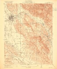
1916 Map of Santa Rosa
USGS Topo · Published 1916About this map
Santa Rosa serves as the focal point of this 1916 survey, appearing at a time when the city was a critical hub for the Northwestern Pacific and Southern Pacific railroads. The landscape is a network of Spanish land grant legacies like Cabeza De Santa Rosa and Roblar De La Miseria, where the agricultural economy is evidenced by a Winery, the County Farm, and numerous rural schoolhouses such as Todd School and Strawberry School. To the east, the Sonoma Mountains and Mayacamas Mountains frame the valley, sheltering specialized sites like the Sonoma State Home and Nuns Iron Spring. The map captures a moment when transport was transitioning from the old Adobe Fort era toward modern connections like the State Highway, while small flag stops and communities like Kenwood, Glen Ellen, and Melitta thrived along the rail lines.
Find a feature on this map
93 named features on this map. Tap any name to fly to it.
Don’t see what you’re looking for? This feature index may not catch every label — zoom into the map to look around manually.
Map Details
Editions of this 1916 Santa Rosa Map
3 editions found
Other maps of this area

1902 · Napa
USGS Topo · 1:125,000

1914 · Petaluma
USGS Topo · 1:62,500

1916 · Mare Island
USGS Topo · 1:62,500

1916 · Point Reyes
USGS Topo · 1:48,000

1918 · Point Reyes
USGS Topo · 1:62,500

1920 · Healdsburg
USGS Topo · 1:62,500

1927 · Calistoga
USGS Topo · 1:62,500

1933 · Healdsburg
USGS Topo · 1:48,000

1935 · Sebastopol
USGS Topo · 1:48,000

1940 · Healdsburg
USGS Topo · 1:62,500