
1942 Map of Sebastopol
USGS Topo · Published 1942About this map
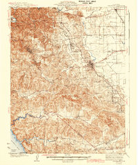
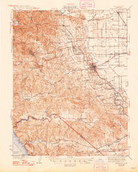
Sebastopol serves as the focal point for this mid-century portrait of western Sonoma County, where the agricultural flats of the Llano de Santa Rosa meet the winding drainages of the coastal hills. The map documents an intricate network of local education and community hubs, featuring rural institutions like Gold Ridge Sch and Pleasant Hill Sch alongside established settlements like Forestville and Graton. Transportation in this era was defined by the Northwestern Pacific RR and the Petaluma and Santa Rosa RR, which connected the inland valleys to the redwood-shaded canyons of the west.
Find a feature on this map
92 named features on this map. Tap any name to fly to it.
Don’t see what you’re looking for? This feature index may not catch every label — zoom into the map to look around manually.
Map Details
Editions of this 1942 Sebastopol Map
3 editions found
Other maps of this area

1914 · Petaluma
USGS Topo · 1:62,500

1916 · Santa Rosa
USGS Topo · 1:62,500

1916 · Point Reyes
USGS Topo · 1:48,000

1918 · Point Reyes
USGS Topo · 1:62,500

1920 · Healdsburg
USGS Topo · 1:62,500

1921 · Skaggs
USGS Topo · 1:62,500

1927 · Calistoga
USGS Topo · 1:62,500

1933 · Healdsburg
USGS Topo · 1:48,000

1935 · Sebastopol
USGS Topo · 1:48,000

1940 · Healdsburg
USGS Topo · 1:62,500