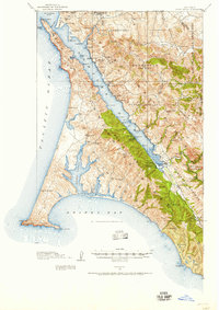
1916 Map of Point Reyes
USGS Topo · Published 1957About this map
The coastal landscape of Marin County is defined here by the long, narrow reach of Tomales Bay, separating the rugged Inverness Ridge from the mainland hills. Along the eastern shore, the Northwestern Pacific RR links small coastal outposts like Marshall and Marconi to the regional hub at Point Reyes Station. This rail corridor was essential for the local dairy and ranching economy, connecting inland valleys to the shipping routes of the Pacific Ocean. On the peninsula, specialized sites like the Coast Guard Station and the Blacksmith Shop near Point Reyes School highlight the maritime and agricultural self-sufficiency of the era. The presence of numerous named ranches, including Pierce Ranch and Adams Ranch, alongside local landmarks like the Trout Farm and Inverness Park, provides a detailed record of land use before the establishment of modern park boundaries.
Find a feature on this map
80 named features on this map. Tap any name to fly to it.
Don’t see what you’re looking for? This feature index may not catch every label — zoom into the map to look around manually.
Map Details
Editions of this 1916 Point Reyes Map
2 editions found
Other maps of this area

1897 · Tamalpais
USGS Topo · 1:62,500

1914 · Petaluma
USGS Topo · 1:62,500

1916 · Santa Rosa
USGS Topo · 1:62,500

1916 · Point Reyes
USGS Topo · 1:48,000

1918 · Point Reyes
USGS Topo · 1:62,500

1935 · Sebastopol
USGS Topo · 1:48,000

1941 · Tamalpais
USGS Topo · 1:62,500

1942 · Sebastopol
USGS Topo · 1:62,500

1942 · Petaluma
USGS Topo · 1:62,500

1942 · Bodega Head
USGS Topo · 1:24,000