2000s (21st Century) Maps of Fish Camp, California
Explore 5 historic maps of Fish Camp from the 2000s (21st Century). These maps offer a rare glimpse into what life looked like during the 2000s — showing old roads, neighborhoods, homes, and landmarks that have changed or disappeared over time.
Whether you're researching your family's past, planning a metal detecting trip, or studying how Fish Camp's landscape evolved across the 2000s, these high-resolution maps are a powerful tool for exploring the history of this region.
- Focus on a specific era: All maps on this page are from the 2000s, giving you a focused view of this time period.
- See what’s changed: Compare century-old streets, trails, and buildings to today's modern landscape using overlays and satellite layers.
- Research with precision: Use these maps for genealogy, historical research, land use analysis, or educational projects.
- View, download, or print: Maps are fully viewable online in high resolution, and can be downloaded or printed for your own records.
Start exploring Fish Camp's history through authentic maps from the 2000s. This is your window into the past.
Fish Camp, CA maps
(5)- 2004 Map of Fish Camp, 2007 Print
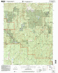 2004 Fish Camp2007 Print · USGSThe borderlands of Mariposa and Madera Counties are captured here during the early 2000s, showcasing the intersection of timber history and park land. Researchers can trace the legacy of mountain industry and indigenous sites at Harris Ranch Mill, Sugar Pine, and the Wassama Roundhouse State Historical Park.
 - 2012 Map of Fish Camp, 2012 Print
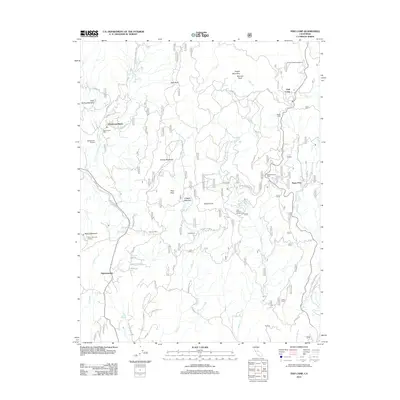 2012 Fish Camp2012 Print · USGSCovers Fish Camp, including Sugar Pine, Ponderosa Basin, and other nearby areas
 - 2015 Map of Fish Camp, 2015 Print
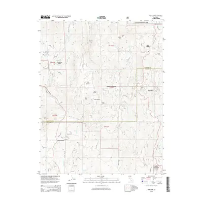 2015 Fish Camp2015 Print · USGSCovers Fish Camp, including Sugar Pine, Ponderosa Basin, and other nearby areas
 - 2018 Map of Fish Camp, 2018 Print
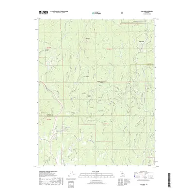 2018 Fish Camp2018 Print · USGSCovers Fish Camp, including Sugar Pine, Ponderosa Basin, and other nearby areas
 - 2021 Map of Fish Camp, 2021 Print
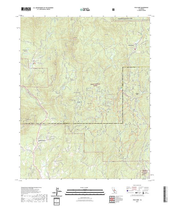 2021 Fish Camp2021 Print · USGSThe Sierra Nevada mountains at the Yosemite boundary are captured here in the early twenty-first century. Genealogists and historians can trace family locations near Harris Family Cem or follow old routes like Grant Grade-Tollroad and the Ten Mile RR Spur.
End of results
Showing maps 1-5 of 5
Top cities near Fish Camp
Frequently asked questions
- What are the different types of historical maps available for Fish Camp?
- What is the oldest map of Fish Camp?
- Where can I purchase historical maps of Fish Camp for my home or office?
- Where can I download high-res historical maps of Fish Camp?
- Are there historical topographic maps available for Fish Camp?
- Is there historical aerial imagery available for Fish Camp?
- Where are historical maps of Fish Camp sourced from?