Old Maps of Cleone, California for Academic Research
Study the evolution of Cleone with 11 high-resolution historic maps. Whether you're teaching, researching, or modeling changes in land use, these maps provide essential visual documentation of urban, environmental, and geographic change.
- Analyze long-term change: Track patterns in development, transportation, and natural features.
- Ideal for environmental or urban studies: Support academic projects with primary historical map data.
- Use in the classroom or lab: Educators and researchers rely on these maps to bring historical context to life.
These maps are a powerful tool for teaching, research, and visualizing how Cleone has changed over the decades.
Cleone, CA maps
(11)- 1920 Map of Fort Bragg, 1928 Print
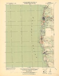 1920 Fort Bragg1928 Print · USGSThe Mendocino coast in the early twentieth century reveals a rugged network of timber ports and pioneer rail lines. Genealogists and historians can trace the early footprints of Fort Bragg, the Cal Western R R & Nav Co railroad, and the historic lighthouse area at Pt. Cabrillo.
 - 1943 Map of Fort Bragg
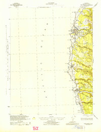 1943 Fort Bragg1943 Print · USGSMendocino County's coastal timber and fishing hubs are captured here during the early 1940s. Researchers can trace the Caspar South Fork Railroad and explore early layouts of Fort Bragg, Mendocino, and the Heeser Addition.2 unique versions available
 - 1957 Map of Ukiah, 1966 Print
 1957 Ukiah1966 Print · USGSNorthern California's diverse terrain comes into focus in the mid-1950s, from the rugged timberlands of the Jackson State Forest to the productive Sacramento Valley. Genealogists and historians can trace the rail lines of the Northwestern Pacific or locate early valley settlements like Arbuckle and Paskenta.3 unique versions available
 - 1960 Map of Ukiah
 1960 Ukiah1960 Print · USGSNorthern California during the late fifties reveals a landscape of deep timber forests and valley agriculture before modern expansion. Trace the historic rail lines of the California Western RR and the Northwestern Pacific RR through settlements like Fort Bragg and Ukiah.2 unique versions available
 - 1960 Map of Fort Bragg, 1962 Print
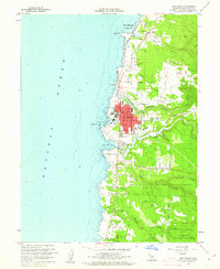 1960 Fort Bragg1962 Print · USGSThe Mendocino coast is shown at a peak of its mid-century industrial and timber era, centered on the bustling hub of Fort Bragg. Researchers can trace the path of the California Western RR or locate coastal landmarks like Lake Cleone and the Noyo waterfront.5 unique versions available
 - 1960 Map of Fort Bragg, 1963 Print
 1960 Fort Bragg1963 Print · USGSThe Mendocino coast in the early sixties remains a hub for timber and coastal trade before its full modern tourism expansion. Trace the California Western railroad line or locate historical maritime landmarks like the Point Cabrillo Light Station and Caspar Anchorage.2 unique versions available
 - 1981 Map of Ukiah
 1981 Ukiah1981 Print · USGSMendocino County’s timber and rail landscape is captured here in the early eighties, from the coastal lumber mills to the inland valleys. Trace the California Western Railroad and find settlements like Fort Bragg, Comptche, and Navarro.3 unique versions available
 - 2012 Map of Fort Bragg, 2012 Print
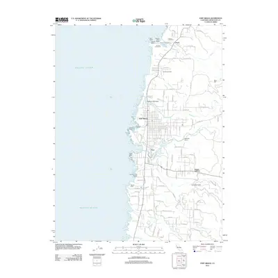 2012 Fort Bragg2012 Print · USGSCovers Cleone, including Fort Bragg, Mendocino County, and other nearby areas
 - 2015 Map of Fort Bragg, 2015 Print
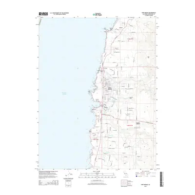 2015 Fort Bragg2015 Print · USGSCovers Cleone, including Fort Bragg, Mendocino County, and other nearby areas
 - 2018 Map of Fort Bragg, 2018 Print
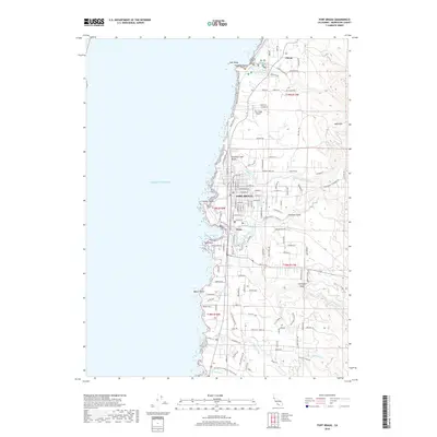 2018 Fort Bragg2018 Print · USGSCovers Cleone, including Fort Bragg, Mendocino County, and other nearby areas
 - 2021 Map of Fort Bragg, 2021 Print
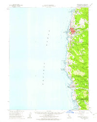
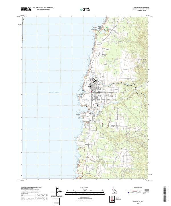 2021 Fort Bragg2021 Print · USGSFort Bragg and the Mendocino coast are documented here in the early twenty-first century as the region balances its industrial roots with parkland and education. Researchers can locate Rose Memorial Park Cem, the Fort Bragg Airport, and the historic fishing hub of Noyo.
End of results
Showing maps 1-11 of 11
Top cities near Cleone
Frequently asked questions
- What are the different types of historical maps available for Cleone?
- What is the oldest map of Cleone?
- Where can I purchase historical maps of Cleone for my home or office?
- Where can I download high-res historical maps of Cleone?
- Are there historical topographic maps available for Cleone?
- Is there historical aerial imagery available for Cleone?
- Where are historical maps of Cleone sourced from?