2020s Maps of Atwater, California
Explore 3 historic maps of Atwater from the 2020s. These maps offer a rare glimpse into what life looked like during the 2020s — showing old roads, neighborhoods, homes, and landmarks that have changed or disappeared over time.
Whether you're researching your family's past, planning a metal detecting trip, or studying how Atwater's landscape evolved across the 2020s, these high-resolution maps are a powerful tool for exploring the history of this region.
- Focus on a specific era: All maps on this page are from the 2020s, giving you a focused view of this time period.
- See what’s changed: Compare century-old streets, trails, and buildings to today's modern landscape using overlays and satellite layers.
- Research with precision: Use these maps for genealogy, historical research, land use analysis, or educational projects.
- View, download, or print: Maps are fully viewable online in high resolution, and can be downloaded or printed for your own records.
Start exploring Atwater's history through authentic maps from the 2020s. This is your window into the past.
Atwater, CA maps
(3)- 2021 Map of Arena, 2021 Print
 2021 Arena2021 Print · USGSThe agricultural heart of Merced County is captured here in the early twenty-first century, showing the developed landscapes between Livingston and Atwater. Genealogists and local historians can trace the complex water networks of the San Joaquin Valley, identifying landmarks like the E Side Canal, Arena, and Bear Creek.
 - 2021 Map of Atwater, 2021 Print
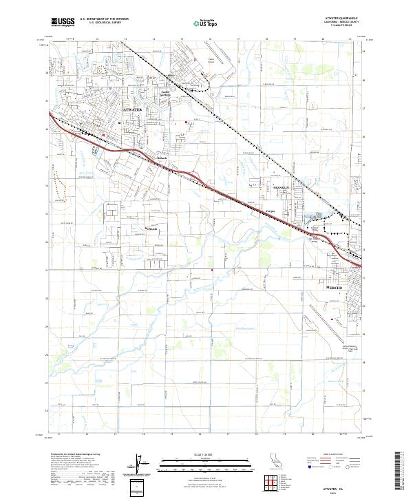 2021 Atwater2021 Print · USGSMerced County agriculture and aviation history converge here in the early twenty-first century. Genealogists and researchers can trace the developed landscape from the Castle Airforce Base grounds to rural hubs like Buhach and McSwain.
 - 2021 Map of Winton, 2021 Print
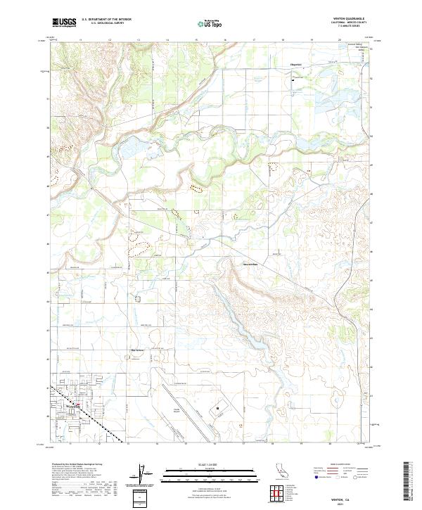 2021 Winton2021 Print · USGSMerced County agriculture and aviation meet in the San Joaquin Valley during this recent era. Genealogists and local historians can trace the irrigation network from the Merced River to Winton, or locate rural landmarks like Hopeton Cem and Castle Airport.
End of results
Showing maps 1-3 of 3
Top cities near Atwater
- Merced historical maps
- Turlock historical maps
- Livingston historical maps
- Delhi historical maps
- Winton historical maps
- Denair historical maps
See more
Top neighborhoods of Atwater
Frequently asked questions
- What are the different types of historical maps available for Atwater?
- What is the oldest map of Atwater?
- Where can I purchase historical maps of Atwater for my home or office?
- Where can I download high-res historical maps of Atwater?
- Are there historical topographic maps available for Atwater?
- Is there historical aerial imagery available for Atwater?
- Where are historical maps of Atwater sourced from?