Old Maps of Atwater, California for Hiking & Exploration
Hike through history with 27 historic maps of Atwater. Explore old trails, ghost towns, and forgotten backroads — perfect for outdoor adventurers and local explorers.
- Rediscover forgotten places: Map out old mining camps, roads, and footpaths that no longer exist on modern maps.
- Layer with modern tools: Combine with LiDAR or satellite views to plan hikes through historical terrain.
- Made for exploration: Popular among hikers, overlanders, and local history lovers.
Use these maps to find adventure and explore the hidden past of Atwater.
Atwater, CA maps
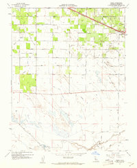
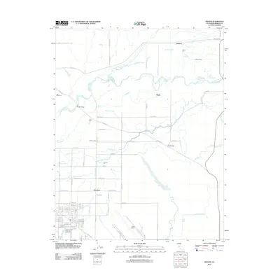
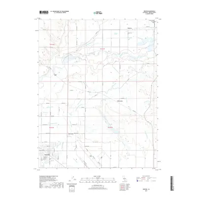
(27)- 1917 Map of Winton
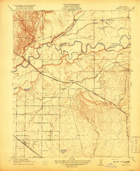 1917 Winton1917 Print · USGSMerced County agriculture was flourishing during the First World War as three major rail lines crossed the valley floor. Genealogists and local historians can trace early settlements at Winton and Amsterdam or locate rural landmarks like Hopeton School.2 unique versions available
 - 1918 Map of Arena
 1918 Arena1918 Print · USGSMerced County agriculture and rural life are captured here during the First World War. Genealogists can locate family homesteads near country landmarks like Witmer School, Jordan School, and the village of Arena along the Southern Pacific tracks.2 unique versions available
 - 1918 Map of Atwater
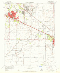
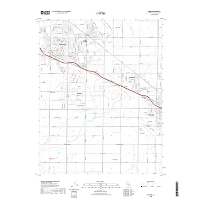
 1918 Atwater1918 Print · USGSMerced County agriculture was flourishing during the First World War as rail lines and irrigation transformed the landscape. Researchers can trace early school districts like McSwain School and Franklin School alongside the competing tracks of the Southern Pacific and the Atchison Topeka and Santa Fe.
 - 1947 Map of San Jose, 1948 Print
 1947 San Jose1948 Print · USGSNorthern California's heartland is captured here just after the war, showing the rapid growth of the Santa Clara and Central Valleys. Researchers can trace the legacy of rail and water at Castle Air Force Base, Stockton, and the Hetch Hetchy Aqueduct.
 - 1948 Map of Winton
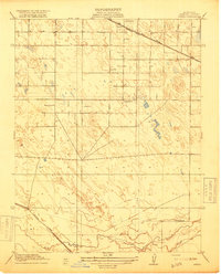
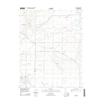
 1948 Winton1948 Print · USGSMerced County agriculture and military aviation converge in this late-1940s survey of the San Joaquin Valley. Local historians can trace the irrigation network of the Escaladian Canal or locate family sites like Reinero Ranch and Washington Sch.2 unique versions available
 - 1948 Map of Arena
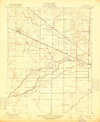
 1948 Arena1948 Print · USGSAgricultural Merced County comes into sharp focus in the late 1940s, showing the precise grid of irrigation and transport that fueled the Central Valley. Researchers can trace historic property boundaries along family-named roads like McGinley Lateral and locate local landmarks such as Arena Sch and Jordan Sch.
 - 1948 Map of Atwater
 1948 Atwater1948 Print · USGSThe Central Valley's agricultural and military landscape is captured here in the late 1940s as irrigation and aviation began to reshape the region. Local historians can trace family-named roads and rural schoolhouses like Buhach Sch and Eschscholtzia Sch alongside Castle Field.2 unique versions available
 - 1956 Map of San Jose
 1956 San Jose1956 Print · USGSCentral California in the mid-fifties reveals the transition from sprawling orchards to growing urban hubs like San Jose and Stockton. Genealogists and historians can trace the rail-era landscape of the Mother Lode through Chinese Camp and Tuttletown, or follow the water through the Joaquin River and Calaveras Reservoir.
 - 1960 Map of Arena, 1961 Print
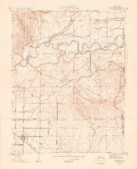
 1960 Arena1961 Print · USGSMerced County at the start of the 1960s showcases a landscape transformed by intensive irrigation and the Southern Pacific rail line. Researchers can trace the layout of Arena and early Atwater, alongside specialized features like the Tin Flume and Airstrip.3 unique versions available
 - 1960 Map of Atwater, 1961 Print
 1960 Atwater1961 Print · USGSAtwater and the outskirts of Merced are seen here at the dawn of the sixties, characterized by a mix of military presence and intensive irrigation. Trace the evolution of Castle Air Force Base or locate local landmarks like the County Honor Farm and McSwain School.4 unique versions available
 - 1961 Map of Winton, 1963 Print
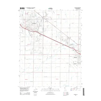
 1961 Winton1963 Print · USGSMerced County agriculture and military operations intersect in the early sixties near the town of Winton. Local researchers can trace the footprint of Castle Air Force Base alongside community landmarks like Hopeton Cem and the Shaffer Bridge over the river.3 unique versions available
 - 1961 Map of Atwater, 1963 Print
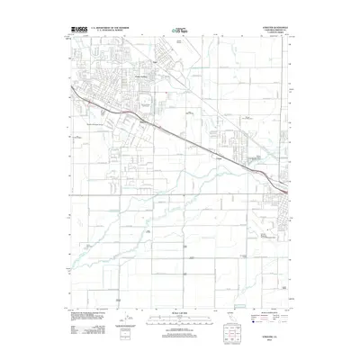
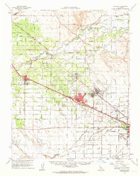 1961 Atwater1963 Print · USGSThe San Joaquin Valley's agricultural and military landscape comes alive in the early sixties as the jet age meets established rail towns. Local historians can trace the development of Castle Air Force Base and find local landmarks like Hopeton Cem, Shaffer Bridge, and numerous rural schools.2 unique versions available
 - 1962 Map of San Jose
 1962 San Jose1962 Print · USGSCentral California in the early sixties showcases the expansion of the San Joaquin and Santa Clara valleys. Researchers can trace the rail-to-road transition along the Southern Pacific RR or locate landmarks like Castle USAF Base and Loma Prieta.4 unique versions available
 - 1966 Map of San Jose
 1966 San Jose1966 Print · USGSCentral California in the mid-1960s reveals a landscape of massive irrigation projects and expanding Cold War military footprints. Researchers can trace the rail-and-river network of the San Joaquin Valley or locate specialized sites like Castle Air Force Base and the Sharp General Depot (Military).
 - 1983 Map of Merced
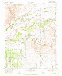
 1983 Merced1983 Print · USGSThe San Joaquin Valley at the start of the eighties is captured here in its full agricultural and military height. Trace the legacy of Castle Air Force Base, old mines like Pocahontas Mine, and the vast Kesterson National Wildlife Refuge.
 - 2012 Map of Arena, 2012 Print
 2012 Arena2012 Print · USGSCovers Atwater, including Livingston, Arena, and other nearby areas
 - 2012 Map of Winton, 2012 Print
 2012 Winton2012 Print · USGSCovers Atwater, including Winton, Hopeton, and other nearby areas
 - 2012 Map of Atwater, 2012 Print
 2012 Atwater2012 Print · USGSCovers Atwater, including Merced, Fergus, and other nearby areas
 - 2015 Map of Arena, 2015 Print
 2015 Arena2015 Print · USGSCovers Atwater, including Livingston, Arena, and other nearby areas
 - 2015 Map of Winton, 2015 Print
 2015 Winton2015 Print · USGSCovers Atwater, including Winton, Hopeton, and other nearby areas
 - 2015 Map of Atwater, 2015 Print
 2015 Atwater2015 Print · USGSCovers Atwater, including Merced, Fergus, and other nearby areas
 - 2018 Map of Atwater, 2018 Print
 2018 Atwater2018 Print · USGSCovers Atwater, including Merced, Fergus, and other nearby areas
 - 2018 Map of Winton, 2018 Print
 2018 Winton2018 Print · USGSCovers Atwater, including Winton, Hopeton, and other nearby areas
 - 2018 Map of Arena, 2018 Print
 2018 Arena2018 Print · USGSCovers Atwater, including Livingston, Arena, and other nearby areas
 - 2021 Map of Arena, 2021 Print
 2021 Arena2021 Print · USGSThe agricultural heart of Merced County is captured here in the early twenty-first century, showing the developed landscapes between Livingston and Atwater. Genealogists and local historians can trace the complex water networks of the San Joaquin Valley, identifying landmarks like the E Side Canal, Arena, and Bear Creek.
Showing maps 1-25 of 27
Top cities near Atwater
- Merced historical maps
- Turlock historical maps
- Livingston historical maps
- Delhi historical maps
- Winton historical maps
- Denair historical maps
See more
Top neighborhoods of Atwater
Frequently asked questions
- What are the different types of historical maps available for Atwater?
- What is the oldest map of Atwater?
- Where can I purchase historical maps of Atwater for my home or office?
- Where can I download high-res historical maps of Atwater?
- Are there historical topographic maps available for Atwater?
- Is there historical aerial imagery available for Atwater?
- Where are historical maps of Atwater sourced from?