1900s (20th Century) Maps of Tuttle, California
Explore 11 historic maps of Tuttle from the 1900s (20th Century). These maps offer a rare glimpse into what life looked like during the 1900s — showing old roads, neighborhoods, homes, and landmarks that have changed or disappeared over time.
Whether you're researching your family's past, planning a metal detecting trip, or studying how Tuttle's landscape evolved across the 1900s, these high-resolution maps are a powerful tool for exploring the history of this region.
- Focus on a specific era: All maps on this page are from the 1900s, giving you a focused view of this time period.
- See what’s changed: Compare century-old streets, trails, and buildings to today's modern landscape using overlays and satellite layers.
- Research with precision: Use these maps for genealogy, historical research, land use analysis, or educational projects.
- View, download, or print: Maps are fully viewable online in high resolution, and can be downloaded or printed for your own records.
Start exploring Tuttle's history through authentic maps from the 1900s. This is your window into the past.
Tuttle, CA maps
(11)- 1914 Map of Merced
 1914 Merced1914 Print · USGSMerced and its surrounding farm colonies are captured in the early twentieth century as the railroad era transformed the valley. Genealogists and researchers can trace local landmarks like Farmdale School, the Merced County Hospital, and the small settlement at Tuttle.
 - 1917 Map of Merced
 1917 Merced1917 Print · USGSMerced was a bustling rail and agricultural center during the First World War era. Genealogists and local historians can locate early landmarks like the Merced County Hospital, the Bellevue Ranch, and several rural schoolhouses such as Farmdale School.
 - 1946 Map of Merced, 1954 Print
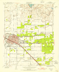 1946 Merced1954 Print · USGSMid-century Merced and its surrounding farm colonies are captured here just after the war, showing the area's transition into a regional agricultural powerhouse. Genealogists can locate family-named landmarks and rural education sites like Merced Colony School and the settlement of Creegan.
 - 1947 Map of San Jose, 1948 Print
 1947 San Jose1948 Print · USGSNorthern California's heartland is captured here just after the war, showing the rapid growth of the Santa Clara and Central Valleys. Researchers can trace the legacy of rail and water at Castle Air Force Base, Stockton, and the Hetch Hetchy Aqueduct.
 - 1948 Map of Merced
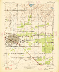 1948 Merced1948 Print · USGSMerced and its agricultural outskirts are captured in the late 1940s as a bustling railroad and institutional center. Genealogists and historians can trace family-named schools and small rail stops like Merced Colony Sch, Tuttle, and Bellevue Ranch.
 - 1956 Map of San Jose
 1956 San Jose1956 Print · USGSCentral California in the mid-fifties reveals the transition from sprawling orchards to growing urban hubs like San Jose and Stockton. Genealogists and historians can trace the rail-era landscape of the Mother Lode through Chinese Camp and Tuttletown, or follow the water through the Joaquin River and Calaveras Reservoir.
 - 1961 Map of Merced, 1963 Print
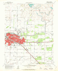 1961 Merced1963 Print · USGSMerced at the start of the 1960s reveals a growing Central Valley hub defined by its busy rail corridors and neighborhood schools. Genealogists can locate family sites near Evergreen Cemetery, Applegate Park, and landmark institutions like Our Lady of Mercy School.3 unique versions available
 - 1962 Map of San Jose
 1962 San Jose1962 Print · USGSCentral California in the early sixties showcases the expansion of the San Joaquin and Santa Clara valleys. Researchers can trace the rail-to-road transition along the Southern Pacific RR or locate landmarks like Castle USAF Base and Loma Prieta.4 unique versions available
 - 1962 Map of Merced, 1963 Print
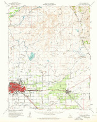 1962 Merced1963 Print · USGSMerced and the surrounding San Joaquin Valley are captured in the early sixties, showing a landscape defined by industrial agriculture and the steel rails of two major railroads. Genealogists and historians can trace family-named properties like La Paloma Ranch or locate local landmarks like Calvary Cem and Planada.
 - 1966 Map of San Jose
 1966 San Jose1966 Print · USGSCentral California in the mid-1960s reveals a landscape of massive irrigation projects and expanding Cold War military footprints. Researchers can trace the rail-and-river network of the San Joaquin Valley or locate specialized sites like Castle Air Force Base and the Sharp General Depot (Military).
 - 1983 Map of Merced
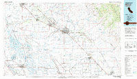 1983 Merced1983 Print · USGSThe San Joaquin Valley at the start of the eighties is captured here in its full agricultural and military height. Trace the legacy of Castle Air Force Base, old mines like Pocahontas Mine, and the vast Kesterson National Wildlife Refuge.
End of results
Showing maps 1-11 of 11
Top cities near Tuttle
- Merced historical maps
- Atwater historical maps
- Chowchilla historical maps
- Planada historical maps
- Le Grand historical maps
Frequently asked questions
- What are the different types of historical maps available for Tuttle?
- What is the oldest map of Tuttle?
- Where can I purchase historical maps of Tuttle for my home or office?
- Where can I download high-res historical maps of Tuttle?
- Are there historical topographic maps available for Tuttle?
- Is there historical aerial imagery available for Tuttle?
- Where are historical maps of Tuttle sourced from?