Old Maps of Willow Springs, California
Explore 14 old maps of Willow Springs, spanning from 1909 to today. These high-resolution historic maps reveal how streets, neighborhoods, landmarks, and natural features evolved over time — perfect for genealogy, metal detecting, research, and local history exploration.
What you can do with these maps:
- See how Willow Springs changed over time: Compare historical maps to modern-day views to trace roads, homesites, rail lines & more.
- View detailed metadata: Each map includes creators, publishers, year, scale, and archive source.
- Overlay maps with satellite & LiDAR: Visualize the past alongside modern tools to explore terrain & human change.
- Trusted historical sources: Maps sourced from the USGS, Library of Congress, and other archives.
- Access maps your way: View online, download high-res files, or order prints for personal or research use.
Start exploring old maps of Willow Springs to uncover forgotten places, hidden landmarks, and the deep history beneath your feet.
Willow Springs, CA maps
(14)- 1909 Map of Bridgeport, 1956 Print
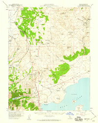
 1909 Bridgeport1956 Print · USGSThe High Sierra and Mono Basin are seen here in the decade following the peak of the local gold boom. Genealogists and historians can trace old stage routes and find significant mining sites like the Dunderberg Mine and the remote settlement of Belfort.
 - 1911 Map of Bridgeport
 1911 Bridgeport1911 Print · USGSMono County at the start of the twentieth century was a landscape of high-altitude mining camps and early park boundaries. Trace the footprints of the gold era at Bodie, locate family ranching history at Mormon Ranch, or study the remote Masonic Liberty Mine.7 unique versions available
 - 1920 Map of Bridgeport
 1920 Bridgeport1920 Print · USGSThe High Sierra and Mono Basin are shown here in the early twentieth century, during a peak period of mining and ranching. Researchers can locate vanished camps like Star City, trace the California Masonic Road, and find family names at Conway Ranch.
 - 1948 Map of Walker Lake
 1948 Walker Lake1948 Print · USGSThe high desert of Nevada and the eastern Sierra Nevada are captured just after the war as mining and ranching shaped the local economy. Genealogists can trace family connections to centers like Hawthorne and Mina or locate the historic Rockland Mines and Aurora.2 unique versions available
 - 1957 Map of Walker Lake
 1957 Walker Lake1957 Print · USGSThe Nevada-California borderlands in the mid-1950s show a rugged network of mining camps and river-valley towns centered around Walker Lake. Researchers can trace the Southern Pacific rail line and locate historical sites like Bodie, Sodaville, and the Leviathan Sulphur Mine.4 unique versions available
 - 1958 Map of Bodie, 1959 Print
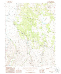
 1958 Bodie1959 Print · USGSThe Bodie Hills and Mono Lake shoreline are captured here in the late fifties, during a period when the historic mining district still stood in stark isolation. Genealogists and historians can trace the foundations of the boom era through the Bodie Cem, Mono Diggings, and the Red Cloud Mine.3 unique versions available
 - 1962 Map of Walker Lake
 1962 Walker Lake1962 Print · USGSThe high desert of western Nevada and the Sierra Nevada crest meet in this mid-century study of the Eastern Sierra frontier. Researchers can trace the Southern Pacific rail lines connecting Hawthorne to remote mining outposts like Bodie, Aurora, and Mina.
 - 1964 Map of Walker Lake
 1964 Walker Lake1964 Print · USGSThe high desert and the Sierra Nevada peaks come together in the mid-1960s, showing a landscape defined by mining, military installations, and vast wilderness. Genealogists and historians can trace the remnants of old mining camps at Bodie or Candelaria and follow the Southern Pacific rail lines.2 unique versions available
 - 1985 Map of Bridgeport
 1985 Bridgeport1985 Print · USGSThe High Sierra and Nevada borderlands are captured in the mid-1980s, documenting a landscape of national forests and high-altitude mining districts. Researchers can trace historic operations like the Bodie Mine and May Lundy Mine or locate early settlements at Aurora and Baker Station.
 - 1989 Map of Big Alkali
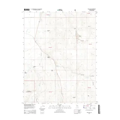
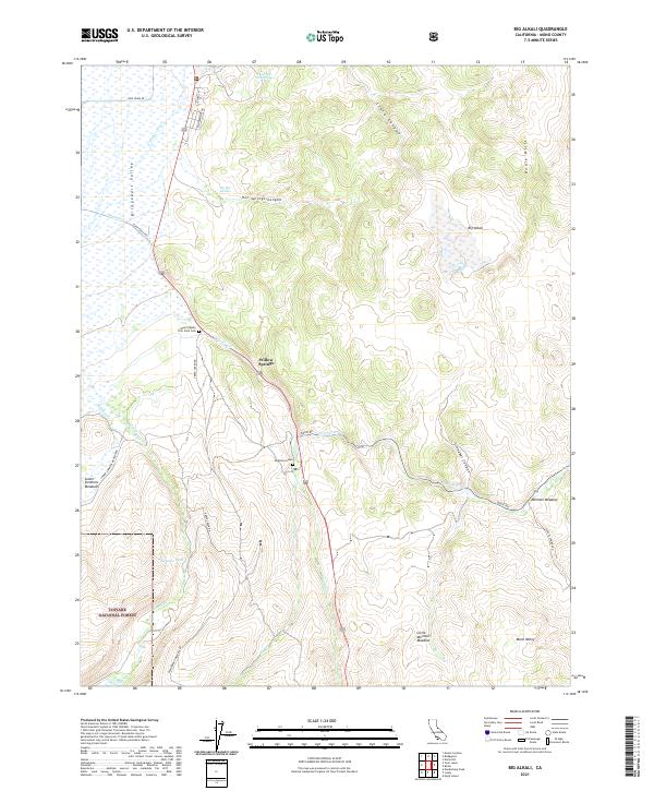
 1989 Big Alkali1989 Print · USGSMono County's high desert landscape comes into focus during the late 1980s, revealing a region of mineral wealth and geothermal activity. Researchers can locate the Dog Town (Site), trace the mining history at the Travertine Quarry, and find family landmarks like Point Ranch.2 unique versions available
 - 2012 Map of Big Alkali, 2012 Print
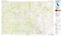
 2012 Big Alkali2012 Print · USGSCovers Willow Springs, including Mono County, United States, and other nearby areas
 - 2015 Map of Big Alkali, 2015 Print
 2015 Big Alkali2015 Print · USGSCovers Willow Springs, including Mono County, United States, and other nearby areas
 - 2018 Map of Big Alkali, 2018 Print
 2018 Big Alkali2018 Print · USGSCovers Willow Springs, including Mono County, United States, and other nearby areas
 - 2021 Map of Big Alkali, 2021 Print
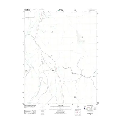
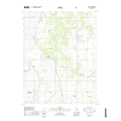
 2021 Big Alkali2021 Print · USGSHigh Sierra ranching and geothermal activity converge in these hills during the early twenty-first century. Researchers can trace historic local sites like Mono County Poor Farm Cem, the Dogtown Grave, and high-altitude pastures at Mormon Meadow.
End of results
Showing maps 1-14 of 14
Frequently asked questions
- What are the different types of historical maps available for Willow Springs?
- What is the oldest map of Willow Springs?
- Where can I purchase historical maps of Willow Springs for my home or office?
- Where can I download high-res historical maps of Willow Springs?
- Are there historical topographic maps available for Willow Springs?
- Is there historical aerial imagery available for Willow Springs?
- Where are historical maps of Willow Springs sourced from?