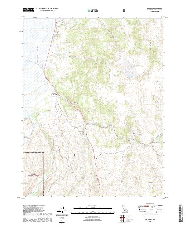
2021 Map of Big Alkali
USGS Topo · Published 2021About this map
Travertine Hot Springs and The Hot Springs define the geothermal character of this landscape in the northern Bodie Hills region. The terrain is marked by steep canyons such as Hot Springs Canyon, Clark Canyon, and Cinnabar Canyon, which descend toward the broad Bridgeport Valley and the Walker River. Local history is deeply etched into the land at sites like the Mono County Poor Farm Cem and the solitary Dogtown Grave near Willow Springs. Evidence of early utility and agriculture appears at Dynamo Pond and through a network of remote routes including Coyote Springs Rd and Bodie Rd. The map also captures several high-elevation meadows, specifically Mormon Meadow, Little Mormon Meadow, and Lower Summers Meadows, which provided vital grazing land for early settlers in this high Sierra Nevada transition zone.
Find a feature on this map
38 named features on this map. Tap any name to fly to it.
Don’t see what you’re looking for? This feature index may not catch every label — zoom into the map to look around manually.
Map Details
Editions of this 2021 Big Alkali Map
This is the sole edition of this map. No revisions or reprints were ever made.
Other maps of this area

1909 · Bridgeport
USGS Topo · 1:125,000

1911 · Bridgeport
USGS Topo · 1:125,000

1920 · Bridgeport
USGS Topo · 1:125,000

1948 · Walker Lake
USGS Topo · 1:250,000

1956 · Fales Hot Springs
USGS Topo · 1:62,500

1956 · Matterhorn Peak
USGS Topo · 1:62,500

1957 · Walker Lake
USGS Topo · 1:250,000

1958 · Bodie
USGS Topo · 1:62,500
1958 · Bridgeport
USGS Topo · 1:62,500

1962 · Walker Lake
USGS Topo · 1:250,000