1940s Maps of FOB Milpitas, California
Explore 4 historic maps of FOB Milpitas from the 1940s. These maps offer a rare glimpse into what life looked like during the 1940s — showing old roads, neighborhoods, homes, and landmarks that have changed or disappeared over time.
Whether you're researching your family's past, planning a metal detecting trip, or studying how FOB Milpitas's landscape evolved across the 1940s, these high-resolution maps are a powerful tool for exploring the history of this region.
- Focus on a specific era: All maps on this page are from the 1940s, giving you a focused view of this time period.
- See what’s changed: Compare century-old streets, trails, and buildings to today's modern landscape using overlays and satellite layers.
- Research with precision: Use these maps for genealogy, historical research, land use analysis, or educational projects.
- View, download, or print: Maps are fully viewable online in high resolution, and can be downloaded or printed for your own records.
Start exploring FOB Milpitas's history through authentic maps from the 1940s. This is your window into the past.
FOB Milpitas, CA maps
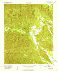
(4)- 1941 Map of Junipero Serra
 1941 Junipero Serra1941 Print · USGSThe Santa Lucia mountains in the early 1940s served as a rugged backdrop for remote cattle ranches and early forest service outposts. Genealogists and researchers can trace family holdings at Abbott Ranch and Berry Ranch or locate the Indian Guard Sta.
 - 1948 Map of Santa Cruz
 1948 Santa Cruz1948 Print · USGSThe Central Coast and San Joaquin Valley meet in this mid-century look at the region's agricultural and military geography. Genealogists and historians can trace the paths of El Camino Real, locate family farms near Hollister, or study the footprint of the Fort Ord Military Reservation.2 unique versions available
 - 1948 Map of Junipero Serra, 1955 Print
 1948 Junipero Serra1955 Print · USGSThe Santa Lucia mountains are captured here in the late 1940s at the height of their post-war wilderness management. Genealogists and researchers can trace family-named sites like Herbert Ranch, the remote community at The Indians, and the Indian Ranger Station.
 - 1949 Map of Bear Canyon, 1955 Print
 1949 Bear Canyon1955 Print · USGSMonterey County was a landscape of federal management and rugged drainage basins in the late 1940s. Researchers can trace the boundaries of the Hunter Liggett Military Reservation and the remote reaches of Wizard Gulch and the San Antonio River.4 unique versions available
End of results
Showing maps 1-4 of 4
Top cities near FOB Milpitas
Frequently asked questions
- What are the different types of historical maps available for FOB Milpitas?
- What is the oldest map of FOB Milpitas?
- Where can I purchase historical maps of FOB Milpitas for my home or office?
- Where can I download high-res historical maps of FOB Milpitas?
- Are there historical topographic maps available for FOB Milpitas?
- Is there historical aerial imagery available for FOB Milpitas?
- Where are historical maps of FOB Milpitas sourced from?