
1948 Map of Junipero Serra
USGS Topo · Published 1955About this map
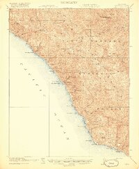
The Santa Lucia Range dominates this mid-century survey of Monterey County, centered on the high elevations of Junipero Serra Peak and the surrounding wilderness of the Los Padres National Forest. The map captures a moment when the northern edge of the Hunter Liggett Military Reservation intersected with long-standing ranching operations and forest management sites. Deep in the canyon interior, remote outposts like The Indians and the Indian Ranger Station highlight the era's fire suppression and recreational infrastructure near Santa Lucia Memorial Park.
Find a feature on this map
40 named features on this map. Tap any name to fly to it.
Don’t see what you’re looking for? This feature index may not catch every label — zoom into the map to look around manually.
Map Details
Editions of this 1948 Junipero Serra Map
This is the sole edition of this map. No revisions or reprints were ever made.
Other maps of this area

1912 · Metz
USGS Topo · 1:31,680

1915 · Soledad
USGS Topo · 1:62,500

1919 · King City
USGS Topo · 1:62,500

1919 · Junipero Serra
USGS Topo · 1:62,500

1919 · Bryson
USGS Topo · 1:62,500

1920 · Jamesburg
USGS Topo · 1:48,000

1921 · Cape San Martin
USGS Topo · 1:62,500

1921 · Jamesburg
USGS Topo · 1:62,500

1921 · Metz
USGS Topo · 1:62,500
1921 · Lucia
USGS Topo · 1:62,500