1980s Maps of Nevada County, California
Explore 7 historic maps of Nevada County from the 1980s. These maps offer a rare glimpse into what life looked like during the 1980s — showing old roads, neighborhoods, homes, and landmarks that have changed or disappeared over time.
Whether you're researching your family's past, planning a metal detecting trip, or studying how Nevada County's landscape evolved across the 1980s, these high-resolution maps are a powerful tool for exploring the history of this region.
- Focus on a specific era: All maps on this page are from the 1980s, giving you a focused view of this time period.
- See what’s changed: Compare century-old streets, trails, and buildings to today's modern landscape using overlays and satellite layers.
- Research with precision: Use these maps for genealogy, historical research, land use analysis, or educational projects.
- View, download, or print: Maps are fully viewable online in high resolution, and can be downloaded or printed for your own records.
Start exploring Nevada County's history through authentic maps from the 1980s. This is your window into the past.
Nevada County, CA maps
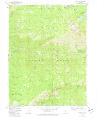
(7)- 1981 Map of Webber Peak
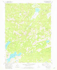 1981 Webber Peak1981 Print · USGSThe high Sierra Nevada mountains of the early 1980s reveal a landscape defined by historic routes and alpine lakes. Researchers can trace the Henness Pass Road, locate the Anderson Mine, and explore the headwaters of the Little Truckee River.3 unique versions available
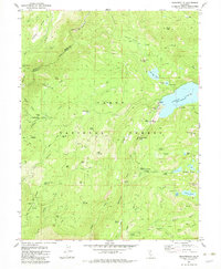
 - 1981 Map of Independence Lake
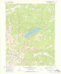 1981 Independence Lake1981 Print · USGSThe High Sierra backcountry is documented in the early 1980s, centered on the waters of Independence Lake. Researchers can trace the path of the Pacific Crest National Scenic Trail and the historic Henness Pass Road across Mt Lola and through Perazzo Meadows.3 unique versions available
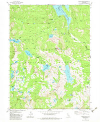
 - 1981 Map of Haypress Valley, 1982 Print
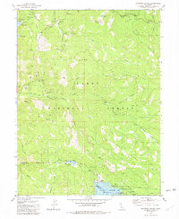 1981 Haypress Valley1982 Print · USGSThe Sierra Nevada high country comes into focus in the 1980s, revealing a landscape of historic mines and modern reservoirs. Researchers can locate the Kentucky Mine, follow the Pacific Crest National Scenic Trail, or trace the old Henness Pass Road.3 unique versions available
 - 1981 Map of Hobart Mills, 1982 Print
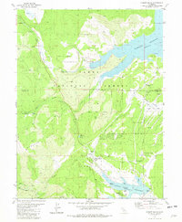 1981 Hobart Mills1982 Print · USGSThe Sierra Nevada high country in the early eighties shows a landscape of timber history and modern water management. Genealogists and historians can trace the locations of the Old Smith Mill (Site), the settlement at Hobart Mills, and the Wildlife Experiment Station.3 unique versions available
 - 1981 Map of Sierra City, 1982 Print
 1981 Sierra City1982 Print · USGSSierra County in the early 1980s remained a landscape defined by its deep mining heritage and the rugged North Fork Yuba River canyon. Researchers can trace historic family holdings at Fournier Ranch, locate the massive Sierra Buttes Mine, and follow the path of the Henness Pass Road.2 unique versions available
 - 1982 Map of Graniteville
 1982 Graniteville1982 Print · USGSGraniteville and the Sierra Nevada high country are shown in the early eighties as a landscape of deep mining history and complex water systems. Researchers can locate historic industrial sites like the Old Condon Mill, the Yellow Metal Mine, and the vanished settlement at Gaston.4 unique versions available
 - 1983 Map of English Mtn
 1983 English Mtn1983 Print · USGSThe high Sierra peaks and old mining frontiers of Nevada and Sierra Counties are shown here during the early eighties. You can trace the sites of gold-rush era camps like Summit City and Baltimore Town or locate the historic Excelsior Mine.3 unique versions available
End of results
Showing maps 1-7 of 7
Top cities of Nevada County
- Truckee historical maps
- Grass Valley historical maps
- Nevada City historical maps
- Rough and Ready historical maps
- Washington historical maps
- Kingvale historical maps
See more
Frequently asked questions
- What are the different types of historical maps available for Nevada County?
- What is the oldest map of Nevada County?
- Where can I purchase historical maps of Nevada County for my home or office?
- Where can I download high-res historical maps of Nevada County?
- Are there historical topographic maps available for Nevada County?
- Is there historical aerial imagery available for Nevada County?
- Where are historical maps of Nevada County sourced from?