Old Maps of South Land Park, Sacramento
Explore 28 old maps of South Land Park, spanning from 1891 to today. These high-resolution historic maps reveal how streets, neighborhoods, landmarks, and natural features evolved over time — perfect for genealogy, metal detecting, research, and local history exploration.
What you can do with these maps:
- See how South Land Park changed over time: Compare historical maps to modern-day views to trace roads, homesites, rail lines & more.
- View detailed metadata: Each map includes creators, publishers, year, scale, and archive source.
- Overlay maps with satellite & LiDAR: Visualize the past alongside modern tools to explore terrain & human change.
- Trusted historical sources: Maps sourced from the USGS, Library of Congress, and other archives.
- Access maps your way: View online, download high-res files, or order prints for personal or research use.
Start exploring old maps of South Land Park to uncover forgotten places, hidden landmarks, and the deep history beneath your feet.
South Land Park, Sacramento maps
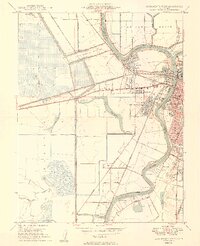
(28)- 1891 Map of Sacramento
 1891 Sacramento1891 Print · USGSCovers South Land Park, including Sacramento, Roseville, and other nearby areas
 - 1892 Map of Sacramento
 1892 Sacramento1892 Print · USGSCovers South Land Park, including Sacramento, Roseville, and other nearby areas5 unique versions available
 - 1893 Map of Sacramento, 1900 Print
 1893 Sacramento1900 Print · USGSCovers South Land Park, including Sacramento, Roseville, and other nearby areas
 - 1902 Map of Fairoaks
 1902 Fairoaks1902 Print · USGSCovers South Land Park, including Sacramento, Roseville, and other nearby areas2 unique versions available
 - 1907 Map of Davisville
 1907 Davisville1907 Print · USGSCovers South Land Park, including Sacramento, Davis, and other nearby areas2 unique versions available
 - 1908 Map of Courtland
 1908 Courtland1908 Print · USGSCovers South Land Park, including Sacramento, Green, and other nearby areas3 unique versions available
 - 1911 Map of Brighton
 1911 Brighton1911 Print · USGSCovers South Land Park, including Sacramento, Elvas, and other nearby areas2 unique versions available
 - 1916 Map of Lovdal
 1916 Lovdal1916 Print · USGSCovers South Land Park, including Sacramento, West Sacramento, and other nearby areas
 - 1916 Map of Babel Slough
 1916 Babel Slough1916 Print · USGSCovers South Land Park, including Sacramento, Coniston, and other nearby areas
 - 1947 Map of Sacramento, 1948 Print
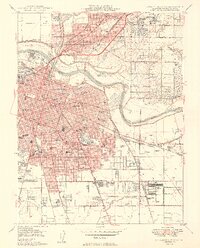
 1947 Sacramento1948 Print · USGSCovers South Land Park, including Sacramento, Stockton, and other nearby areas2 unique versions available
 - 1948 Map of Sacramento, 1951 Print
 1948 Sacramento1951 Print · USGSCovers South Land Park, including Sacramento, Stockton, and other nearby areas
 - 1948 Map of Sacramento West, 1958 Print
 1948 Sacramento West1958 Print · USGSCovers South Land Park, including Sacramento, West Sacramento, and other nearby areas
 - 1949 Map of Sacramento West
 1949 Sacramento West1949 Print · USGSCovers South Land Park, including Sacramento, West Sacramento, and other nearby areas2 unique versions available
 - 1949 Map of Sacramento East
 1949 Sacramento East1949 Print · USGSCovers South Land Park, including Sacramento, Elvas, and other nearby areas2 unique versions available
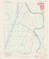
 - 1952 Map of Clarksburg, 1954 Print
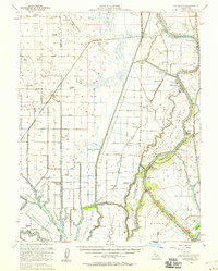
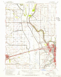
 1952 Clarksburg1954 Print · USGSCovers South Land Park, including Sacramento, Coniston, and other nearby areas2 unique versions available
 - 1952 Map of Courtland, 1959 Print
 1952 Courtland1959 Print · USGSCovers South Land Park, including Sacramento, Green, and other nearby areas3 unique versions available
 - 1954 Map of Sacramento East, 1956 Print
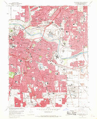
 1954 Sacramento East1956 Print · USGSCovers South Land Park, including Sacramento, Elvas, and other nearby areas2 unique versions available
 - 1954 Map of Davis, 1956 Print
 1954 Davis1956 Print · USGSCovers South Land Park, including Sacramento, Davis, and other nearby areas2 unique versions available
 - 1954 Map of Fair Oaks, 1957 Print
 1954 Fair Oaks1957 Print · USGSCovers South Land Park, including Sacramento, Roseville, and other nearby areas2 unique versions available
 - 1956 Map of Sacramento
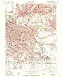
 1956 Sacramento1956 Print · USGSCovers South Land Park, including Sacramento, Stockton, and other nearby areas2 unique versions available
 - 1957 Map of Sacramento, 1966 Print
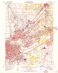
 1957 Sacramento1966 Print · USGSCovers South Land Park, including Sacramento, Stockton, and other nearby areas4 unique versions available
 - 1967 Map of Sacramento West, 1968 Print
 1967 Sacramento West1968 Print · USGSCovers South Land Park, including Sacramento, West Sacramento, and other nearby areas3 unique versions available
 - 1967 Map of Sacramento East, 1969 Print
 1967 Sacramento East1969 Print · USGSCovers South Land Park, including Sacramento, Elvas, and other nearby areas3 unique versions available
 - 1967 Map of Clarksburg, 1969 Print
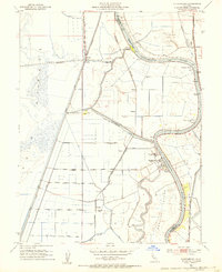
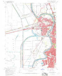
 1967 Clarksburg1969 Print · USGSCovers South Land Park, including Sacramento, Coniston, and other nearby areas5 unique versions available
 - 1992 Map of Sacramento East, 1997 Print
 1992 Sacramento East1997 Print · USGSCovers South Land Park, including Sacramento, Elvas, and other nearby areas
Showing maps 1-25 of 28
Frequently asked questions
- What are the different types of historical maps available for South Land Park?
- What is the oldest map of South Land Park?
- Where can I purchase historical maps of South Land Park for my home or office?
- Where can I download high-res historical maps of South Land Park?
- Are there historical topographic maps available for South Land Park?
- Is there historical aerial imagery available for South Land Park?
- Where are historical maps of South Land Park sourced from?