Old Maps of South Land Park, Sacramento for Academic Research
Study the evolution of South Land Park with 28 high-resolution historic maps. Whether you're teaching, researching, or modeling changes in land use, these maps provide essential visual documentation of urban, environmental, and geographic change.
- Analyze long-term change: Track patterns in development, transportation, and natural features.
- Ideal for environmental or urban studies: Support academic projects with primary historical map data.
- Use in the classroom or lab: Educators and researchers rely on these maps to bring historical context to life.
These maps are a powerful tool for teaching, research, and visualizing how South Land Park has changed over the decades.
South Land Park, Sacramento maps
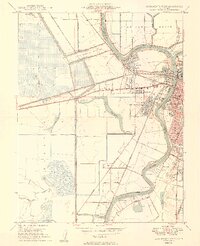
(28)- 1891 Map of Sacramento
 1891 Sacramento1891 Print · USGSCovers South Land Park, including Sacramento, Roseville, and other nearby areas
 - 1892 Map of Sacramento
 1892 Sacramento1892 Print · USGSCovers South Land Park, including Sacramento, Roseville, and other nearby areas5 unique versions available
 - 1893 Map of Sacramento, 1900 Print
 1893 Sacramento1900 Print · USGSCovers South Land Park, including Sacramento, Roseville, and other nearby areas
 - 1902 Map of Fairoaks
 1902 Fairoaks1902 Print · USGSCovers South Land Park, including Sacramento, Roseville, and other nearby areas2 unique versions available
 - 1907 Map of Davisville
 1907 Davisville1907 Print · USGSCovers South Land Park, including Sacramento, Davis, and other nearby areas2 unique versions available
 - 1908 Map of Courtland
 1908 Courtland1908 Print · USGSCovers South Land Park, including Sacramento, Green, and other nearby areas3 unique versions available
 - 1911 Map of Brighton
 1911 Brighton1911 Print · USGSCovers South Land Park, including Sacramento, Elvas, and other nearby areas2 unique versions available
 - 1916 Map of Lovdal
 1916 Lovdal1916 Print · USGSCovers South Land Park, including Sacramento, West Sacramento, and other nearby areas
 - 1916 Map of Babel Slough
 1916 Babel Slough1916 Print · USGSCovers South Land Park, including Sacramento, Coniston, and other nearby areas
 - 1947 Map of Sacramento, 1948 Print
 1947 Sacramento1948 Print · USGSCovers South Land Park, including Sacramento, Stockton, and other nearby areas2 unique versions available
 - 1948 Map of Sacramento, 1951 Print
 1948 Sacramento1951 Print · USGSCovers South Land Park, including Sacramento, Stockton, and other nearby areas
 - 1948 Map of Sacramento West, 1958 Print
 1948 Sacramento West1958 Print · USGSCovers South Land Park, including Sacramento, West Sacramento, and other nearby areas
 - 1949 Map of Sacramento West
 1949 Sacramento West1949 Print · USGSCovers South Land Park, including Sacramento, West Sacramento, and other nearby areas2 unique versions available
 - 1949 Map of Sacramento East
 1949 Sacramento East1949 Print · USGSCovers South Land Park, including Sacramento, Elvas, and other nearby areas2 unique versions available
 - 1952 Map of Clarksburg, 1954 Print
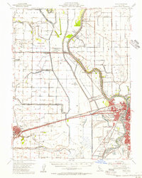
 1952 Clarksburg1954 Print · USGSCovers South Land Park, including Sacramento, Coniston, and other nearby areas2 unique versions available
 - 1952 Map of Courtland, 1959 Print
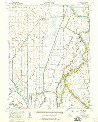 1952 Courtland1959 Print · USGSCovers South Land Park, including Sacramento, Green, and other nearby areas3 unique versions available
 - 1954 Map of Sacramento East, 1956 Print
 1954 Sacramento East1956 Print · USGSCovers South Land Park, including Sacramento, Elvas, and other nearby areas2 unique versions available
 - 1954 Map of Davis, 1956 Print
 1954 Davis1956 Print · USGSCovers South Land Park, including Sacramento, Davis, and other nearby areas2 unique versions available
 - 1954 Map of Fair Oaks, 1957 Print
 1954 Fair Oaks1957 Print · USGSCovers South Land Park, including Sacramento, Roseville, and other nearby areas2 unique versions available
 - 1956 Map of Sacramento
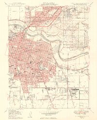
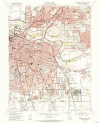
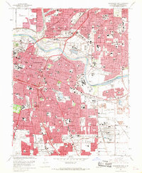
 1956 Sacramento1956 Print · USGSCovers South Land Park, including Sacramento, Stockton, and other nearby areas2 unique versions available
 - 1957 Map of Sacramento, 1966 Print
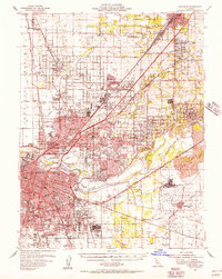
 1957 Sacramento1966 Print · USGSCovers South Land Park, including Sacramento, Stockton, and other nearby areas4 unique versions available
 - 1967 Map of Sacramento West, 1968 Print
 1967 Sacramento West1968 Print · USGSCovers South Land Park, including Sacramento, West Sacramento, and other nearby areas3 unique versions available
 - 1967 Map of Sacramento East, 1969 Print
 1967 Sacramento East1969 Print · USGSCovers South Land Park, including Sacramento, Elvas, and other nearby areas3 unique versions available
 - 1967 Map of Clarksburg, 1969 Print
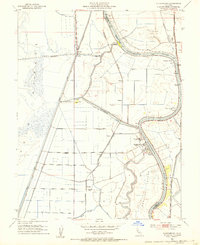
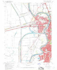
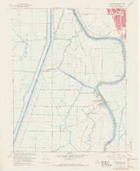 1967 Clarksburg1969 Print · USGSCovers South Land Park, including Sacramento, Coniston, and other nearby areas5 unique versions available
 - 1992 Map of Sacramento East, 1997 Print
 1992 Sacramento East1997 Print · USGSCovers South Land Park, including Sacramento, Elvas, and other nearby areas
Showing maps 1-25 of 28
Frequently asked questions
- What are the different types of historical maps available for South Land Park?
- What is the oldest map of South Land Park?
- Where can I purchase historical maps of South Land Park for my home or office?
- Where can I download high-res historical maps of South Land Park?
- Are there historical topographic maps available for South Land Park?
- Is there historical aerial imagery available for South Land Park?
- Where are historical maps of South Land Park sourced from?