Old Maps of Pinnacles, California for Academic Research
Study the evolution of Pinnacles with 16 high-resolution historic maps. Whether you're teaching, researching, or modeling changes in land use, these maps provide essential visual documentation of urban, environmental, and geographic change.
- Analyze long-term change: Track patterns in development, transportation, and natural features.
- Ideal for environmental or urban studies: Support academic projects with primary historical map data.
- Use in the classroom or lab: Educators and researchers rely on these maps to bring historical context to life.
These maps are a powerful tool for teaching, research, and visualizing how Pinnacles has changed over the decades.
Pinnacles, CA maps
(16)- 1919 Map of San Benito
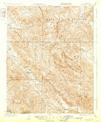
 1919 San Benito1919 Print · USGSSan Benito County in the decade after the Great War is a landscape of high ridges and remote ranching outposts. Genealogists and historians can trace the foundations of the local community through landmarks like Willow Creek School, the Bradford Mine, and the early borders of Pinnacles Nat Mon.2 unique versions available
 - 1931 Map of San Benito
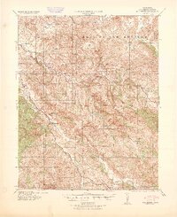
 1931 San Benito1931 Print · USGSThe high ridges and deep river canyons of San Benito County are captured here in the early twentieth century. Genealogists and local historians can trace the remote Los Muertos Ranch, early rural schoolhouses like Emmett School, and the northern reaches of Pinnacles Nat Mon.2 unique versions available
 - 1940 Map of San Benito
 1940 San Benito1940 Print · USGSThe San Benito River valley in the early 1940s was a landscape of remote ranching and rural education. Genealogists can locate family-named outposts like Elkhorn Ranch and several country schools, including Cottonwood School and Emmett School.2 unique versions available
 - 1948 Map of Santa Cruz
 1948 Santa Cruz1948 Print · USGSThe Central Coast and San Joaquin Valley meet in this mid-century look at the region's agricultural and military geography. Genealogists and historians can trace the paths of El Camino Real, locate family farms near Hollister, or study the footprint of the Fort Ord Military Reservation.2 unique versions available
 - 1955 Map of Santa Cruz
 1955 Santa Cruz1955 Print · USGSCoastal Monterey Bay and the fertile Salinas Valley are captured here during the post-war expansion of the mid-fifties. Researchers can trace the era's rail-and-road network via the Southern Pacific lines and find landmarks like Fort Ord or the Lonoak School.
 - 1957 Map of Santa Cruz
 1957 Santa Cruz1957 Print · USGSCentral California comes into sharp focus during the late fifties, from the fog-swept Monterey Bay to the sun-drenched San Joaquin Valley. Genealogists and historians can trace the mid-century footprints of Fort Ord Military Reservation, the Southern Pacific line, and the historic streets of San Juan Bautista.
 - 1957 Map of San Benito, 1958 Print
 1957 San Benito1958 Print · USGSThe Diablo Range interior in the late fifties was a network of remote ranches and isolated schoolhouses. Genealogists and historians can trace the foundations of the San Benito community and find landmarks like Cottonwood School and the Bradford Mine.2 unique versions available
 - 1958 Map of Santa Cruz
 1958 Santa Cruz1958 Print · USGSCoastal California and the central valleys are shown during the mid-fifties, capturing a landscape of massive military reserves and vital rail arteries. Genealogists and historians can trace the Southern Pacific line through Salinas or explore the early footprints of the Fort Ord Military Reservation and San Juan Bautista.2 unique versions available
 - 1965 Map of Santa Cruz, 1968 Print
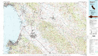
 1965 Santa Cruz1968 Print · USGSThe Central Coast and San Joaquin Valley meet here during the mid-sixties, capturing the growth of agricultural and coastal hubs. Trace the historic Southern Pacific RR lines and locate sites like the Presidio of Monterey or Pinnacles National Monument.
 - 1968 Map of Bickmore Canyon, 1971 Print
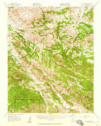
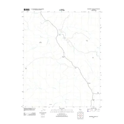
 1968 Bickmore Canyon1971 Print · USGSThe San Andreas fault line cuts directly through San Benito County in the late sixties, defining a landscape of isolated ranches and wilderness. Researchers can trace the heritage of Melendy Ranch, find the Willow Creek Cem, and explore the rugged northern boundary of Pinnacles National Monument.6 unique versions available
 - 1974 Map of Monterey, 1977 Print
 1974 Monterey1977 Print · USGSThe Central Coast and San Joaquin Valley meet in this mid-seventies survey of the Monterey region. Genealogists and historians can locate Spanish-era sites like the San Antonio de Padua Mission, early industrial markers such as the New Idria Mine, and coastal landmarks like the Point Sur Lighthouse.
 - 1983 Map of Monterey, 1984 Print
 1983 Monterey1984 Print · USGSCoastal Monterey and the Salinas Valley appear in the early eighties as a hub of military activity and deep-rooted agriculture. Researchers can trace historic land grant boundaries like Rancho Buena Vista or locate sites like Mission San Juan Bautista and Spreckels.2 unique versions available
 - 2012 Map of Bickmore Canyon, 2012 Print
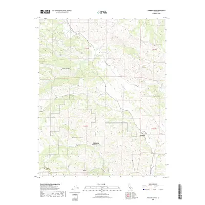
 2012 Bickmore Canyon2012 Print · USGSCovers Pinnacles, including Schmidt Ranch, Monterey County, and other nearby areas
 - 2015 Map of Bickmore Canyon, 2015 Print
 2015 Bickmore Canyon2015 Print · USGSCovers Pinnacles, including Schmidt Ranch, Monterey County, and other nearby areas
 - 2018 Map of Bickmore Canyon, 2018 Print
 2018 Bickmore Canyon2018 Print · USGSCovers Pinnacles, including Schmidt Ranch, Monterey County, and other nearby areas
 - 2021 Map of Bickmore Canyon, 2021 Print
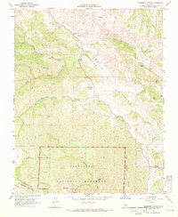
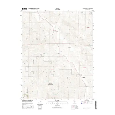
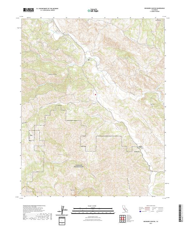 2021 Bickmore Canyon2021 Print · USGSSan Benito County’s high country is captured here in the modern era, showing the intersection of park lands and ranching history. You can trace the path of the San Benito River or locate the Willow Creek Cem and the peaks surrounding Pinnacles National Park.
End of results
Showing maps 1-16 of 16
Top cities near Pinnacles
Frequently asked questions
- What are the different types of historical maps available for Pinnacles?
- What is the oldest map of Pinnacles?
- Where can I purchase historical maps of Pinnacles for my home or office?
- Where can I download high-res historical maps of Pinnacles?
- Are there historical topographic maps available for Pinnacles?
- Is there historical aerial imagery available for Pinnacles?
- Where are historical maps of Pinnacles sourced from?