1970s Maps of Barstow, California
Explore 6 historic maps of Barstow from the 1970s. These maps offer a rare glimpse into what life looked like during the 1970s — showing old roads, neighborhoods, homes, and landmarks that have changed or disappeared over time.
Whether you're researching your family's past, planning a metal detecting trip, or studying how Barstow's landscape evolved across the 1970s, these high-resolution maps are a powerful tool for exploring the history of this region.
- Focus on a specific era: All maps on this page are from the 1970s, giving you a focused view of this time period.
- See what’s changed: Compare century-old streets, trails, and buildings to today's modern landscape using overlays and satellite layers.
- Research with precision: Use these maps for genealogy, historical research, land use analysis, or educational projects.
- View, download, or print: Maps are fully viewable online in high resolution, and can be downloaded or printed for your own records.
Start exploring Barstow's history through authentic maps from the 1970s. This is your window into the past.
Barstow, CA maps
(6)- 1971 Map of Hodge, 1973 Print
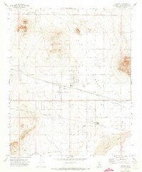
 1971 Hodge1973 Print · USGSThe Mojave River valley in the early 1970s is shown as a vital rail corridor between desert peaks. Researchers can trace historic routes like the Wagonwheel Trail and Chisholm Trail near the settlement of Hodge.3 unique versions available
 - 1971 Map of Barstow SE, 1973 Print
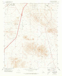 1971 Barstow SE1973 Print · USGSThe Mojave Desert settlement of Lenwood and the southern expansion of Barstow are captured here just as the region's modern infrastructure was solidifying. Researchers can trace historical land use through local landmarks like Barstow College, the Drive-in Theater, and various mining Prospects near STODDARD WELL ROAD.2 unique versions available
 - 1971 Map of Daggett, 1973 Print
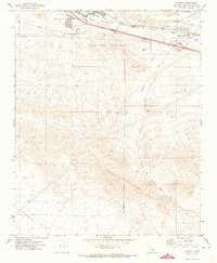 1971 Daggett1973 Print · USGSThe high desert around the Mojave River in the early seventies shows a landscape of military logistics and rail transit. Researchers can find the McKinney Sch, Daggett Cem, and the sprawling Marine Corps Supply Center.2 unique versions available
 - 1971 Map of Hinkley, 1973 Print
 1971 Hinkley1973 Print · USGSHinkley is documented here in the early 1970s as a desert hub defined by its rail siding and scattered ranch-style settlement. You can trace family footprints near the Hinkley Union Sch, the Grange Hall, and early developments at Highcrest.3 unique versions available
 - 1971 Map of Barstow, 1974 Print
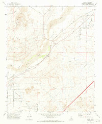
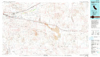
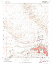 1971 Barstow1974 Print · USGSThe Mojave River valley thrived as a major California rail and logistics hub in the early seventies. Genealogists and historians can trace the growth of Barstow neighborhoods and locate landmarks like Mt View Cem and the Waterman Mine.5 unique versions available
 - 1977 Map of Newberry Springs, 1993 Print
 1977 Newberry Springs1993 Print · USGSThe Mojave High Desert in the late seventies is shown here as a landscape of railroads and mining. Researchers can trace the legacy of remote camps and transport hubs like Stedman, Ragtown, and the busy Barstow-Daggett Airport.
End of results
Showing maps 1-6 of 6
Top cities near Barstow
Top neighborhoods of Barstow
Frequently asked questions
- What are the different types of historical maps available for Barstow?
- What is the oldest map of Barstow?
- Where can I purchase historical maps of Barstow for my home or office?
- Where can I download high-res historical maps of Barstow?
- Are there historical topographic maps available for Barstow?
- Is there historical aerial imagery available for Barstow?
- Where are historical maps of Barstow sourced from?