1900s (20th Century) Maps of Homestead Valley, California
Explore 23 historic maps of Homestead Valley from the 1900s (20th Century). These maps offer a rare glimpse into what life looked like during the 1900s — showing old roads, neighborhoods, homes, and landmarks that have changed or disappeared over time.
Whether you're researching your family's past, planning a metal detecting trip, or studying how Homestead Valley's landscape evolved across the 1900s, these high-resolution maps are a powerful tool for exploring the history of this region.
- Focus on a specific era: All maps on this page are from the 1900s, giving you a focused view of this time period.
- See what’s changed: Compare century-old streets, trails, and buildings to today's modern landscape using overlays and satellite layers.
- Research with precision: Use these maps for genealogy, historical research, land use analysis, or educational projects.
- View, download, or print: Maps are fully viewable online in high resolution, and can be downloaded or printed for your own records.
Start exploring Homestead Valley's history through authentic maps from the 1900s. This is your window into the past.
Homestead Valley, CA maps
(23)- 1901 Map of Southern California Sheet No. 1
 1901 Southern California Sheet No. 11901 Print · USGSGreater Los Angeles at the dawn of the twentieth century is a landscape of growing citrus towns and a burgeoning rail network. Genealogists and historians can trace the early gridded streets of Hollywood and Pasadena or locate landmarks like Bear Lake and the Cahuilla Indian Reservation.6 unique versions available
 - 1902 Map of San Gorgonio
 1902 San Gorgonio1902 Print · USGSSouthern California at the turn of the century reveals a land of high-desert ranches and remote mountain mining camps. Genealogists and historians can locate early landmarks like Box S Ranch, Old Woman Springs, and the Rose Mine.8 unique versions available
 - 1904 Map of Southern California Sheet No. 1, 1905 Print
 1904 Southern California Sheet No. 11905 Print · USGSSouthern California at the dawn of the twentieth century shows a landscape of citrus groves and coastal towns connected by rail. Genealogists and historians can trace early settlements like San Juan Capistrano, find remote sites like the Rose Mine, and study the original water systems of the Santa Ana River.2 unique versions available
 - 1953 Map of San Bernardino
 1953 San Bernardino1953 Print · USGSSouthern California underwent massive post-war growth as suburban sprawl reached the foothills of the San Bernardino Mountains. Genealogists and historians can trace the rail-and-road roots of the Inland Empire through the Union Pacific RR and Lake Arrowhead resorts.2 unique versions available
 - 1955 Map of Goat Mountain
 1955 Goat Mountain1955 Print · USGSThe high desert of San Bernardino County is shown here in the mid-fifties as military interests began to define the landscape. Researchers can trace early mining attempts at Goat Mountain and the Mine Tunnel or locate the original limits of the Naval Marine Corps Training Center Reservation.4 unique versions available
 - 1955 Map of Old Woman Springs, 1956 Print
 1955 Old Woman Springs1956 Print · USGSThe high desert of San Bernardino County is documented here in the mid-1950s, showing a landscape of vital desert springs and early mining. Researchers can trace historic water sources like Old Woman Springs and find mining sites including the Bessemer Mine and prospects.3 unique versions available
 - 1955 Map of Emerson Lake, 1956 Print
 1955 Emerson Lake1956 Print · USGSThe California high desert is revealed in the mid-fifties through its mining outposts and early airstrips near the Naval Reservation Bdy. Locate old mineral claims like the Blue Ribbon Mine or trace the early development of Landers and the area around Giant Rock.3 unique versions available
 - 1955 Map of Joshua Tree, 1957 Print
 1955 Joshua Tree1957 Print · USGSThe High Desert communities of San Bernardino County are shown during their mid-century growth period. Researchers can trace early settlements and desert landmarks like Pioneertown, Desert-Christ Park, and the northern reaches of Joshua Tree National Monument.3 unique versions available
 - 1956 Map of San Bernardino
 1956 San Bernardino1956 Print · USGSSouthern California's Inland Empire and High Desert come into focus in the mid-fifties as agriculture gives way to suburban and military growth. Trace early rail lines like the Pacific Electric or find remote landmarks like Camp Rock Mine and George AFB.
 - 1957 Map of San Bernardino
 1957 San Bernardino1957 Print · USGSSouthern California's Inland Empire and High Desert met during the postwar expansion of the late fifties. Genealogists and historians can trace the growth of San Bernardino and Redlands alongside remote landmarks like Edwards AFB and the Camp Rock Mine.
 - 1958 Map of San Bernardino, 1975 Print
 1958 San Bernardino1975 Print · USGSSouthern California’s Inland Empire and High Desert come into focus during the mid-century boom, showing the rise of suburbs and massive military installations. Researchers can trace the rail networks of the Union Pacific RR or locate landmarks like Norton AFB and Big Bear Lake.
 - 1959 Map of San Bernardino
 1959 San Bernardino1959 Print · USGSSouthern California underwent a massive transformation in the late fifties as suburban growth and military power reshaped the desert and valley. Researchers can trace the legacy of the Union Pacific Railroad and locate early footprints of Joshua Tree National Monument and Edwards Air Force Base.
 - 1966 Map of San Bernardino
 1966 San Bernardino1966 Print · USGSThe San Bernardino Valley and Mojave Desert met during a period of massive military and suburban growth in the mid-sixties. Genealogists and historians can trace the development of Edwards Air Force Base, old desert mines like the Bagdad Chase Mine, and mountain communities near Big Bear Lake.
 - 1972 Map of Bighorn Canyon, 1975 Print
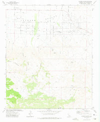 1972 Bighorn Canyon1975 Print · USGSThe high desert of Johnson Valley is captured here in the early seventies as a planned street grid began to meet the foothills. Researchers can find isolated landmarks like Rock Corral and Parsons Ranch among the canyons of the Bighorn Mountains.3 unique versions available
 - 1972 Map of Old Woman Springs, 1975 Print
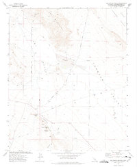 1972 Old Woman Springs1975 Print · USGSSan Bernardino County ranching and mining life comes into focus in the early seventies. Genealogists and desert historians can trace the foundations of the Old Woman Springs Ranch and the Lafon Ranch, or locate the Green Rock Mine.2 unique versions available
 - 1972 Map of Melville Lake, 1975 Print
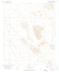 1972 Melville Lake1975 Print · USGSThe Mojave Desert interior comes into focus during the 1970s, showing a landscape of dry lake beds and isolated outposts. Researchers can trace remote desert life through landmarks like Shehorn Ranch, the Landing Strip, and the crossroads at Armelino.3 unique versions available
 - 1972 Map of Yucca Valley North, 1975 Print
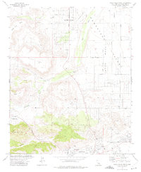 1972 Yucca Valley North1975 Print · USGSThe High Desert comes into focus in the early 1970s as new settlements began to shape the Mojave landscape. Local historians can trace the development of Flamingo Heights and Pioneertown near landmarks like Black Lava Butte.4 unique versions available
 - 1972 Map of Joshua Tree North, 1975 Print
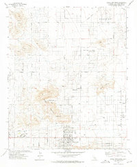 1972 Joshua Tree North1975 Print · USGSJoshua Tree and the surrounding High Desert were seeing steady residential growth in the early seventies as new roads pushed into the valley floors. Researchers can trace early infrastructure and community landmarks like the Hi Desert Airport, Sportsmans Park, and the settlement at Sunfair.3 unique versions available
 - 1972 Map of Rattlesnake Canyon, 1976 Print
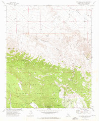 1972 Rattlesnake Canyon1976 Print · USGSSan Bernardino's high desert and mountain peaks come alive in this early 1970s survey. Researchers can trace historic mining activity near Rattlesnake Canyon or locate remote water sources like Viscera Springs and Two Hole Spring.4 unique versions available
 - 1972 Map of Landers, 1976 Print
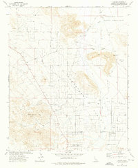 1972 Landers1976 Print · USGSThe High Desert community of Landers comes into focus in the early 1970s as a growing rural enclave. Researchers can trace the layout of Homestead Valley, its pioneer airstrips at Giant Rock Airport, and named desert tracks like Happy Trail.2 unique versions available
 - 1982 Map of Big Bear Lake, 1996 Print
 1982 Big Bear Lake1996 Print · USGSThe San Bernardino Mountains meet the high Mojave desert in the early eighties, showing a landscape defined by mountain resorts and desert basins. Trace the historic Belleville (Site), the rail lines of the Atchison Topeka and Santa Fe, and old mining works like the Gold Belt Mine.
 - 1996 Map of Rattlesnake Canyon, 1999 Print
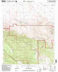 1996 Rattlesnake Canyon1999 Print · USGSThe Bighorn Mountains meet the high desert in the mid-1990s, revealing a landscape of mining claims and vital desert springs. Researchers can trace the Mound Spring Road or locate historic water sources like Viscera Spring and Vaughn Spring.
 - 1999 Map of Old Woman Springs, 2002 Print
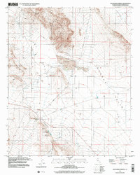 1999 Old Woman Springs2002 Print · USGSThe high-desert ranching and mining country of the Mojave comes into focus during the late 1990s. Genealogists and desert researchers can trace the Old Woman Springs Ranch and mining routes like Bessemer Mine Road.
End of results
Showing maps 1-23 of 23
Top cities near Homestead Valley
Top neighborhoods of Homestead Valley
Frequently asked questions
- What are the different types of historical maps available for Homestead Valley?
- What is the oldest map of Homestead Valley?
- Where can I purchase historical maps of Homestead Valley for my home or office?
- Where can I download high-res historical maps of Homestead Valley?
- Are there historical topographic maps available for Homestead Valley?
- Is there historical aerial imagery available for Homestead Valley?
- Where are historical maps of Homestead Valley sourced from?