Old Maps of Newberry Springs, California for Metal Detecting
Plan your next treasure hunt with 21 historic maps of Newberry Springs. Find old homesites, ghost towns, trails, and gathering spots that may be lost to time — perfect for identifying promising metal detecting locations.
- Locate forgotten sites: Uncover places like long-lost settlements, abandoned rail lines, or gathering spots.
- Plan better hunts: Use map overlays combined with LiDAR or satellite views to narrow in on historically rich areas.
- Made for detectorists: Thousands of hobbyists use these maps to discover relics, coins, and hidden history.
Use these historic maps to boost your research and find new opportunities beneath the surface of Newberry Springs.
Newberry Springs, CA maps
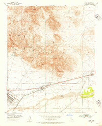
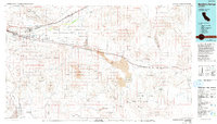
(21)- 1953 Map of San Bernardino
 1953 San Bernardino1953 Print · USGSSouthern California underwent massive post-war growth as suburban sprawl reached the foothills of the San Bernardino Mountains. Genealogists and historians can trace the rail-and-road roots of the Inland Empire through the Union Pacific RR and Lake Arrowhead resorts.2 unique versions available
 - 1953 Map of Yermo, 1954 Print
 1953 Yermo1954 Print · USGSIn the early fifties, the Mojave Desert landscape near Yermo balanced its silver mining past with growing military logistics. Trace the sites of Bismarck and Calico, old mining camps, and the expanding Yermo Marine Base.3 unique versions available
 - 1955 Map of Newberry, 1956 Print
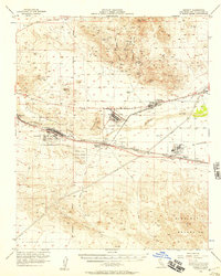
 1955 Newberry1956 Print · USGSThe Mojave River valley in the mid-1950s was a critical transit corridor defined by two major railroads and historical military outposts. Genealogists and desert historians can trace the foundations of Newberry, the Camp Cady (Site), and the remote stopping point at Lava.3 unique versions available
 - 1956 Map of San Bernardino
 1956 San Bernardino1956 Print · USGSSouthern California's Inland Empire and High Desert come into focus in the mid-fifties as agriculture gives way to suburban and military growth. Trace early rail lines like the Pacific Electric or find remote landmarks like Camp Rock Mine and George AFB.
 - 1956 Map of Daggett, 1957 Print
 1956 Daggett1957 Print · USGSThe Mojave Desert at the height of the Cold War reveals a landscape defined by heavy rail, military supply bases, and hard-rock mining. Trace the historic tracks of the Union Pacific through Yermo or locate the old Silver Bow Mine and Azucar Mine in the surrounding peaks.4 unique versions available
 - 1957 Map of San Bernardino
 1957 San Bernardino1957 Print · USGSSouthern California's Inland Empire and High Desert met during the postwar expansion of the late fifties. Genealogists and historians can trace the growth of San Bernardino and Redlands alongside remote landmarks like Edwards AFB and the Camp Rock Mine.
 - 1958 Map of San Bernardino, 1975 Print
 1958 San Bernardino1975 Print · USGSSouthern California’s Inland Empire and High Desert come into focus during the mid-century boom, showing the rise of suburbs and massive military installations. Researchers can trace the rail networks of the Union Pacific RR or locate landmarks like Norton AFB and Big Bear Lake.
 - 1959 Map of San Bernardino
 1959 San Bernardino1959 Print · USGSSouthern California underwent a massive transformation in the late fifties as suburban growth and military power reshaped the desert and valley. Researchers can trace the legacy of the Union Pacific Railroad and locate early footprints of Joshua Tree National Monument and Edwards Air Force Base.
 - 1966 Map of San Bernardino
 1966 San Bernardino1966 Print · USGSThe San Bernardino Valley and Mojave Desert met during a period of massive military and suburban growth in the mid-sixties. Genealogists and historians can trace the development of Edwards Air Force Base, old desert mines like the Bagdad Chase Mine, and mountain communities near Big Bear Lake.
 - 1971 Map of Minneola, 1973 Print
 1971 Minneola1973 Print · USGSThe Mojave high desert during the early seventies reveals a landscape defined by Route 66 and mountain mining. Trace the historic National Trails Highway past Minneola, locate the Azucar Mine in the hills, or study the Barstow Daggett Airport.2 unique versions available
 - 1977 Map of Newberry Springs, 1993 Print
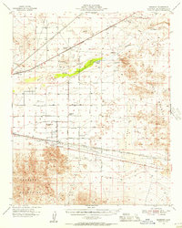
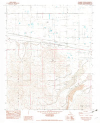
 1977 Newberry Springs1993 Print · USGSThe Mojave High Desert in the late seventies is shown here as a landscape of railroads and mining. Researchers can trace the legacy of remote camps and transport hubs like Stedman, Ragtown, and the busy Barstow-Daggett Airport.
 - 1982 Map of Troy Lake
 1982 Troy Lake1982 Print · USGSThe Mojave desert floor and its surrounding peaks are captured in the early eighties, revealing a landscape shaped by dry lake beds and energy infrastructure. Researchers can locate the Poe (Site) near a field of Lava or trace the industrial footprint of a clay borrow pit and Gravel Pit.3 unique versions available
 - 1982 Map of Newberry Springs
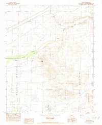
 1982 Newberry Springs1982 Print · USGSThe high desert of the Mojave Valley in the early eighties was a landscape of stark contrasts between utility infrastructure and volcanic terrain. Researchers can trace the desert topography from Newberry Peak down to the lava fields and seasonal drainage of Kane Wash.2 unique versions available
 - 1982 Map of Manix
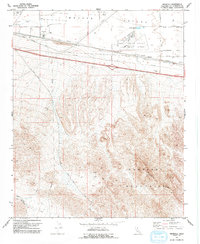
 1982 Manix1982 Print · USGSThe Mojave Desert interior during the early eighties revealed a landscape of vital waterholes and historic western outposts. Researchers can trace the legacy of the Mojave River corridor through Camp Cady (Site), Cady Spring, and the lonely settlement of Manix.4 unique versions available
 - 1982 Map of Harvard Hill
 1982 Harvard Hill1982 Print · USGSSan Bernardino County's high desert landscape comes into focus during the early eighties, showing the intersection of heavy rail and desert life. Trace the Union Pacific line as it passes Harvard or locate the Dirt Airstrip Facilities and Lake Dolores near the riverbed.2 unique versions available
 - 2021 Map of Newberry Springs, 2021 Print
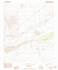
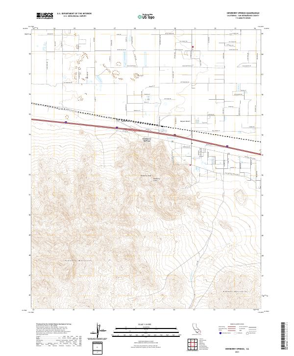 2021 Newberry Springs2021 Print · USGSNewberry Springs and the surrounding Mojave Valley are captured in this recent study of the high desert landscape. Researchers can locate Newberry Spring, trace the rugged Kane Wash, and identify landmarks like Newberry Cairn and Black Butte.
 - 2021 Map of Minneola, 2021 Print
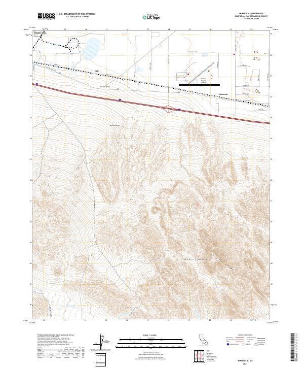 2021 Minneola2021 Print · USGSThe Mojave Valley is shown here at a fascinating intersection of desert transit and aviation history. Trace the layouts of Minneola and Gale or locate the Barstow-Daggett Airport near the iconic National Trails Hwy.
 - 2021 Map of Harvard Hill, 2021 Print
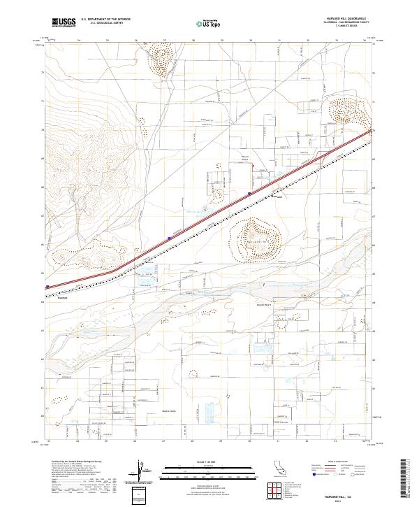 2021 Harvard Hill2021 Print · USGSThe Mojave Desert at the start of the 2020s shows a landscape of remote settlements and dry riverbeds. Researchers can trace local landmarks like Harvard Hill, the small waters of Lake Jodie, and the desert transit hub at Harvard.
 - 2021 Map of Manix, 2021 Print
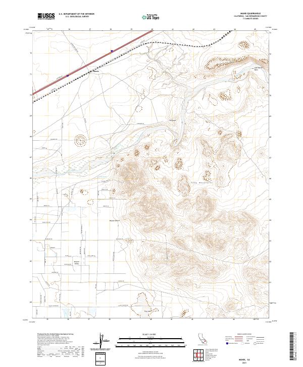 2021 Manix2021 Print · USGSThe high desert landscape near the Mojave River comes into focus in this contemporary survey of San Bernardino County. Researchers can trace the path of the river past Manix or locate remote water sources like Cady Spring and the ephemeral Troy Lake.
 - 2021 Map of Yermo, 2021 Print
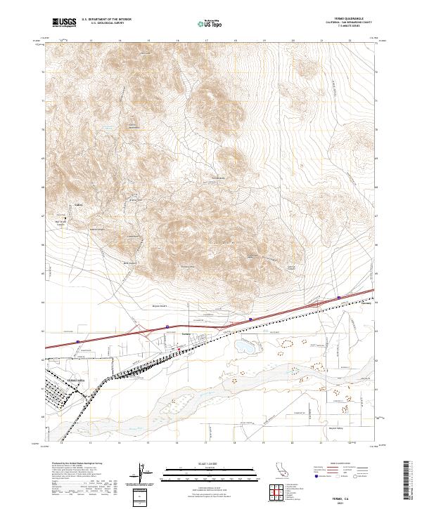 2021 Yermo2021 Print · USGSThe High Desert near Barstow comes into focus in this recent survey of the historic Calico mining district and the town of Yermo. Genealogists and desert explorers can trace the roads around Calico Cem, the Mojave River, and geological landmarks like Kramer Arch.
 - 2023 Map of Troy Lake, 2023 Print
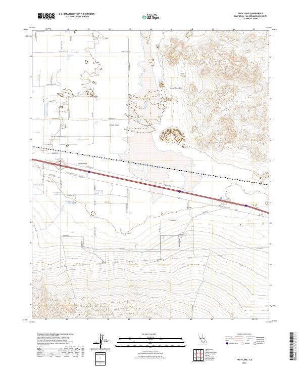 2023 Troy Lake2023 Print · USGSThe high desert of San Bernardino County is documented here in the early twenty-first century, showing the intersection of major transit routes and protected wildlands. You can trace the path of the National Trails Hwy through the Mojave Valley or explore the drainage of Kane Wash near the Rodman Mountains Wilderness.
End of results
Showing maps 1-21 of 21
Frequently asked questions
- What are the different types of historical maps available for Newberry Springs?
- What is the oldest map of Newberry Springs?
- Where can I purchase historical maps of Newberry Springs for my home or office?
- Where can I download high-res historical maps of Newberry Springs?
- Are there historical topographic maps available for Newberry Springs?
- Is there historical aerial imagery available for Newberry Springs?
- Where are historical maps of Newberry Springs sourced from?