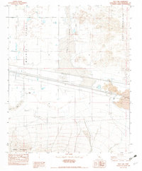
1982 Map of Troy Lake
USGS Topo · Published 1982About this map
The arid landscape of the Mojave Valley dominates this 1982 provisional survey, centered on the expansive floor of Troy Lake (Dry Lake). To the east, the Cady Mountains rise sharply, while the southern margin is defined by the Rodman Mountains. This desert basin serves as a corridor for significant industrial infrastructure, marked by several underground gas pipelines and a clay borrow pit near the center of the lake bed. Local history is anchored at Poe (Site), a named location situated near a distinct field of Lava. The presence of Kane Wash and numerous dry wells across the valley floor illustrates the extreme water management challenges of the Mojave region during this era.
Find a feature on this map
15 named features on this map. Tap any name to fly to it.
Don’t see what you’re looking for? This feature index may not catch every label — zoom into the map to look around manually.
Map Details
Editions of this 1982 Troy Lake Map
3 editions found
Other maps of this area

1953 · San Bernardino
USGS Topo · 1:250,000

1955 · Silver Bell Mine
USGS Topo · 1:24,000

1955 · Sunshine Peak
USGS Topo · 1:24,000

1955 · Newberry
USGS Topo · 1:62,500

1955 · Lavic
USGS Topo · 1:62,500

1955 · Cady Mountains
USGS Topo · 1:62,500

1955 · Rodman Mountains
USGS Topo · 1:62,500

1956 · San Bernardino
USGS Topo · 1:250,000

1957 · San Bernardino
USGS Topo · 1:250,000

1958 · San Bernardino
USGS Topo · 1:250,000