
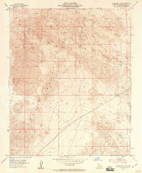
1955 Map of Silver Bell Mine
USGS Topo · Published 1955About this map
Silver Bell Mine occupies the high ground of the Lava Mountains in this mid-century desert survey, surrounded by several isolated Prospect x sites and unnamed prospects. The landscape is defined by its arid, volcanic character, prominently featuring an expansive area simply labeled Lava and the deeply incised Box Canyon. A significant cultural detail appears in the hills: Indian Petroglyphs are marked, indicating long-standing human presence in this high-elevation terrain. In the southeast, the encroachment of contemporary military infrastructure is evident with the boundary of the Marine Corps Training Center, contrasting the ancient petroglyphs and early mining activities. Geodetic points like VABM 4455 Bess and the remote Sheep Spr offer further orientation for those tracing the development of San Bernardino County's high desert during the 1950s.
Find a feature on this map
11 named features on this map. Tap any name to fly to it.
Don’t see what you’re looking for? This feature index may not catch every label — zoom into the map to look around manually.
Map Details
Editions of this 1955 Silver Bell Mine Map
3 editions found
Other maps of this area

1953 · San Bernardino
USGS Topo · 1:250,000

1954 · Galway Lake
USGS Topo · 1:24,000

1955 · Sunshine Peak
USGS Topo · 1:24,000

1955 · Newberry
USGS Topo · 1:62,500

1955 · Lavic
USGS Topo · 1:62,500

1955 · Cady Mountains
USGS Topo · 1:62,500

1955 · Rodman Mountains
USGS Topo · 1:62,500

1956 · San Bernardino
USGS Topo · 1:250,000

1957 · San Bernardino
USGS Topo · 1:250,000

1958 · San Bernardino
USGS Topo · 1:250,000