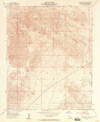
1955 Map of Silver Bell Mine
USGS Topo · Published 1958About this map
Silver Bell Mine and the surrounding high desert of San Bernardino County are captured here during a mid-century period of mineral prospecting and military expansion. This portion of the Lava Bed Mountains shows a landscape defined by volcanic geology and scarce water sources like Sheep Spr. Evidence of early human activity is noted at Indian Petroglyphs, while modern industry is represented by Prospect X, various Prospects, and a Cinder Pit. The southern portion of the map is dominated by the Marine Corps Training Center, reflecting the increasing federal use of the California desert following the second World War. Technical surveyors utilized high points such as VABM 4155 Bess along Iron Ridge to map the complex terrain of Box Canyon and the expansive volcanic flows simply labeled as Lava.
Find a feature on this map
12 named features on this map. Tap any name to fly to it.
Don’t see what you’re looking for? This feature index may not catch every label — zoom into the map to look around manually.
Map Details
Editions of this 1955 Silver Bell Mine Map
3 editions found
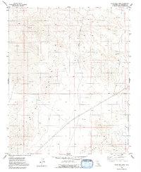
Other maps of this area

1953 · San Bernardino
USGS Topo · 1:250,000

1954 · Galway Lake
USGS Topo · 1:24,000

1955 · Silver Bell Mine
USGS Topo · 1:24,000

1955 · Sunshine Peak
USGS Topo · 1:24,000

1955 · Newberry
USGS Topo · 1:62,500

1955 · Lavic
USGS Topo · 1:62,500

1955 · Cady Mountains
USGS Topo · 1:62,500

1955 · Rodman Mountains
USGS Topo · 1:62,500

1956 · San Bernardino
USGS Topo · 1:250,000

1957 · San Bernardino
USGS Topo · 1:250,000