Old Maps of Phelan, California for Genealogy
Trace your family roots with 27 historic maps of Phelan. These high-res maps reveal old neighborhoods, homesites, landmarks, and streets — helping you uncover where your ancestors lived and how the area evolved over time.
- Explore historic neighborhoods: Identify where your relatives may have lived in the 1800s or 1900s.
- Compare maps over time: Trace the changes in streets, buildings, and landmarks for multi-generational research.
- Perfect for genealogy & ancestry research: Used by family historians and researchers to map out lineage and migration.
These maps are an incredible resource for exploring your personal connection to Phelan's past.
Phelan, CA maps
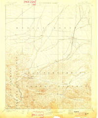
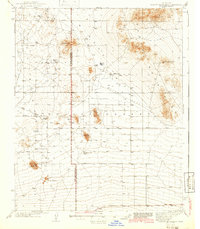
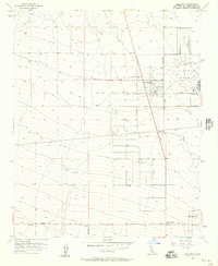
(27)- 1901 Map of Southern California Sheet No. 1
 1901 Southern California Sheet No. 11901 Print · USGSCovers Phelan, including Los Angeles, Long Beach, and other nearby areas11 unique versions available
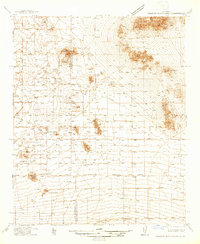
 - 1902 Map of Hesperia
 1902 Hesperia1902 Print · USGSCovers Phelan, including Victorville, Hesperia, and other nearby areas7 unique versions available
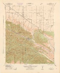
 - 1903 Map of San Antonio
 1903 San Antonio1903 Print · USGSCovers Phelan, including Piñon Hills, Wrightwood, and other nearby areas8 unique versions available
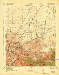
 - 1904 Map of Southern California Sheet No. 1, 1905 Print
 1904 Southern California Sheet No. 11905 Print · USGSCovers Phelan, including Los Angeles, Long Beach, and other nearby areas3 unique versions available
 - 1932 Map of Barstow, 1956 Print
 1932 Barstow1956 Print · USGSCovers Phelan, including Victorville, Apple Valley, and other nearby areas
 - 1934 Map of Barstow
 1934 Barstow1934 Print · USGSCovers Phelan, including Victorville, Apple Valley, and other nearby areas3 unique versions available
 - 1937 Map of Shadow Mountains
 1937 Shadow Mountains1937 Print · USGSCovers Phelan, including Adelanto, Piñon Hills, and other nearby areas2 unique versions available
 - 1942 Map of San Antonio
 1942 San Antonio1942 Print · USGSCovers Phelan, including Piñon Hills, Wrightwood, and other nearby areas4 unique versions available
 - 1942 Map of Hesperia
 1942 Hesperia1942 Print · USGSCovers Phelan, including Victorville, Hesperia, and other nearby areas
 - 1942 Map of Shadow Mountains
 1942 Shadow Mountains1942 Print · USGSCovers Phelan, including Adelanto, Piñon Hills, and other nearby areas2 unique versions available
 - 1953 Map of San Bernardino
 1953 San Bernardino1953 Print · USGSCovers Phelan, including Riverside, Fontana, and other nearby areas2 unique versions available
 - 1955 Map of Shadow Mountains SE, 1957 Print
 1955 Shadow Mountains SE1957 Print · USGSCovers Phelan, including Adelanto, Piñon Hills, and other nearby areas4 unique versions available
 - 1956 Map of San Bernardino
 1956 San Bernardino1956 Print · USGSCovers Phelan, including Riverside, Fontana, and other nearby areas
 - 1956 Map of Cajon, 1957 Print
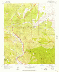 1956 Cajon1957 Print · USGSCovers Phelan, including Hesperia, Cajon, and other nearby areas8 unique versions available
 - 1956 Map of Baldy Mesa, 1957 Print
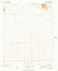
 1956 Baldy Mesa1957 Print · USGSCovers Phelan, including Victorville, Hesperia, and other nearby areas8 unique versions available
 - 1956 Map of Phelan, 1957 Print
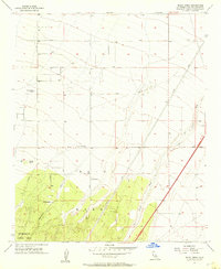
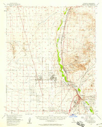
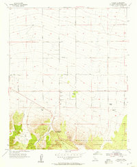 1956 Phelan1957 Print · USGSCovers Phelan, including Piñon Hills, Deer Haven, and other nearby areas6 unique versions available
 - 1956 Map of Adelanto, 1957 Print
 1956 Adelanto1957 Print · USGSCovers Phelan, including Victorville, Adelanto, and other nearby areas8 unique versions available
 - 1956 Map of Victorville, 1958 Print
 1956 Victorville1958 Print · USGSCovers Phelan, including Victorville, Apple Valley, and other nearby areas3 unique versions available
 - 1957 Map of San Bernardino
 1957 San Bernardino1957 Print · USGSCovers Phelan, including Riverside, Fontana, and other nearby areas
 - 1958 Map of San Bernardino, 1975 Print
 1958 San Bernardino1975 Print · USGSCovers Phelan, including Riverside, Fontana, and other nearby areas
 - 1959 Map of San Bernardino
 1959 San Bernardino1959 Print · USGSCovers Phelan, including Riverside, Fontana, and other nearby areas
 - 1966 Map of San Bernardino
 1966 San Bernardino1966 Print · USGSCovers Phelan, including Riverside, Fontana, and other nearby areas
 - 1982 Map of Victorville
 1982 Victorville1982 Print · USGSCovers Phelan, including Palmdale, Lancaster, and other nearby areas2 unique versions available
 - 1982 Map of San Bernardino, 1983 Print
 1982 San Bernardino1983 Print · USGSCovers Phelan, including Riverside, Fontana, and other nearby areas
 - 1996 Map of Phelan, 1999 Print
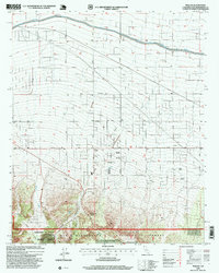 1996 Phelan1999 Print · USGSCovers Phelan, including Piñon Hills, Deer Haven, and other nearby areas
Showing maps 1-25 of 27
Top cities near Phelan
- Victorville historical maps
- Hesperia historical maps
- Adelanto historical maps
- Oak Hills historical maps
- Piñon Hills historical maps
- Wrightwood historical maps
Top neighborhoods of Phelan
Frequently asked questions
- What are the different types of historical maps available for Phelan?
- What is the oldest map of Phelan?
- Where can I purchase historical maps of Phelan for my home or office?
- Where can I download high-res historical maps of Phelan?
- Are there historical topographic maps available for Phelan?
- Is there historical aerial imagery available for Phelan?
- Where are historical maps of Phelan sourced from?