Old Maps of Piñon Hills, California
Explore 43 old maps of Piñon Hills, spanning from 1901 to today. These high-resolution historic maps reveal how streets, neighborhoods, landmarks, and natural features evolved over time — perfect for genealogy, metal detecting, research, and local history exploration.
What you can do with these maps:
- See how Piñon Hills changed over time: Compare historical maps to modern-day views to trace roads, homesites, rail lines & more.
- View detailed metadata: Each map includes creators, publishers, year, scale, and archive source.
- Overlay maps with satellite & LiDAR: Visualize the past alongside modern tools to explore terrain & human change.
- Trusted historical sources: Maps sourced from the USGS, Library of Congress, and other archives.
- Access maps your way: View online, download high-res files, or order prints for personal or research use.
Start exploring old maps of Piñon Hills to uncover forgotten places, hidden landmarks, and the deep history beneath your feet.
Piñon Hills, CA maps
(43)- 1901 Map of Southern California Sheet No. 1
 1901 Southern California Sheet No. 11901 Print · USGSGreater Los Angeles at the dawn of the twentieth century is a landscape of growing citrus towns and a burgeoning rail network. Genealogists and historians can trace the early gridded streets of Hollywood and Pasadena or locate landmarks like Bear Lake and the Cahuilla Indian Reservation.6 unique versions available
 - 1903 Map of San Antonio
 1903 San Antonio1903 Print · USGSThe high divide of the San Gabriel Mountains is captured here at the turn of the century, showing the early boundaries of the San Gabriel Timber Land Reserve. Local history enthusiasts can trace the old paths through Swartout Valley, the depths of Mine Gulch, and the descent into Lone Pine Canyon.7 unique versions available
 - 1904 Map of Southern California Sheet No. 1, 1905 Print
 1904 Southern California Sheet No. 11905 Print · USGSSouthern California at the dawn of the twentieth century shows a landscape of citrus groves and coastal towns connected by rail. Genealogists and historians can trace early settlements like San Juan Capistrano, find remote sites like the Rose Mine, and study the original water systems of the Santa Ana River.2 unique versions available
 - 1930 Map of Angle
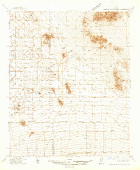
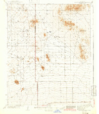
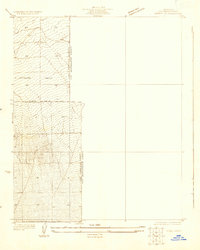 1930 Angle1930 Print · USGSThe high desert of the Antelope Valley comes into focus in 1930, capturing the region just as early roads began to define the terrain. Researchers can trace the path of the Palmdale-Victorville Road and locate an isolated desert Well.
 - 1932 Map of Angle
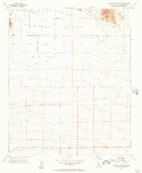
 1932 Angle1932 Print · USGSAntelope Valley was a sparsely inhabited desert frontier in the early 1930s as surveyors began formalizing the county lines. Researchers can trace the early jurisdictional divide between Los Angeles Co and San Bernardino Co near a lone Well.2 unique versions available
 - 1934 Map of Boneyard Canyon
 1934 Boneyard Canyon1934 Print · USGSThe Antelope Valley floor meets the steep mountain slopes in the mid-1930s. Researchers can trace early desert routes like Palmdale Victorville Road and Fort Tejon Road alongside the Angeles National Forest boundary.
 - 1936 Map of Swarthout
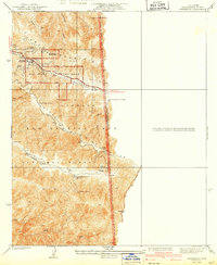
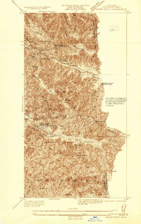 1936 Swarthout1936 Print · USGSThe high San Gabriel Mountains are captured in the mid-1930s as they evolved into a center for recreation and scientific study. Researchers can locate the Smithsonian Solar Observatory, the historic Native Son Mine, and the Master Ski Jump at the county recreation camps.
 - 1937 Map of Shadow Mountains
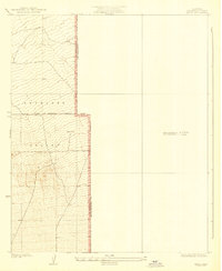
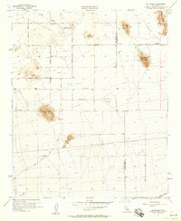
 1937 Shadow Mountains1937 Print · USGSThe High Desert border of San Bernardino and Los Angeles counties appears here as a landscape of isolated 1930s ranching outposts. Genealogists can trace family-named sites like Walton Place, Engelbrecht Place, and the Hibbard Ranch.2 unique versions available
 - 1939 Map of Boneyard Canyon
 1939 Boneyard Canyon1939 Print · USGSThe high desert meets the northern slopes of the San Gabriel Mountains during the late 1930s. Trace the paths of early travel routes like Fort Tejon Road and find landmarks such as the Reservoir near Mescal Creek.2 unique versions available
 - 1941 Map of Swarthout
 1941 Swarthout1941 Print · USGSThe high San Gabriel Mountains come into focus during the mid-1930s as a hub for scientific observation and mountain recreation. Researchers can trace the San Andreas Rift Zone or locate early forest outposts like Smithsonian Observatory and Prairie Fork Guard Sta.3 unique versions available
 - 1942 Map of San Antonio
 1942 San Antonio1942 Print · USGSThe high San Gabriel Mountains meet the Mojave Desert in the early 1940s, showing a rugged landscape of ranching and early mountain recreation. Genealogists and local historians can trace family lands like Smith Ranch and Nuss Ranch, or locate landmarks like the Smithsonian Observatory and Wrightwood.4 unique versions available
 - 1942 Map of Shadow Mountains
 1942 Shadow Mountains1942 Print · USGSThe High Desert at the start of the war reveals a landscape of isolated homesteads and early aviation landmarks. Genealogists and desert historians can locate family outposts like Walton Place and Hess Ranch or trace the early Palmdale Victorville Road.2 unique versions available
 - 1953 Map of San Bernardino
 1953 San Bernardino1953 Print · USGSSouthern California underwent massive post-war growth as suburban sprawl reached the foothills of the San Bernardino Mountains. Genealogists and historians can trace the rail-and-road roots of the Inland Empire through the Union Pacific RR and Lake Arrowhead resorts.2 unique versions available
 - 1955 Map of Shadow Mountains SE, 1957 Print
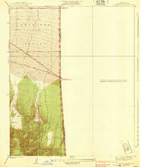
 1955 Shadow Mountains SE1957 Print · USGSThe high desert of San Bernardino County comes into focus mid-century, showing the early infrastructure of the El Mirage Valley. Researchers can trace the development of rural routes like Old Phelan Road and locate landmarks such as El Mirage Field.4 unique versions available
 - 1956 Map of San Bernardino
 1956 San Bernardino1956 Print · USGSSouthern California's Inland Empire and High Desert come into focus in the mid-fifties as agriculture gives way to suburban and military growth. Trace early rail lines like the Pacific Electric or find remote landmarks like Camp Rock Mine and George AFB.
 - 1956 Map of El Mirage, 1957 Print
 1956 El Mirage1957 Print · USGSThe high desert along the Los Angeles and San Bernardino county line comes into focus in the mid-1950s. Genealogists and researchers can trace the early road network and find historic landmarks like Moody Springs, the Three Sisters peaks, and the Gray Butte Field (Abandoned).5 unique versions available
 - 1956 Map of Phelan, 1957 Print
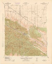
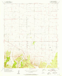 1956 Phelan1957 Print · USGSPhelan and the surrounding high desert ranchlands are captured here in the mid-1950s as the rural grid began to expand. Family historians can locate established properties like Johnson Ranch and Buttemer Ranch, or trace old routes through Cajon Canyon.6 unique versions available
 - 1956 Map of Mescal Creek, 1958 Print
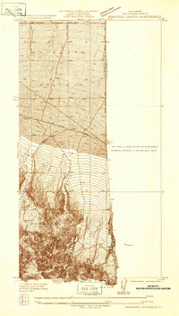
 1956 Mescal Creek1958 Print · USGSThe high San Gabriel Mountains meet the desert floor in the mid-1950s, a time when alpine recreation and organization camps flourished. Researchers can trace historic retreats like YMCA Camp, find the Smithsonian Observatory, and locate remote outposts like Hagenbaugh Ranch.6 unique versions available
 - 1957 Map of San Bernardino
 1957 San Bernardino1957 Print · USGSSouthern California's Inland Empire and High Desert met during the postwar expansion of the late fifties. Genealogists and historians can trace the growth of San Bernardino and Redlands alongside remote landmarks like Edwards AFB and the Camp Rock Mine.
 - 1958 Map of San Bernardino, 1975 Print
 1958 San Bernardino1975 Print · USGSSouthern California’s Inland Empire and High Desert come into focus during the mid-century boom, showing the rise of suburbs and massive military installations. Researchers can trace the rail networks of the Union Pacific RR or locate landmarks like Norton AFB and Big Bear Lake.
 - 1959 Map of San Bernardino
 1959 San Bernardino1959 Print · USGSSouthern California underwent a massive transformation in the late fifties as suburban growth and military power reshaped the desert and valley. Researchers can trace the legacy of the Union Pacific Railroad and locate early footprints of Joshua Tree National Monument and Edwards Air Force Base.
 - 1966 Map of San Bernardino
 1966 San Bernardino1966 Print · USGSThe San Bernardino Valley and Mojave Desert met during a period of massive military and suburban growth in the mid-sixties. Genealogists and historians can trace the development of Edwards Air Force Base, old desert mines like the Bagdad Chase Mine, and mountain communities near Big Bear Lake.
 - 1968 Map of El Mirage, 1969 Print
 1968 El Mirage1969 Print · USGSEl Mirage Valley and the high desert borderlands are shown here in the late sixties as aviation and rail infrastructure reshaped the landscape. Researchers can find the 36 Field (Abandoned) airfield, the Southern Pacific railroad line, and local landmarks like Black Butte.
 - 1982 Map of Victorville
 1982 Victorville1982 Print · USGSThe High Desert during the early eighties reveals a landscape of massive aerospace installations and growing desert communities. Researchers can trace the sprawling boundaries of Edwards Air Force Base alongside the vital California Aqueduct and the rail hub at Barstow.2 unique versions available
 - 1982 Map of San Bernardino, 1983 Print
 1982 San Bernardino1983 Print · USGSThe Inland Empire and San Gabriel Valley met at a peak of suburban and industrial expansion in the early eighties. Researchers can trace the massive rail infrastructure through Cajon Pass and locate landmarks like Norton Air Force Base or the Fontana International Raceway.
Showing maps 1-25 of 43
Top cities near Piñon Hills
- Victorville historical maps
- Hesperia historical maps
- Adelanto historical maps
- Wrightwood historical maps
Top neighborhoods of Piñon Hills
- Pinon Hills Estates historical maps
- Wildhorse Canyon historical maps
- Deer Haven historical maps
- Yucca Inn historical maps
Frequently asked questions
- What are the different types of historical maps available for Piñon Hills?
- What is the oldest map of Piñon Hills?
- Where can I purchase historical maps of Piñon Hills for my home or office?
- Where can I download high-res historical maps of Piñon Hills?
- Are there historical topographic maps available for Piñon Hills?
- Is there historical aerial imagery available for Piñon Hills?
- Where are historical maps of Piñon Hills sourced from?