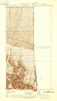
1934 Map of Boneyard Canyon
USGS Topo · Published 1934About this map
The Antelope Valley floor meets the northern slopes of the San Gabriel Mountains in this 1934 topographic study. Surveyed by F. K. Van Zandt under Division Engineer H. H. Hodgeson, the map documents the desert landscape just as formal county boundaries were being solidified between Los Angeles and San Bernardino. The northern sections show the early grid of the valley, featuring the Palmdale Victorville Road and Ave W, which served as primary corridors for desert travel.
Find a feature on this map
16 named features on this map. Tap any name to fly to it.
Don’t see what you’re looking for? This feature index may not catch every label — zoom into the map to look around manually.
Map Details
Editions of this 1934 Boneyard Canyon Map
This is the sole edition of this map. No revisions or reprints were ever made.
Other maps of this area

1901 · Southern California Sheet No. 1
USGS Topo · 1:250,000

1903 · San Antonio
USGS Topo · 1:62,500

1904 · Southern California Sheet No. 1
USGS Topo · 1:250,000

1930 · Black Butte
USGS Topo · 1:24,000

1930 · Angle
USGS Topo · 1:24,000

1932 · Angle
USGS Topo · 1:24,000

1933 · Black Butte
USGS Topo · 1:24,000

1934 · Mescal Creek
USGS Topo · 1:24,000
1936 · Mt. Baden-Powell
USGS Topo · 1:24,000
1936 · Swarthout
USGS Topo · 1:24,000