
1932 Map of Angle
USGS Topo · Published 1932About this map
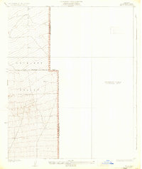
Antelope Valley defines the western half of this 1930s topographic study, a region of High Desert terrain marked by the convergence of the Los Angeles Co and San Bernardino Co boundaries. The map reveals a stark contrast between surveyed and unsurveyed lands during the early twentieth century, with the eastern portion designated as a Preliminary Edition Unsurveyed Area. Human footprint in this arid landscape is sparse, represented primarily by a single Well and the long east-west line of the First Standard Parallel North. This document captures the transition from raw desert frontier to an organized territorial grid, overseen by surveyors F.K. Van Zandt and J.E. Rockhold. The precise five-foot contour intervals provide a detailed record of the alluvial fans and subtle elevations as the valley floor slopes toward the San Gabriel range foothills.
Find a feature on this map
5 named features on this map. Tap any name to fly to it.
Don’t see what you’re looking for? This feature index may not catch every label — zoom into the map to look around manually.
Map Details
Editions of this 1932 Angle Map
2 editions found
Other maps of this area

1901 · Southern California Sheet No. 1
USGS Topo · 1:250,000

1903 · San Antonio
USGS Topo · 1:62,500

1904 · Southern California Sheet No. 1
USGS Topo · 1:250,000

1930 · Black Butte
USGS Topo · 1:24,000

1930 · El Mirage
USGS Topo · 1:24,000

1930 · Angle
USGS Topo · 1:24,000

1930 · Wilsona
USGS Topo · 1:24,000

1933 · El Mirage
USGS Topo · 1:24,000

1933 · Black Butte
USGS Topo · 1:24,000

1934 · Mescal Creek
USGS Topo · 1:24,000