1930s Maps of Piñon Hills, California
Explore 6 historic maps of Piñon Hills from the 1930s. These maps offer a rare glimpse into what life looked like during the 1930s — showing old roads, neighborhoods, homes, and landmarks that have changed or disappeared over time.
Whether you're researching your family's past, planning a metal detecting trip, or studying how Piñon Hills's landscape evolved across the 1930s, these high-resolution maps are a powerful tool for exploring the history of this region.
- Focus on a specific era: All maps on this page are from the 1930s, giving you a focused view of this time period.
- See what’s changed: Compare century-old streets, trails, and buildings to today's modern landscape using overlays and satellite layers.
- Research with precision: Use these maps for genealogy, historical research, land use analysis, or educational projects.
- View, download, or print: Maps are fully viewable online in high resolution, and can be downloaded or printed for your own records.
Start exploring Piñon Hills's history through authentic maps from the 1930s. This is your window into the past.
Piñon Hills, CA maps
(6)- 1930 Map of Angle
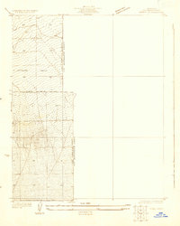 1930 Angle1930 Print · USGSThe high desert of the Antelope Valley comes into focus in 1930, capturing the region just as early roads began to define the terrain. Researchers can trace the path of the Palmdale-Victorville Road and locate an isolated desert Well.
 - 1932 Map of Angle
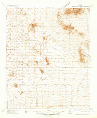
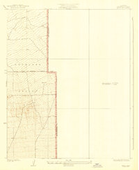 1932 Angle1932 Print · USGSAntelope Valley was a sparsely inhabited desert frontier in the early 1930s as surveyors began formalizing the county lines. Researchers can trace the early jurisdictional divide between Los Angeles Co and San Bernardino Co near a lone Well.2 unique versions available
 - 1934 Map of Boneyard Canyon
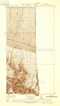 1934 Boneyard Canyon1934 Print · USGSThe Antelope Valley floor meets the steep mountain slopes in the mid-1930s. Researchers can trace early desert routes like Palmdale Victorville Road and Fort Tejon Road alongside the Angeles National Forest boundary.
 - 1936 Map of Swarthout
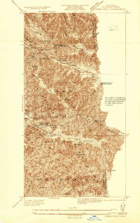 1936 Swarthout1936 Print · USGSThe high San Gabriel Mountains are captured in the mid-1930s as they evolved into a center for recreation and scientific study. Researchers can locate the Smithsonian Solar Observatory, the historic Native Son Mine, and the Master Ski Jump at the county recreation camps.
 - 1937 Map of Shadow Mountains
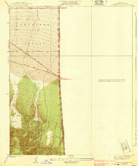
 1937 Shadow Mountains1937 Print · USGSThe High Desert border of San Bernardino and Los Angeles counties appears here as a landscape of isolated 1930s ranching outposts. Genealogists can trace family-named sites like Walton Place, Engelbrecht Place, and the Hibbard Ranch.2 unique versions available
 - 1939 Map of Boneyard Canyon
 1939 Boneyard Canyon1939 Print · USGSThe high desert meets the northern slopes of the San Gabriel Mountains during the late 1930s. Trace the paths of early travel routes like Fort Tejon Road and find landmarks such as the Reservoir near Mescal Creek.2 unique versions available
End of results
Showing maps 1-6 of 6
Top cities near Piñon Hills
- Victorville historical maps
- Hesperia historical maps
- Adelanto historical maps
- Wrightwood historical maps
Top neighborhoods of Piñon Hills
- Pinon Hills Estates historical maps
- Wildhorse Canyon historical maps
- Deer Haven historical maps
- Yucca Inn historical maps
Frequently asked questions
- What are the different types of historical maps available for Piñon Hills?
- What is the oldest map of Piñon Hills?
- Where can I purchase historical maps of Piñon Hills for my home or office?
- Where can I download high-res historical maps of Piñon Hills?
- Are there historical topographic maps available for Piñon Hills?
- Is there historical aerial imagery available for Piñon Hills?
- Where are historical maps of Piñon Hills sourced from?