Old Maps of Escondido, California for Hiking & Exploration
Hike through history with 61 historic maps of Escondido. Explore old trails, ghost towns, and forgotten backroads — perfect for outdoor adventurers and local explorers.
- Rediscover forgotten places: Map out old mining camps, roads, and footpaths that no longer exist on modern maps.
- Layer with modern tools: Combine with LiDAR or satellite views to plan hikes through historical terrain.
- Made for exploration: Popular among hikers, overlanders, and local history lovers.
Use these maps to find adventure and explore the hidden past of Escondido.
Escondido, CA maps
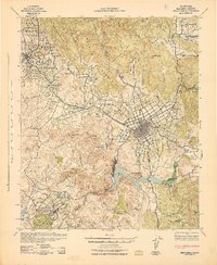
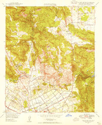
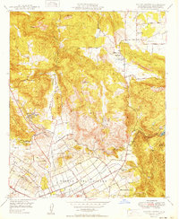
(61)- 1893 Map of Escondido
 1893 Escondido1893 Print · USGSNorth County San Diego emerges in the early 1890s as a region of new railroad towns and foothill settlements. Genealogists and historians can trace early grids in Escondido and locate smaller outposts like Olivenhain, Bernardo, and Vista.2 unique versions available
 - 1901 Map of Escondido
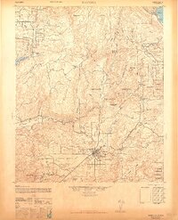
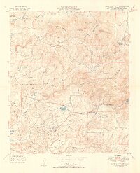
 1901 Escondido1901 Print · USGSInland San Diego County was a landscape of citrus groves and cattle ranges at the dawn of the twentieth century. Genealogists can trace family footprints in early settlements like Escondido and Bernardo, or follow the rail path of the Southern California R. R. Escondido Branch.6 unique versions available
 - 1901 Map of San Luis Rey
 1901 San Luis Rey1901 Print · USGSNorthern San Diego County is shown at the turn of the century as a landscape of sprawling ranchos, early coastal railroads, and secluded mountain valleys. Researchers can trace the routes of the California Southern RR or locate early settlements like De Luz, Pala, and the Temecula Indian Res.8 unique versions available
 - 1903 Map of Ramona
 1903 Ramona1903 Print · USGSSan Diego County's high country and interior valleys are captured here at the start of the twentieth century, during a time of mountain ranching and early gold mining. Researchers can trace the early footprints of Julian, Ramona, and Mesa Grande, alongside the boundaries of the San Jacinto Forest Reserve.6 unique versions available
 - 1904 Map of Southern California Sheet No. 2
 1904 Southern California Sheet No. 21904 Print · USGSSouthern California during the early 1900s shows the transition from vast ranchos to coastal rail towns. Genealogists and researchers can trace the Southern California R.R. through Oceanside, explore old land grants like Mission Viejo, and locate early settlements from Fallbrook to Julian.5 unique versions available
 - 1942 Map of Escondido
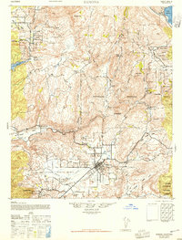
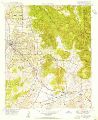
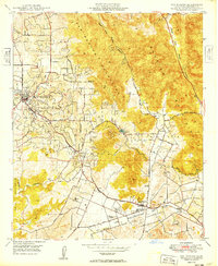
 1942 Escondido1942 Print · USGSNorthern San Diego County is captured here in the early 1940s, showing the inland citrus and ranching valleys before major development. Researchers can locate early schoolhouses like Rincon Sch and trace the original Escondido Branch rail line.
 - 1942 Map of Ramona, 1947 Print
 1942 Ramona1947 Print · USGSNorthern San Diego County ranching and forest lands are detailed here during the mid-1940s. Local researchers can trace family-named sites like Silvano Ranch or explore the boundaries of the San Pasqual Indian Reservation and Mesa Grande.2 unique versions available
 - 1947 Map of Ramona
 1947 Ramona1947 Print · USGSSan Diego’s inland valleys and mountain ranges appear in detail during the late 1940s as ranching and forestry shaped the region. Genealogists and local historians can locate early homesteads like Vineyard Ranch and trace the boundaries of the Mesa Grande Ind Res or San Pasqual Indian Reservation.
 - 1947 Map of Santa Ana, 1949 Print
 1947 Santa Ana1949 Print · USGSSouthern California is depicted here in the late forties, showing the expansion of the Inland Empire and the Orange County coast. Researchers can trace the early layout of Palm Springs or locate long-standing tribal lands like the Pala Indian Reservation and Rincon Indian Res.
 - 1948 Map of Rancho Santa Fe, 1955 Print
 1948 Rancho Santa Fe1955 Print · USGSCoastal San Diego County appears here shortly after the war, when the landscape was still defined by large ranchos and quiet canyons. Genealogists and local historians can trace the footprint of Rancho Santa Fe, find early mining sites like the Pyrophyllite Mine, or locate ancient Petroglyphs.3 unique versions available
 - 1948 Map of Valley Center, 1955 Print
 1948 Valley Center1955 Print · USGSNorthern San Diego County is captured here in the late 1940s as citrus groves and water projects reshaped the valley. Genealogists and local historians can locate Jesmond Dene, Oak Hill Cemetery, and the Valley Center (PO).2 unique versions available
 - 1948 Map of San Marcos, 1955 Print
 1948 San Marcos1955 Print · USGSPost-war San Diego County comes to life as citrus groves and early suburban growth meet the rugged San Marcos Mountains. Trace local heritage at San Marcos Cem, the early campus of Palomar Junior College and High School, and the San Marcos Valley Airport.2 unique versions available
 - 1948 Map of Rodriguez Mtn., 1957 Print
 1948 Rodriguez Mtn.1957 Print · USGSSan Diego County in the late 1940s is shown here as a landscape of tribal reservations and remote ranching outposts. Genealogists and historians can trace family locations at Melrose Ranch or follow the early footprint of the Bear Valley School.6 unique versions available
 - 1948 Map of Escondido, 1958 Print
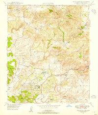
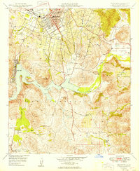
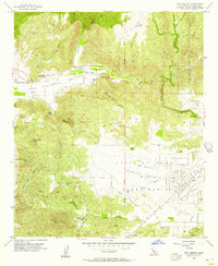
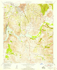 1948 Escondido1958 Print · USGSEscondido and the surrounding valleys of San Diego County are captured here just after the war as agriculture and early suburban growth began to meet. Genealogists can locate family holdings like Cloverdale Ranch or trace the historic Bernardo Winery and the original A T & S F rail alignment.2 unique versions available
 - 1949 Map of Valley Center
 1949 Valley Center1949 Print · USGSInland San Diego County was defined by its complex irrigation networks and rural ranching communities in the late 1940s. Genealogists and local historians can trace family-named roads and early civic sites like Valley Center Union School, Jesmond Dene, and Oak Hill Cemetery.2 unique versions available
 - 1949 Map of Rancho Santa Fe
 1949 Rancho Santa Fe1949 Print · USGSNorth coastal San Diego County is shown here in the late 1940s, a landscape of sprawling ranchos and early hilltop settlements. Researchers can trace historic boundaries like Los Encenitos and locate landmarks such as Olivenhain and the Pyrophyllite Mine.2 unique versions available
 - 1949 Map of Rodriguez Mtn.
 1949 Rodriguez Mtn.1949 Print · USGSSan Diego County's inland ridges and canyons are captured in the late 1940s before modern development transformed these ranchlands. Researchers can trace historic water management and rural life through the Escondido Canal, Bear Valley School, and Melrose Ranch.2 unique versions available
 - 1949 Map of San Marcos
 1949 San Marcos1949 Print · USGSNorthern San Diego County is captured here in the late 1940s, showing a landscape of burgeoning agricultural valleys and rugged mountain peaks. Genealogists can locate family landmarks like the San Marcos Cem, Rich-mar Sch, and the early San Marcos Valley Airport.
 - 1949 Map of Escondido
 1949 Escondido1949 Print · USGSPost-war San Diego County comes to life as the city of Escondido expands into the surrounding Rincon Del Diablo. Genealogists and historians can trace old property lines and landmarks like the Bernardo Winery, Del Dios, and the Union Elementary Schools.2 unique versions available
 - 1949 Map of Santa Ana
 1949 Santa Ana1949 Print · USGSSouthern California underwent a profound transformation in the late 1940s as military installations and citrus groves shared the landscape. Researchers can trace early coastal growth at Laguna Beach, military history at Camp Pendleton, and the rail corridors of the Pacific Electric.
 - 1954 Map of San Pasqual, 1957 Print
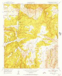
 1954 San Pasqual1957 Print · USGSThe valleys and peaks of San Diego County are captured here in the mid-1950s, showing a landscape of sprawling ranches and early aviation. Local historians can trace family-named sites like Fenton Ranch and find the Indian Cem near the San Pasqual Battlefield State Historical Monument.5 unique versions available
 - 1956 Map of Santa Ana
 1956 Santa Ana1956 Print · USGSSouthern California underwent massive mid-century transformation as suburban growth met major military and water projects. Trace the postwar expansion of Santa Ana and Riverside, the layout of Camp Pendleton, and the path of the Colorado River Aqueduct.
 - 1959 Map of Santa Ana, 1971 Print
 1959 Santa Ana1971 Print · USGSSouthern California is captured in a decade of transformation, from the Orange County coast to the desert floor. Researchers can trace the mid-century footprints of Camp Pendleton, March Air Force Base, and the original Ortega Highway.3 unique versions available
 - 1960 Map of Santa Ana
 1960 Santa Ana1960 Print · USGSSouthern California's coastal plains and inland deserts meet in this mid-century survey of the burgeoning Orange and Riverside county corridors. Researchers can trace the layout of early freeway systems, find tribal lands like the Soboba Indian Reservation, and locate military landmarks such as March Field.2 unique versions available
 - 1965 Map of Santa Ana
 1965 Santa Ana1965 Print · USGSSouthern California is captured in a decade of rapid growth, showing the coastal expansion from Santa Ana down to Oceanside. Genealogists and historians can trace the mid-century development of places like Garden Grove or the rural reaches of Escondido and the Palomar Observatory.
Showing maps 1-25 of 61
Top cities near Escondido
- San Diego historical maps
- Oceanside historical maps
- Carlsbad historical maps
- Vista historical maps
- San Marcos historical maps
- Encinitas historical maps
See more
Top neighborhoods of Escondido
- Downtown historical maps
- Los Arboles historical maps
- Mission Park historical maps
- Old Escondido historical maps
- Westside historical maps
Frequently asked questions
- What are the different types of historical maps available for Escondido?
- What is the oldest map of Escondido?
- Where can I purchase historical maps of Escondido for my home or office?
- Where can I download high-res historical maps of Escondido?
- Are there historical topographic maps available for Escondido?
- Is there historical aerial imagery available for Escondido?
- Where are historical maps of Escondido sourced from?