Old Maps of Atascadero, California for Academic Research
Study the evolution of Atascadero with 31 high-resolution historic maps. Whether you're teaching, researching, or modeling changes in land use, these maps provide essential visual documentation of urban, environmental, and geographic change.
- Analyze long-term change: Track patterns in development, transportation, and natural features.
- Ideal for environmental or urban studies: Support academic projects with primary historical map data.
- Use in the classroom or lab: Educators and researchers rely on these maps to bring historical context to life.
These maps are a powerful tool for teaching, research, and visualizing how Atascadero has changed over the decades.
Atascadero, CA maps
(31)- 1897 Map of San Luis Obispo
 1897 San Luis Obispo1897 Print · USGSCoastal California in the late nineteenth century centers on the vital Southern Pacific Line as it carves through the Santa Lucia Range. Genealogists and historians can trace the early city grid of San Luis Obispo and rural stops like Goldtree and Cuesta.4 unique versions available
 - 1900 Map of San Luis
 1900 San Luis1900 Print · USGSCoastal California at the turn of the century shows a landscape where rail lines like the Pacific Coast Ry met the sea. Trace early industrial sites like the Asphalt Mines or follow the coast from Morro Rock to the pier at Port Harford.4 unique versions available
 - 1919 Map of Paso Robles
 1919 Paso Robles1919 Print · USGSSan Luis Obispo County in the late nineteen-teens shows a landscape where the railroad spurred the growth of cattle and grain hubs. Researchers can trace the layout of Paso Robles or find rural landmarks like San Miguel Mission and Geneseo School.5 unique versions available
 - 1942 Map of San Luis Obispo
 1942 San Luis Obispo1942 Print · USGSSan Luis Obispo and the surrounding Santa Lucia Range are captured here just before the mid-century expansion, centered on the Southern Pacific rail line. Researchers can trace early campus boundaries at the California Polytechnic School and find rural landmarks like Stowe Sch and Eagle Ranch.2 unique versions available
 - 1943 Map of Paso Robles
 1943 Paso Robles1943 Print · USGSMid-century San Luis Obispo County is defined here by the river-and-rail corridor connecting Paso Robles to its rural agricultural outposts during the war years. Genealogists and historians can trace local family landmarks and district hubs like San Miguel Mission, Creston, and the Oak Flat School.
 - 1947 Map of San Luis Obispo, 1948 Print
 1947 San Luis Obispo1948 Print · USGSCoastal California at the dawn of the Cold War reveals a landscape of massive military reservations and quiet seaside towns. Genealogists and researchers can trace the Southern Pacific rail line, old mining sites like Los Burros Mine, and local landmarks from Point Buchon to the Carrizo Plain.
 - 1948 Map of San Luis Obispo
 1948 San Luis Obispo1948 Print · USGSCentral Coast life in the late 1940s is centered on the Southern Pacific rail line and expanding military bases. Genealogists can trace early rural life through Union School and local operations like the Klau Mine or Buena Vista Mine.
 - 1948 Map of Templeton, 1952 Print
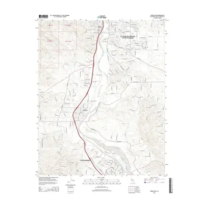
 1948 Templeton1952 Print · USGSThe Salinas River valley was a busy agricultural corridor in the late 1940s, anchored by the rail line and the growing community of Templeton. Genealogists and historians can trace family locations near Poultry Farms, the Eureka Sch, and the Templeton Cem.6 unique versions available
 - 1948 Map of Paso Robles, 1955 Print
 1948 Paso Robles1955 Print · USGSMid-century San Luis Obispo County comes to life along the Salinas River valley as the region's agricultural and transit networks solidified. Researchers can trace the Southern Pacific rail line through Paso Robles and locate vanished landmarks like Bethel School (Aband) and the Old Adobe.2 unique versions available
 - 1952 Map of San Luis Obispo, 1954 Print
 1952 San Luis Obispo1954 Print · USGSSan Luis Obispo County in the early fifties shows a landscape of burgeoning colleges, military grounds, and historic mines. Trace the Southern Pacific rail line as it winds past Santa Margarita and the Pick and Shovel Mine.2 unique versions available
 - 1956 Map of San Luis Obispo, 1963 Print
 1956 San Luis Obispo1963 Print · USGSCentral California coastal and valley life unfolds in the mid-fifties, from the shoreline of Pismo Beach to the arid Carrizo Plain. Trace early travel routes along the Southern Pacific RR or locate family sites near the Templeton Cemetery and Paso Robles County Cemetery.5 unique versions available
 - 1957 Map of San Luis Obispo
 1957 San Luis Obispo1957 Print · USGSCoastal California in the late fifties is defined by the steep Santa Lucia Range and the rail-connected hub of San Luis Obispo. Genealogists and researchers can trace rural life via Union School, the Southern Pacific line, and old sites like the Polar Star Mine.
 - 1958 Map of San Luis Obispo
 1958 San Luis Obispo1958 Print · USGSThe Central Coast in the late fifties reveals a landscape of ranching and early tourism before the massive expansion of the modern era. Trace the path of the Southern Pacific through Atascadero or locate family roots in coastal towns like Cayucos and Cambria.
 - 1961 Map of Paso Robles, 1968 Print
 1961 Paso Robles1968 Print · USGSSan Luis Obispo County’s interior emerges here in the early 1960s, centered on the Salinas River valley and its established rail-and-highway routes. Researchers can trace the layout of Paso Robles, locate the Templeton Cem, or find rural sites like Whitley Gardens and the Estrella Adobe Ch.2 unique versions available
 - 1965 Map of Atascadero, 1966 Print
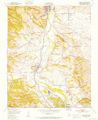
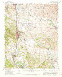
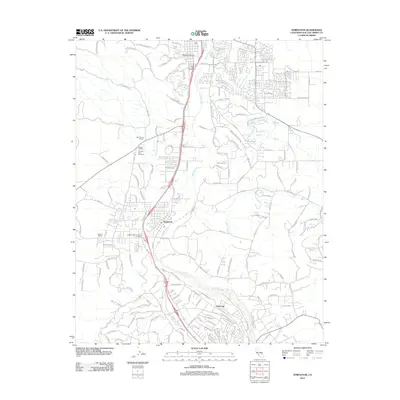
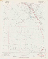 1965 Atascadero1966 Print · USGSMid-century San Luis Obispo County comes to life as Atascadero expands between the Salinas River and the Santa Lucia mountains. Genealogists and historians can trace local landmarks like Santa Rosa Sch, the Atascadero State Hospital, and the heights of Cerro Alto Lookout.4 unique versions available
 - 1965 Map of Santa Margarita, 1967 Print
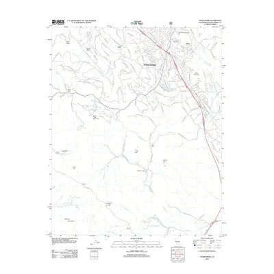
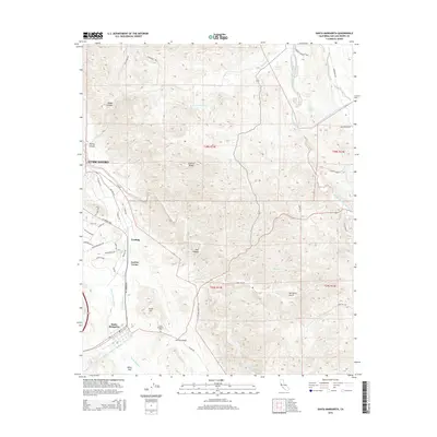
 1965 Santa Margarita1967 Print · USGSSanta Margarita and the Salinas River valley are captured in the mid-sixties as the railroad and ranching culture shaped the landscape. Genealogists can locate family sites at the Santa Margarita Cemetery, the Asistencia de Santa Margarita (Ruins), and Garden Farms.3 unique versions available
 - 1981 Map of San Luis Obispo
 1981 San Luis Obispo1981 Print · USGSThe Central Coast comes alive in the early eighties as the Southern Pacific railroad connects growing coastal towns and rugged inland ranges. Researchers can trace land grants like Santa Manuela, locate Cem sites, and explore the footprint of California Polytechnic State University.3 unique versions available
 - 1989 Map of Paso Robles
 1989 Paso Robles1989 Print · USGSCoastal mountains and the Salinas River valley meet in the late eighties as this region balances military installations and agriculture. Genealogists and historians can trace the Southern Pacific line through Paso Robles and Templeton or locate the Klau Mine and San Miguel.
 - 1995 Map of Atascadero, 2000 Print
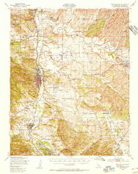
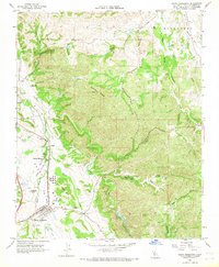
 1995 Atascadero2000 Print · USGSAtascadero and the Salinas River valley are captured in the mid-nineties as suburban growth pressed against the Santa Lucia Range. Researchers can locate established landmarks like the Atascadero State Hospital, the Charles Paddock Zoo, and Atascadero Lake.
 - 2012 Map of Santa Margarita, 2012 Print
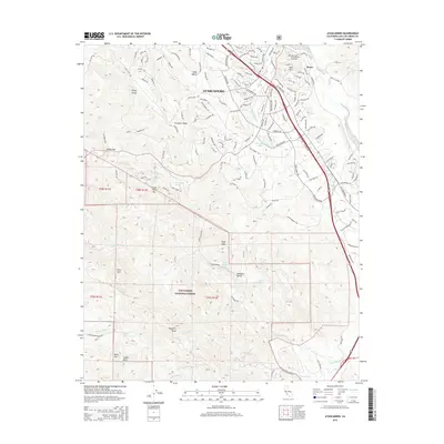
 2012 Santa Margarita2012 Print · USGSCovers Atascadero, including Garden Farms, Santa Margarita, and other nearby areas
 - 2012 Map of Templeton, 2012 Print
 2012 Templeton2012 Print · USGSCovers Atascadero, including Paso Robles, Asuncion, and other nearby areas
 - 2012 Map of Atascadero, 2012 Print
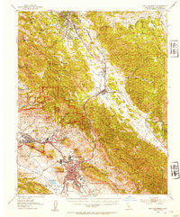
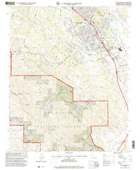
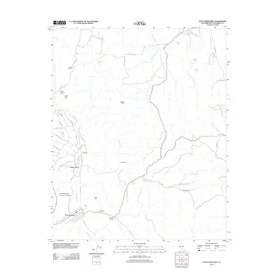
 2012 Atascadero2012 Print · USGSCovers Atascadero, including Morro Toro, San Luis Obispo County, and other nearby areas
 - 2015 Map of Atascadero, 2015 Print
 2015 Atascadero2015 Print · USGSCovers Atascadero, including Morro Toro, San Luis Obispo County, and other nearby areas
 - 2015 Map of Templeton, 2015 Print
 2015 Templeton2015 Print · USGSCovers Atascadero, including Paso Robles, Asuncion, and other nearby areas
 - 2015 Map of Santa Margarita, 2015 Print
 2015 Santa Margarita2015 Print · USGSCovers Atascadero, including Garden Farms, Santa Margarita, and other nearby areas
Showing maps 1-25 of 31
Top cities near Atascadero
Top neighborhoods of Atascadero
- Asuncion historical maps
- Las Lomas Village historical maps
- Dove Creek historical maps
- Woodridge historical maps
Frequently asked questions
- What are the different types of historical maps available for Atascadero?
- What is the oldest map of Atascadero?
- Where can I purchase historical maps of Atascadero for my home or office?
- Where can I download high-res historical maps of Atascadero?
- Are there historical topographic maps available for Atascadero?
- Is there historical aerial imagery available for Atascadero?
- Where are historical maps of Atascadero sourced from?