Old Maps of Butano Park, California for Hiking & Exploration
Hike through history with 23 historic maps of Butano Park. Explore old trails, ghost towns, and forgotten backroads — perfect for outdoor adventurers and local explorers.
- Rediscover forgotten places: Map out old mining camps, roads, and footpaths that no longer exist on modern maps.
- Layer with modern tools: Combine with LiDAR or satellite views to plan hikes through historical terrain.
- Made for exploration: Popular among hikers, overlanders, and local history lovers.
Use these maps to find adventure and explore the hidden past of Butano Park.
Butano Park, CA maps
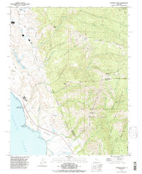
(23)- 1902 Map of Santa Cruz
 1902 Santa Cruz1902 Print · USGSCoastal California at the end of the Victorian era reveals a landscape of redwood forests, early university towns, and remote Pacific outposts. Genealogists and historians can trace the early rail corridors through Boulder Creek and Felton or locate coastal landmarks like Pigeon Point and Halfmoon Bay.9 unique versions available
 - 1940 Map of Ano Nuevo, 1943 Print
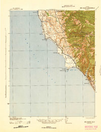
 1940 Ano Nuevo1943 Print · USGSThe San Mateo and Santa Cruz coastlines appear here in the early 1940s, highlighting a period of rural ranching and isolated coastal outposts. Genealogists and historians can trace the locations of Coastways Ranch, the Whitehouse Camp, and Trantor.
 - 1941 Map of Ano Nuevo Pt.
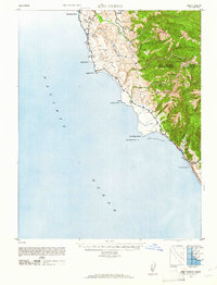
 1941 Ano Nuevo Pt.1941 Print · USGSThe rugged San Mateo coastline comes alive in the early 1940s, showing a landscape of maritime navigation and coastal ranching. Genealogy and history buffs can locate early landmarks like Pigeon Point LH, Notley Junction, and the historic Coastways Ranch.
 - 1942 Map of Ano Nuevo
 1942 Ano Nuevo1942 Print · USGSThe Central Coast south of Pescadero appears in this wartime survey, showing a landscape of remote ranching and prominent maritime landmarks. Researchers can trace early 20th-century coastal sites like Coastways Ranch, Notley Junction, and the iconic Pigeon Point light station.2 unique versions available
 - 1947 Map of San Francisco, 1948 Print
 1947 San Francisco1948 Print · USGSThe Bay Area in the late 1940s reveals a region transitioning from wartime intensity to post-war suburban growth. Trace the historic rail lines of the Southern Pacific RR or locate early military footprints at Fort Funston and Moffett Field.
 - 1948 Map of San Francisco, 1951 Print
 1948 San Francisco1951 Print · USGSThe Bay Area in the late 1940s reveals a landscape defined by rapid post-war growth and a heavy military presence at the Golden Gate. Trace the development of early trans-bay infrastructure like the Oakland-Bay Bridge and historic coastal defense sites such as Fort Funston and Alcatraz Island.
 - 1948 Map of Ano Nuevo, 1961 Print
 1948 Ano Nuevo1961 Print · USGSThe San Mateo and Santa Cruz coast is documented here in the decade following the Great Depression. Trace early coastal land use through landmarks like Whitehouse Camp (Abandoned), the Chalks Lookout, and Coastways Ranch.2 unique versions available
 - 1955 Map of San Francisco
 1955 San Francisco1955 Print · USGSThe San Francisco Bay Area and central coast are captured during the postwar boom as suburbs and infrastructure expanded rapidly. Trace the development of local communities and military installations like the Presidio and Fort Mason, or follow the Southern Pacific rail lines.
 - 1955 Map of Franklin Point, 1957 Print
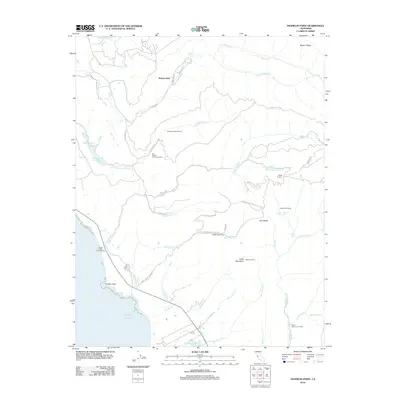
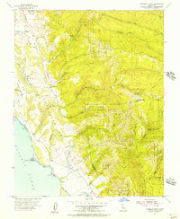 1955 Franklin Point1957 Print · USGSThe rugged San Mateo coastline meets the redwoods in the mid-1950s, a time when fire lookouts and old land grants still defined the backwoods. Researchers can locate the Yankee Jim Lookout Station, trace the Butano Grant Bdy, or find the secluded Cemetery near the coast.5 unique versions available
 - 1956 Map of San Francisco
 1956 San Francisco1956 Print · USGSThe San Francisco Bay Area is captured in the mid-fifties, showing a landscape of rapid post-war growth and massive military installations. Researchers can trace the sprawling rail lines of the Southern Pacific and locate historic sites like Stanford University or the Hunters Point Naval Shipyard.4 unique versions available
 - 1957 Map of San Francisco
 1957 San Francisco1957 Print · USGSThe Bay Area in the mid-fifties reveals a rapidly growing metropolitan landscape connected by its iconic spans and rail networks. Researchers can trace the layout of military sites like the Presidio and the extent of the Southern Pacific and Western Pacific railroads.
 - 1960 Map of San Francisco
 1960 San Francisco1960 Print · USGSThe San Francisco Bay Area at the start of the sixties reveals a landscape of rapid expansion and critical infrastructure. Researchers can trace the development of East Bay communities like Russell City and Mt Eden or locate early rural landmarks like Alpine School.
 - 1961 Map of San Francisco
 1961 San Francisco1961 Print · USGSThe Bay Area at the dawn of the 1960s reveals a landscape of growing cities and massive Cold War military installations. Genealogists and historians can trace the mid-century urban footprint from Berkeley to San Mateo, while locating landmarks like the Presidio, Alcatraz Island, and Moffett Field Air Station.
 - 1964 Map of San Francisco
 1964 San Francisco1964 Print · USGSThe Bay Area in the mid-sixties shows a region of rapid suburban expansion and major military installations. Researchers can trace the development of the South Bay near Stanford University or locate family plots in the historic Cypress Lawn Cem and Holy Cross Cem.
 - 1971 Map of San Francisco
 1971 San Francisco1971 Print · USGSThe San Francisco Bay Area at the start of the 1970s is shown here as a dense network of aerospace hubs, naval bases, and expanding suburbs. Researchers can trace the mid-century footprint of Stanford University, the industrial Salt Evaporators, and the Southern Pacific rail lines.
 - 1982 Map of Palo Alto, 1983 Print
 1982 Palo Alto1983 Print · USGSThe Santa Cruz Mountains and the Peninsula's bayshore are captured here in the early eighties as tech-driven growth reshaped the valley. Researchers can trace the sprawling grounds of Stanford University or explore coastal landmarks like the Pigeon Point Lighthouse.2 unique versions available
 - 1985 Map of San Francisco, 1989 Print
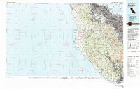
 1985 San Francisco1989 Print · USGSThe Bay Area is captured in the mid-1980s through experimental Landsat satellite imagery, offering a unique technological perspective of the California coast. Trace the urban boundaries of San Francisco and Alameda against the San Francisco Bay and Lorenzo.
 - 1991 Map of Franklin Point, 1995 Print
 1991 Franklin Point1995 Print · USGSThe San Mateo coast in the early nineties displays a landscape of rugged state reserves and ancient redwood forests. Genealogists and historians can locate Pescadero High Sch, the Cemetery near Cascade Creek, and remote landmarks like Chalk Mtn.2 unique versions available
 - 1998 Map of Franklin Point, 2002 Print
 1998 Franklin Point2002 Print · USGSThe San Mateo and Santa Cruz coastlines meet in the 1990s at the rugged Punta del Año Nuevo headlands. Genealogists and historians can trace the remote Cemetery near Cascade Creek or locate landmarks like Chalk Mtn and the Sandy Point Guard Station.
 - 2012 Map of Franklin Point, 2012 Print
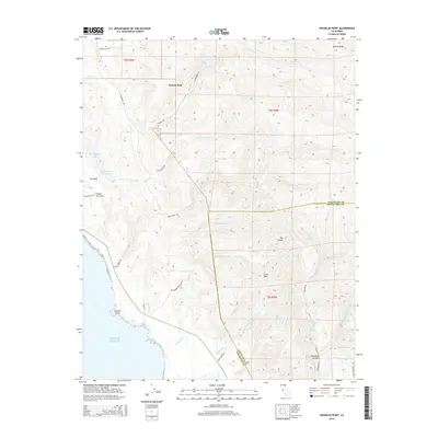
 2012 Franklin Point2012 Print · USGSCovers Butano Park, including Whitehouse Canyon, San Mateo County, and other nearby areas
 - 2015 Map of Franklin Point, 2015 Print
 2015 Franklin Point2015 Print · USGSCovers Butano Park, including Whitehouse Canyon, San Mateo County, and other nearby areas
 - 2018 Map of Franklin Point, 2018 Print
 2018 Franklin Point2018 Print · USGSCovers Butano Park, including Whitehouse Canyon, San Mateo County, and other nearby areas
 - 2021 Map of Franklin Point, 2021 Print
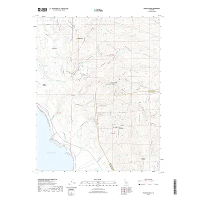
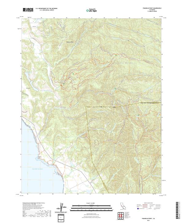 2021 Franklin Point2021 Print · USGSThe rugged coastline of the Santa Cruz Mountains comes to life in this recent survey. Local historians can trace the paths of the Butano Fire Rd Trl and find landmarks like Berry Creek Falls and Franklin Point.
End of results
Showing maps 1-23 of 23
Top cities near Butano Park
- Redwood City historical maps
- Mountain View historical maps
- Palo Alto historical maps
- Santa Cruz historical maps
- Menlo Park historical maps
- East Palo Alto historical maps
See more
Frequently asked questions
- What are the different types of historical maps available for Butano Park?
- What is the oldest map of Butano Park?
- Where can I purchase historical maps of Butano Park for my home or office?
- Where can I download high-res historical maps of Butano Park?
- Are there historical topographic maps available for Butano Park?
- Is there historical aerial imagery available for Butano Park?
- Where are historical maps of Butano Park sourced from?