1950s Maps of Pacifica, California
Explore 6 historic maps of Pacifica from the 1950s. These maps offer a rare glimpse into what life looked like during the 1950s — showing old roads, neighborhoods, homes, and landmarks that have changed or disappeared over time.
Whether you're researching your family's past, planning a metal detecting trip, or studying how Pacifica's landscape evolved across the 1950s, these high-resolution maps are a powerful tool for exploring the history of this region.
- Focus on a specific era: All maps on this page are from the 1950s, giving you a focused view of this time period.
- See what’s changed: Compare century-old streets, trails, and buildings to today's modern landscape using overlays and satellite layers.
- Research with precision: Use these maps for genealogy, historical research, land use analysis, or educational projects.
- View, download, or print: Maps are fully viewable online in high resolution, and can be downloaded or printed for your own records.
Start exploring Pacifica's history through authentic maps from the 1950s. This is your window into the past.
Pacifica, CA maps
(6)- 1950 Map of San Francisco South
 1950 San Francisco South1950 Print · USGSThe San Francisco peninsula mid-century is a landscape of rapid suburban growth and massive memorial parks. Trace the historic grounds of the Tanforan Race Track, the early runways of the International Airport, and the sprawling Golden Gate National Cemetery.
 - 1955 Map of San Francisco
 1955 San Francisco1955 Print · USGSThe San Francisco Bay Area and central coast are captured during the postwar boom as suburbs and infrastructure expanded rapidly. Trace the development of local communities and military installations like the Presidio and Fort Mason, or follow the Southern Pacific rail lines.
 - 1956 Map of San Francisco
 1956 San Francisco1956 Print · USGSThe San Francisco Bay Area is captured in the mid-fifties, showing a landscape of rapid post-war growth and massive military installations. Researchers can trace the sprawling rail lines of the Southern Pacific and locate historic sites like Stanford University or the Hunters Point Naval Shipyard.4 unique versions available
 - 1956 Map of Montara Mountain, 1957 Print
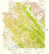 1956 Montara Mountain1957 Print · USGSThe San Francisco Peninsula comes into sharp focus during the mid-fifties, showing the coastal fog-belt towns meeting the expanding suburban sprawl. Trace early landmarks like the Sanchez Adobe and Point Montara Light Station alongside the rising San Francisco International Airport.5 unique versions available
 - 1956 Map of San Francisco South, 1958 Print
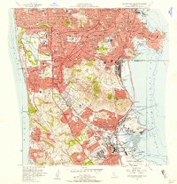 1956 San Francisco South1958 Print · USGSThe San Francisco peninsula transitioned into a post-war suburban and industrial hub during the mid-fifties. Researchers can trace the vast cemetery complex of Colma, the early layout of San Francisco International Airport, and the Naval Reservation at South Basin.6 unique versions available
 - 1957 Map of San Francisco
 1957 San Francisco1957 Print · USGSThe Bay Area in the mid-fifties reveals a rapidly growing metropolitan landscape connected by its iconic spans and rail networks. Researchers can trace the layout of military sites like the Presidio and the extent of the Southern Pacific and Western Pacific railroads.
End of results
Showing maps 1-6 of 6
Top cities near Pacifica
- San Francisco historical maps
- Oakland historical maps
- Berkeley historical maps
- San Mateo historical maps
- Daly City historical maps
- Redwood City historical maps
See more
Top neighborhoods of Pacifica
- Castle Hill historical maps
- Hilton Heights historical maps
- Pedro Valley historical maps
- Rockaway Beach historical maps
- Linda Mar historical maps
- Vallemar historical maps
See more
Frequently asked questions
- What are the different types of historical maps available for Pacifica?
- What is the oldest map of Pacifica?
- Where can I purchase historical maps of Pacifica for my home or office?
- Where can I download high-res historical maps of Pacifica?
- Are there historical topographic maps available for Pacifica?
- Is there historical aerial imagery available for Pacifica?
- Where are historical maps of Pacifica sourced from?