2000s (21st Century) Maps of Pacifica, California
Explore 12 historic maps of Pacifica from the 2000s (21st Century). These maps offer a rare glimpse into what life looked like during the 2000s — showing old roads, neighborhoods, homes, and landmarks that have changed or disappeared over time.
Whether you're researching your family's past, planning a metal detecting trip, or studying how Pacifica's landscape evolved across the 2000s, these high-resolution maps are a powerful tool for exploring the history of this region.
- Focus on a specific era: All maps on this page are from the 2000s, giving you a focused view of this time period.
- See what’s changed: Compare century-old streets, trails, and buildings to today's modern landscape using overlays and satellite layers.
- Research with precision: Use these maps for genealogy, historical research, land use analysis, or educational projects.
- View, download, or print: Maps are fully viewable online in high resolution, and can be downloaded or printed for your own records.
Start exploring Pacifica's history through authentic maps from the 2000s. This is your window into the past.
Pacifica, CA maps
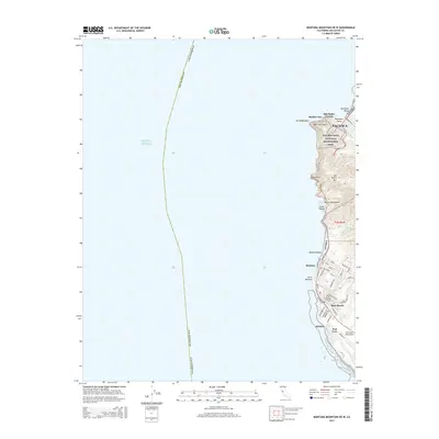
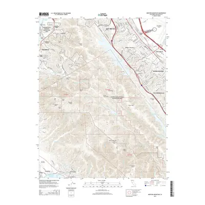
(12)- 2012 Map of Montara Mountain OE W, 2012 Print
 2012 Montara Mountain OE W2012 Print · USGSCovers Pacifica, including Moss Beach, Montara, and other nearby areas
 - 2012 Map of San Francisco South, 2012 Print
 2012 San Francisco South2012 Print · USGSCovers Pacifica, including San Francisco, Daly City, and other nearby areas
 - 2012 Map of Montara Mountain, 2012 Print
 2012 Montara Mountain2012 Print · USGSCovers Pacifica, including San Bruno, Burlingame, and other nearby areas
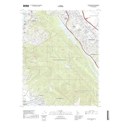
 - 2015 Map of Montara Mountain OE W, 2015 Print
 2015 Montara Mountain OE W2015 Print · USGSCovers Pacifica, including Moss Beach, Montara, and other nearby areas
 - 2015 Map of Montara Mountain, 2015 Print
 2015 Montara Mountain2015 Print · USGSCovers Pacifica, including San Bruno, Burlingame, and other nearby areas
 - 2015 Map of San Francisco South, 2015 Print
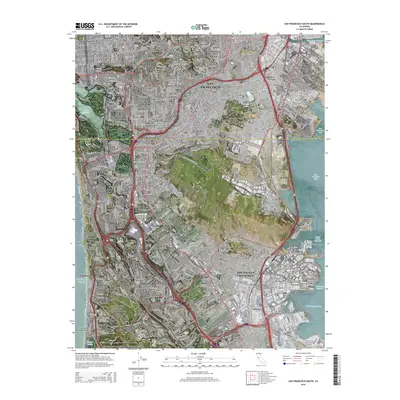 2015 San Francisco South2015 Print · USGSCovers Pacifica, including San Francisco, Daly City, and other nearby areas
 - 2018 Map of Montara Mountain OE W, 2018 Print
 2018 Montara Mountain OE W2018 Print · USGSCovers Pacifica, including Moss Beach, Montara, and other nearby areas
 - 2018 Map of Montara Mountain, 2018 Print
 2018 Montara Mountain2018 Print · USGSCovers Pacifica, including San Bruno, Burlingame, and other nearby areas
 - 2018 Map of San Francisco South, 2018 Print
 2018 San Francisco South2018 Print · USGSCovers Pacifica, including San Francisco, Daly City, and other nearby areas
 - 2021 Map of Montara Mountain OE W, 2021 Print
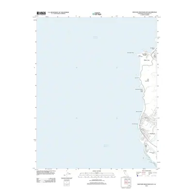
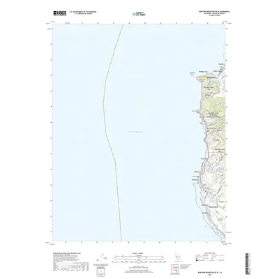
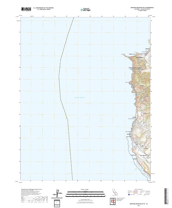 2021 Montara Mountain OE W2021 Print · USGSThe San Mateo coastline comes alive in this contemporary record of the rugged cliffs and canyons south of San Francisco. Trace the evolution of coastal transit through Devils Slide and find local landmarks like Point Montara and the Half Moon Bay Airport.
 - 2021 Map of San Francisco South, 2021 Print
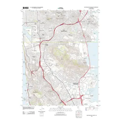
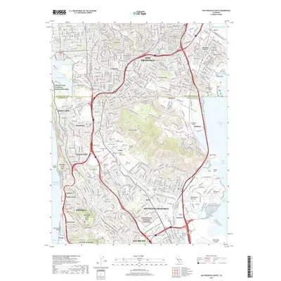
 2021 San Francisco South2021 Print · USGSThe San Francisco Peninsula and northern San Mateo County appear here as a complex urban corridor during the early twenty-first century. Researchers can trace the vast cemetery lands of Colma, including the Italian Cem, or locate landmarks like Lake Merced and the Bayview District.
 - 2022 Map of Montara Mountain, 2022 Print
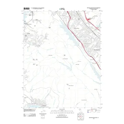
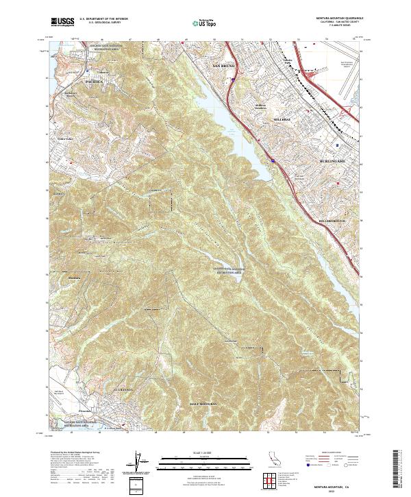 2022 Montara Mountain2022 Print · USGSThe San Francisco Peninsula highlands and the Pacific coast come together in this 2022 survey of San Mateo County. Local researchers can trace modern trail systems like the Sweeney Ridge Trail and Coastal Trail alongside landmarks like Half Moon Bay Airport and San Andreas Lake.
End of results
Showing maps 1-12 of 12
Top cities near Pacifica
- San Francisco historical maps
- Oakland historical maps
- Berkeley historical maps
- San Mateo historical maps
- Daly City historical maps
- Redwood City historical maps
See more
Top neighborhoods of Pacifica
- Castle Hill historical maps
- Hilton Heights historical maps
- Pedro Valley historical maps
- Rockaway Beach historical maps
- Linda Mar historical maps
- Vallemar historical maps
See more
Frequently asked questions
- What are the different types of historical maps available for Pacifica?
- What is the oldest map of Pacifica?
- Where can I purchase historical maps of Pacifica for my home or office?
- Where can I download high-res historical maps of Pacifica?
- Are there historical topographic maps available for Pacifica?
- Is there historical aerial imagery available for Pacifica?
- Where are historical maps of Pacifica sourced from?