Old Maps of Redwood City, California for Academic Research
Study the evolution of Redwood City with 64 high-resolution historic maps. Whether you're teaching, researching, or modeling changes in land use, these maps provide essential visual documentation of urban, environmental, and geographic change.
- Analyze long-term change: Track patterns in development, transportation, and natural features.
- Ideal for environmental or urban studies: Support academic projects with primary historical map data.
- Use in the classroom or lab: Educators and researchers rely on these maps to bring historical context to life.
These maps are a powerful tool for teaching, research, and visualizing how Redwood City has changed over the decades.
Redwood City, CA maps
(64)- 1892 Map of San Mateo
 1892 San Mateo1892 Print · USGSThe San Francisco Peninsula in the 1890s reveals a landscape of ranchos and rising rail towns. Trace the early footprints of Colma, Millbrae, and South San Francisco alongside vital water infrastructure like the Crystal Springs Dam.
 - 1896 Map of San Mateo
 1896 San Mateo1896 Print · USGSThe northern San Francisco Peninsula comes alive in this late nineteenth-century survey. Genealogists and historians can trace early trackage of the Southern Pacific R. R. through Colma and Millbrae, or locate the Industrial School and Brewer School.
 - 1897 Map of Palo Alto
 1897 Palo Alto1897 Print · USGSThe San Francisco Peninsula and Santa Clara Valley emerge in the late nineteenth century as academic and rail hubs. Trace the early footprints of Stanford University, the primary line of the Southern Pacific RR, and the transition of old ranchos like La Purisima Concepcion.
 - 1899 Map of Palo Alto
 1899 Palo Alto1899 Print · USGSThe San Francisco Peninsula was entering a period of rapid development in the 1890s as railroad towns began to flourish around the new Stanford University campus. You can trace early property lines across Pastoria de las Borregas or locate nineteenth-century landings like Cooley Landing and Jagel Landing.11 unique versions available
 - 1899 Map of Haywards
 1899 Haywards1899 Print · USGSThe East Bay shoreline at the end of the century was a landscape of industrial salt works and vital maritime landings. Genealogists and historians can trace the early rail stops at Haywards Sta. or locate family trade hubs at Mulford Landing and Jarvis Landing.5 unique versions available
 - 1899 Map of San Mateo
 1899 San Mateo1899 Print · USGSThe northern San Mateo peninsula appears here in the late nineteenth century as a landscape of early rail lines and critical water infrastructure. Trace the early development of South San Francisco, the sprawling Cemeteries of Colma, and rural schoolhouses like Hoyt School.6 unique versions available
 - 1902 Map of Santa Cruz
 1902 Santa Cruz1902 Print · USGSCoastal California at the end of the Victorian era reveals a landscape of redwood forests, early university towns, and remote Pacific outposts. Genealogists and historians can trace the early rail corridors through Boulder Creek and Felton or locate coastal landmarks like Pigeon Point and Halfmoon Bay.9 unique versions available
 - 1915 Map of San Mateo
 1915 San Mateo1915 Print · USGSThe San Francisco Peninsula at the start of the twentieth century shows a landscape transitioning from rural ranchos to industrial centers and suburbs. Genealogists can trace family footprints at Colma, locate the Hoyt School, or follow the Southern Pacific RR through Baden Sta.6 unique versions available
 - 1915 Map of Haywards
 1915 Haywards1915 Print · USGSThe East Bay shoreline and inland foothills are shown here in the mid-1910s during a height of coastal industry. Genealogists and historians can trace old shipping points like Mulford Landing, early salt operations at Union City Salt Works, and the rail lines of the Western Pacific.4 unique versions available
 - 1939 Map of San Mateo, 1956 Print
 1939 San Mateo1956 Print · USGSThe San Francisco Peninsula at the brink of the 1940s reveals a landscape of ridge-top vistas and growing railroad towns. Researchers can trace the early layouts of Burlingame, San Bruno, and Millbrae, or locate institutional landmarks like St Josephs Military Academy and the extensive Chinese Cem.3 unique versions available
 - 1940 Map of Halfmoon Bay
 1940 Halfmoon Bay1940 Print · USGSThe San Mateo coast and Santa Cruz Mountains appear here in the early 1940s, balancing rural ranching with early oil exploration. Genealogists and local historians can trace family-named sites like Bowman Ranch and old rural hubs including Pescadero and La Honda.2 unique versions available
 - 1941 Map of Palo Alto
 1941 Palo Alto1941 Print · USGSThe Peninsula and Santa Clara Valley are seen here in the early 1940s, just as the region began its mid-century transformation. Researchers can trace the layout of Stanford University, the military grounds of Moffett Field, and local landmarks like Flood Park.
 - 1942 Map of Hayward
 1942 Hayward1942 Print · USGSThe East Bay shoreline and inland foothills come alive in the early 1940s as industry and infrastructure reshape the landscape. Researchers can trace the original footprints of Russell City and Mt Eden or locate the historic Oakland Speedway and Fairmont Hospital.
 - 1943 Map of Palo Alto
 1943 Palo Alto1943 Print · USGSThe San Francisco Peninsula was still a region of orchards and academic outposts in the years following the Great Depression. Researchers can trace the development of early Silicon Valley through the Southern Pacific line and family landmarks like Duveneck Ranch and the Whisman Dist School.
 - 1943 Map of San Mateo
 1943 San Mateo1943 Print · USGSThe San Francisco Peninsula during the mid-war years shows a region of expanding shoreline industry and established hillside communities. Researchers can trace historic landmarks like St Josephs Military Academy and the Golden Gate National Cem.
 - 1943 Map of Halfmoon Bay
 1943 Halfmoon Bay1943 Print · USGSSan Mateo County's coastline and mountain ridges appear here during the mid-war years, showcasing a landscape of rural schoolhouses and coastal hamlets. Trace family roots and local landmarks from the Pulgas Water Temple to old sites like Pescadero and Purisima Sch.
 - 1947 Map of San Francisco, 1948 Print
 1947 San Francisco1948 Print · USGSThe Bay Area in the late 1940s reveals a region transitioning from wartime intensity to post-war suburban growth. Trace the historic rail lines of the Southern Pacific RR or locate early military footprints at Fort Funston and Moffett Field.
 - 1947 Map of San Mateo, 1957 Print
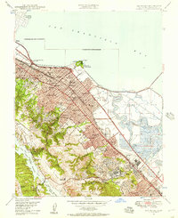 1947 San Mateo1957 Print · USGSMid-century San Mateo County shows a landscape of growing suburbs and salt marshes before the era of massive bay fill. Genealogists and historians can locate the San Mateo Junior College, trace the Southern Pacific line, or find the California Military Academy in Belmont.
 - 1948 Map of Redwood Point
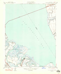 1948 Redwood Point1948 Print · USGSThe San Mateo County shoreline in the late 1940s was a landscape of tidal marshes and industrial salt production. Trace the early layout of City Harbor and San Carlos Airport alongside landmarks like Oradio Sta KNBC.
 - 1948 Map of San Francisco, 1951 Print
 1948 San Francisco1951 Print · USGSThe Bay Area in the late 1940s reveals a landscape defined by rapid post-war growth and a heavy military presence at the Golden Gate. Trace the development of early trans-bay infrastructure like the Oakland-Bay Bridge and historic coastal defense sites such as Fort Funston and Alcatraz Island.
 - 1948 Map of Palo Alto, 1956 Print
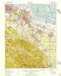 1948 Palo Alto1956 Print · USGSThe San Francisco Peninsula is captured here during its postwar transformation into a suburban and technological hub. Genealogists and local historians can trace early neighborhood boundaries near Stanford University, the sprawling Moffet Naval Air Station, and family landmarks like O'Neal Ranch.
 - 1949 Map of San Mateo
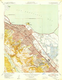 1949 San Mateo1949 Print · USGSThe mid-century San Mateo Peninsula is captured here as a bustling landscape of suburban growth and institutional development. Researchers can trace the legacy of local landmarks like the Bay Meadows Race Track, St Johns Cem, and the historic College of Notre Dame.
 - 1953 Map of Woodside, 1954 Print
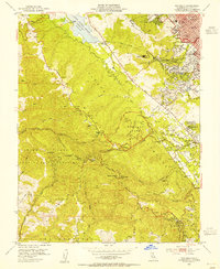 1953 Woodside1954 Print · USGSThe Woodside hills and San Mateo ridges come into sharp focus in the early 1950s, showing a landscape of mountain schools and deep gulches. Genealogists and hikers can trace the Old Woodside Store, the high-altitude Sky Londa, and the historic Pulgas Water Temple.2 unique versions available
 - 1953 Map of Palo Alto, 1955 Print
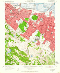 1953 Palo Alto1955 Print · USGSMid-century development spreads across the San Francisco Peninsula in the 1950s, bridging the gap between historic ranchos and suburban growth. Genealogists and local historians can trace the footprint of Stanford University, locate old neighborhood schools like Selby Lane Sch, or follow the Southern Pacific rail line.2 unique versions available
 - 1955 Map of San Francisco
 1955 San Francisco1955 Print · USGSThe San Francisco Bay Area and central coast are captured during the postwar boom as suburbs and infrastructure expanded rapidly. Trace the development of local communities and military installations like the Presidio and Fort Mason, or follow the Southern Pacific rail lines.
Showing maps 1-25 of 64
Top cities near Redwood City
- San Jose historical maps
- San Francisco historical maps
- Oakland historical maps
- Fremont historical maps
- Hayward historical maps
- Sunnyvale historical maps
See more
Top neighborhoods of Redwood City
Frequently asked questions
- What are the different types of historical maps available for Redwood City?
- What is the oldest map of Redwood City?
- Where can I purchase historical maps of Redwood City for my home or office?
- Where can I download high-res historical maps of Redwood City?
- Are there historical topographic maps available for Redwood City?
- Is there historical aerial imagery available for Redwood City?
- Where are historical maps of Redwood City sourced from?