Old Maps of Cuyama, California for Metal Detecting
Plan your next treasure hunt with 17 historic maps of Cuyama. Find old homesites, ghost towns, trails, and gathering spots that may be lost to time — perfect for identifying promising metal detecting locations.
- Locate forgotten sites: Uncover places like long-lost settlements, abandoned rail lines, or gathering spots.
- Plan better hunts: Use map overlays combined with LiDAR or satellite views to narrow in on historically rich areas.
- Made for detectorists: Thousands of hobbyists use these maps to discover relics, coins, and hidden history.
Use these historic maps to boost your research and find new opportunities beneath the surface of Cuyama.
Cuyama, CA maps
(17)- 1902 Map of Santa Ynez
 1902 Santa Ynez1902 Print · USGSSanta Barbara County at the turn of the century was a land of high mountain meadows and isolated ranching outposts. Genealogists can trace family holdings at Cuyama Ranch or follow old trails through Salisbury Potrero and the San Rafael Mountains.
 - 1905 Map of Santa Ynez
 1905 Santa Ynez1905 Print · USGSThe Santa Barbara backcountry is shown here at the start of the twentieth century, focusing on the high ridges and canyons of the San Rafael Mountains. Genealogists and hikers can trace early routes through San Marcos Pass or locate old sites like Wasioja and the Montgomery Potrero.5 unique versions available
 - 1942 Map of East of Cuyama Ranch, 1959 Print
 1942 East of Cuyama Ranch1959 Print · USGSThe Cuyama Valley at the start of the 1940s reveals a landscape of isolated ranching and early petroleum discovery. Genealogists and historians can trace family holdings like Coulter Ranch and Whitner Ranch near the Cuyama School.
 - 1944 Map of East of Cuyama Ranch
 1944 East of Cuyama Ranch1944 Print · USGSThe high desert of the Cuyama Valley during the mid-1940s is captured here, showing a landscape of deep canyons and isolated outposts. Researchers can trace early ranching and energy activity at Whitner Ranch, Coulter Ranch, and a lonely Oil Well.
 - 1949 Map of Los Angeles
 1949 Los Angeles1949 Print · USGSSouthern California and the South Coast appear at the onset of the post-war boom, from the Channel Islands to the Mojave Desert. Trace early aviation sites like Lockheed Air Terminal and mining history at the Redrock Quicksilver Mine and Redrover Mine.2 unique versions available
 - 1955 Map of Los Angeles
 1955 Los Angeles1955 Print · USGSThe mid-century transformation of Southern California comes into focus as the urban sprawl of Los Angeles meets the wilderness of the Santa Monica Mountains. Researchers can trace the development of post-war suburbs alongside historic landmarks like the Santa Barbara Lighthouse and early industrial sites such as the Good Luck Mine.
 - 1959 Map of Los Angeles
 1959 Los Angeles1959 Print · USGSCoastal California and the high desert met in a period of booming growth after the war. Researchers can trace early aviation and military history at the Point Mugu Air Missile Test Ctr or locate desert mining sites like the Double Eagle Mine.3 unique versions available
 - 1964 Map of Cuyama, 1965 Print
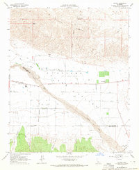 1964 Cuyama1965 Print · USGSThe high desert landscape of the Santa Barbara and San Luis Obispo border comes into focus during the mid-1960s. Researchers can trace the development of the Cuyama Valley through its complex grid of wells, the settlement of Cuyama, and water features like Willow Spring.3 unique versions available
 - 1964 Map of Salisbury Canyon, 1966 Print
 1964 Salisbury Canyon1966 Print · USGSThe high Cuyama Valley and Sierra Madre mountains are captured in the mid-sixties during a peak of local oil production. Genealogists and historians can trace ranching and industry through landmarks like Cuyama Ranch, the Cuyama Oil Field, and Snedden.
 - 1966 Map of Los Angeles
 1966 Los Angeles1966 Print · USGSSouthern California underwent a mid-century transformation as suburban grids reached the base of the San Gabriel Mountains. Researchers can trace the path of the Los Angeles Aqueduct or locate defense landmarks like Edwards Air Force Base.
 - 1975 Map of Los Angeles, 1977 Print
 1975 Los Angeles1977 Print · USGSSouthern California is captured in a period of significant growth during the mid-seventies, showing the urban sprawl from the coast to the high desert. Researchers can trace the development of the Pacific Coast Hwy and find aerospace landmarks like Edwards Air Force Base and the Flight Test Center (NASA).2 unique versions available
 - 1977 Map of Cuyama
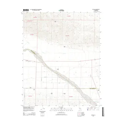
 1977 Cuyama1977 Print · USGSCovers Cuyama, including San Luis Obispo County, Santa Barbara County, and other nearby areas
 - 1981 Map of Cuyama
 1981 Cuyama1981 Print · USGSThe high Cuyama Valley and the vast reaches of the Los Padres National Forest are captured here in the early eighties. Researchers can trace the San Andreas Rift Zone past New Cuyama or locate remote outposts like the Gibraltar Mine and Thorn Lookout.2 unique versions available
 - 2012 Map of Cuyama, 2012 Print
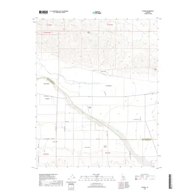
 2012 Cuyama2012 Print · USGSCovers Cuyama, including Santa Barbara County, San Luis Obispo County, and other nearby areas
 - 2015 Map of Cuyama, 2015 Print
 2015 Cuyama2015 Print · USGSCovers Cuyama, including Santa Barbara County, San Luis Obispo County, and other nearby areas
 - 2018 Map of Cuyama, 2018 Print
 2018 Cuyama2018 Print · USGSCovers Cuyama, including Santa Barbara County, San Luis Obispo County, and other nearby areas
 - 2021 Map of Cuyama, 2021 Print
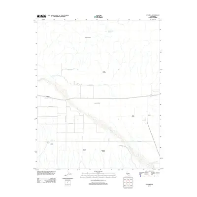
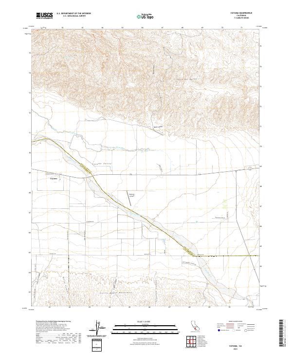 2021 Cuyama2021 Print · USGSThe Cuyama Valley and surrounding mountain ranges are captured in this modern survey as they appeared in 2021. Researchers can trace rural landmarks and terrain features from Vosburgh Airfield and the settlement of Cuyama to the winding Cuyama River.
End of results
Showing maps 1-17 of 17
Top cities near Cuyama
Frequently asked questions
- What are the different types of historical maps available for Cuyama?
- What is the oldest map of Cuyama?
- Where can I purchase historical maps of Cuyama for my home or office?
- Where can I download high-res historical maps of Cuyama?
- Are there historical topographic maps available for Cuyama?
- Is there historical aerial imagery available for Cuyama?
- Where are historical maps of Cuyama sourced from?