Old Maps of Bella Vista, California for Academic Research
Study the evolution of Bella Vista with 13 high-resolution historic maps. Whether you're teaching, researching, or modeling changes in land use, these maps provide essential visual documentation of urban, environmental, and geographic change.
- Analyze long-term change: Track patterns in development, transportation, and natural features.
- Ideal for environmental or urban studies: Support academic projects with primary historical map data.
- Use in the classroom or lab: Educators and researchers rely on these maps to bring historical context to life.
These maps are a powerful tool for teaching, research, and visualizing how Bella Vista has changed over the decades.
Bella Vista, CA maps
(13)- 1890 Map of Red Bluff
 1890 Red Bluff1890 Print · USGSNorthern California in the late nineteenth century was a hub of river-and-rail activity where the Central Pacific Railroad met the rugged Klamath Mountains. Researchers can trace old ferry crossings like Ball's Ferry, locate the U.S. Fishery, or find early mining camps and stations such as Minersville and Buck Horn Station.
 - 1894 Map of Red Bluff, 1896 Print
 1894 Red Bluff1896 Print · USGSNorthern California's mining and river-trading frontier comes alive in this survey of the late nineteenth century. Genealogists and historians can trace the growth of rail hubs like Redding or locate early river crossings and industrial sites such as Jelley's Ferry and the Copper Mine.6 unique versions available
 - 1901 Map of Redding
 1901 Redding1901 Print · USGSShasta County's northern canyon and mining districts come into focus at the dawn of the twentieth century. Researchers can trace the original rail stops at Kennett and Keswick or locate early industrial sites like the Bully Hill Mine and Baird Fish Hatchery.7 unique versions available
 - 1953 Map of Millville, 1955 Print
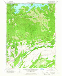
 1953 Millville1955 Print · USGSShasta County transitions from the valley floor to the forested ridges of the southern Cascades during the 1950s. Genealogists can locate family names at the Masonic Cem and Odd Fellows Cem or trace vanished locales like Tollgate (Site).3 unique versions available
 - 1958 Map of Redding
 1958 Redding1958 Print · USGSNorthern California's valley and mountain landscapes are captured in the late fifties, showing the region as new reservoirs reshaped the river systems. Genealogists and historians can trace rail-side towns like Cottonwood, the military presence at Red Bluff Air Force Station, and mountain outposts like Weaverville.5 unique versions available
 - 1965 Map of Bella Vista, 1966 Print
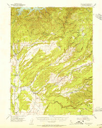
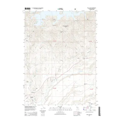
 1965 Bella Vista1966 Print · USGSShasta County in the mid-1960s reveals a landscape of transition between the waters of Shasta Lake and the pastoral lands of Bella Vista. Researchers can trace the network of ranch roads and jeep trails leading toward Backbone Ridge and the Little Cow Creek drainage.3 unique versions available
 - 1984 Map of Redding
 1984 Redding1984 Print · USGSThe Shasta County region in the mid-1980s reveals a landscape of massive reservoirs and active mining districts. Researchers can trace the development of Redding and Enterprise or locate historic mineral sites like Iron Mountain Mine and Keystone Mine.2 unique versions available
 - 1998 Map of Bella Vista, 2003 Print
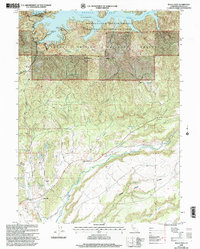 1998 Bella Vista2003 Print · USGSIn the late 1990s, the area surrounding Bella Vista remained a blend of Shasta County ranch land and national forest recreation. Genealogists and historians can trace local landmarks like Frazier Corners, the Diversion Dam, and the early development of the Jones Valley Marina on Shasta Lake.2 unique versions available
 - 2012 Map of Bella Vista, 2012 Print
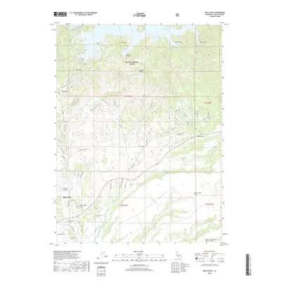
 2012 Bella Vista2012 Print · USGSCovers Bella Vista, including Frazier Corners, Sherman, and other nearby areas
 - 2015 Map of Bella Vista, 2015 Print
 2015 Bella Vista2015 Print · USGSCovers Bella Vista, including Frazier Corners, Sherman, and other nearby areas
 - 2018 Map of Bella Vista, 2018 Print
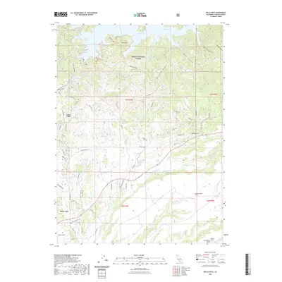
 2018 Bella Vista2018 Print · USGSCovers Bella Vista, including Frazier Corners, Sherman, and other nearby areas
 - 2021 Map of Bella Vista, 2021 Print
 2021 Bella Vista2021 Print · USGSCovers Bella Vista, including Frazier Corners, Sherman, and other nearby areas
 - 2023 Map of Bella Vista, 2023 Print
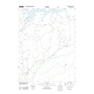
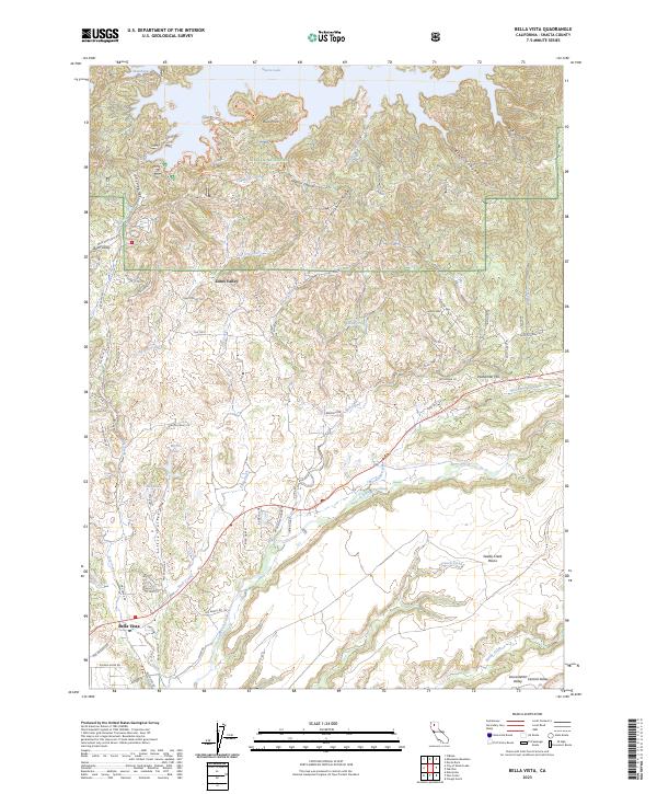 2023 Bella Vista2023 Print · USGSShasta County’s transition from the valley floor to the national forest is captured here in the early twenty-first century. Researchers can trace land divisions and local landmarks from Bella Vista up to Shasta Lake, including Mirror Lake and Woodman Hill.
End of results
Showing maps 1-13 of 13
Top cities near Bella Vista
Frequently asked questions
- What are the different types of historical maps available for Bella Vista?
- What is the oldest map of Bella Vista?
- Where can I purchase historical maps of Bella Vista for my home or office?
- Where can I download high-res historical maps of Bella Vista?
- Are there historical topographic maps available for Bella Vista?
- Is there historical aerial imagery available for Bella Vista?
- Where are historical maps of Bella Vista sourced from?