1990s Maps of Montgomery Creek, California
Explore 2 historic maps of Montgomery Creek from the 1990s. These maps offer a rare glimpse into what life looked like during the 1990s — showing old roads, neighborhoods, homes, and landmarks that have changed or disappeared over time.
Whether you're researching your family's past, planning a metal detecting trip, or studying how Montgomery Creek's landscape evolved across the 1990s, these high-resolution maps are a powerful tool for exploring the history of this region.
- Focus on a specific era: All maps on this page are from the 1990s, giving you a focused view of this time period.
- See what’s changed: Compare century-old streets, trails, and buildings to today's modern landscape using overlays and satellite layers.
- Research with precision: Use these maps for genealogy, historical research, land use analysis, or educational projects.
- View, download, or print: Maps are fully viewable online in high resolution, and can be downloaded or printed for your own records.
Start exploring Montgomery Creek's history through authentic maps from the 1990s. This is your window into the past.
Montgomery Creek, CA maps
(2)- 1990 Map of Montgomery Creek
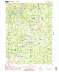 1990 Montgomery Creek1990 Print · USGSUpper Shasta County comes into focus in the 1990s as a hub of hydroelectric power and forest management. Researchers can trace tribal lands at the Montgomery Creek Rancheria, locate the Halcumb Cemetery, and study the Cedar Powerhouse along the creek.2 unique versions available
 - 1998 Map of Montgomery Creek, 2003 Print
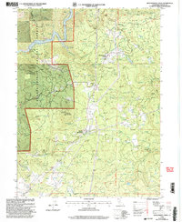 1998 Montgomery Creek2003 Print · USGSShasta County’s timber and water infrastructure are on display in the late nineties, from the Montgomery Creek Rancheria to the Pit River Reservoir. Genealogists and local historians can trace legacy sites like the Halcumb Cemetery and the Cedar Creek School among the forest slopes.2 unique versions available
End of results
Showing maps 1-2 of 2
Frequently asked questions
- What are the different types of historical maps available for Montgomery Creek?
- What is the oldest map of Montgomery Creek?
- Where can I purchase historical maps of Montgomery Creek for my home or office?
- Where can I download high-res historical maps of Montgomery Creek?
- Are there historical topographic maps available for Montgomery Creek?
- Is there historical aerial imagery available for Montgomery Creek?
- Where are historical maps of Montgomery Creek sourced from?