Old Maps of Shasta Lake, California for Metal Detecting
Plan your next treasure hunt with 21 historic maps of Shasta Lake. Find old homesites, ghost towns, trails, and gathering spots that may be lost to time — perfect for identifying promising metal detecting locations.
- Locate forgotten sites: Uncover places like long-lost settlements, abandoned rail lines, or gathering spots.
- Plan better hunts: Use map overlays combined with LiDAR or satellite views to narrow in on historically rich areas.
- Made for detectorists: Thousands of hobbyists use these maps to discover relics, coins, and hidden history.
Use these historic maps to boost your research and find new opportunities beneath the surface of Shasta Lake.
Shasta Lake, CA maps
(21)- 1890 Map of Red Bluff
 1890 Red Bluff1890 Print · USGSNorthern California in the late nineteenth century was a hub of river-and-rail activity where the Central Pacific Railroad met the rugged Klamath Mountains. Researchers can trace old ferry crossings like Ball's Ferry, locate the U.S. Fishery, or find early mining camps and stations such as Minersville and Buck Horn Station.
 - 1894 Map of Red Bluff, 1896 Print
 1894 Red Bluff1896 Print · USGSNorthern California's mining and river-trading frontier comes alive in this survey of the late nineteenth century. Genealogists and historians can trace the growth of rail hubs like Redding or locate early river crossings and industrial sites such as Jelley's Ferry and the Copper Mine.6 unique versions available
 - 1901 Map of Redding
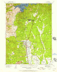
 1901 Redding1901 Print · USGSShasta County's northern canyon and mining districts come into focus at the dawn of the twentieth century. Researchers can trace the original rail stops at Kennett and Keswick or locate early industrial sites like the Bully Hill Mine and Baird Fish Hatchery.7 unique versions available
 - 1944 Map of Redding, 1957 Print
 1944 Redding1957 Print · USGSShasta County during the mid-1940s was a landscape in transition, anchored by the recently completed Shasta Dam and the bustling rail hub of Redding. Family historians and researchers can pinpoint long-standing schools like Grant School and trace industrial sites from the Walker Mine to Benton Airport.2 unique versions available
 - 1946 Map of Redding
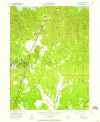
 1946 Redding1946 Print · USGSShasta County underwent a massive transformation in the mid-forties following the completion of Shasta Dam. Researchers can trace the rise of boomtowns like Project City alongside legacy mining operations such as the Balaklala Mine and Yankee John Mine.2 unique versions available
 - 1956 Map of Shasta Dam, 1958 Print
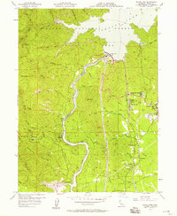 1956 Shasta Dam1958 Print · USGSMid-century Shasta County undergoes a radical transformation as the completion of Shasta Dam reshapes the canyon. Trace the development of Summit City, the infrastructure of Government Camp, and legacy mines like the Uncle Sam Mine.5 unique versions available
 - 1957 Map of Project City, 1958 Print
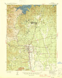
 1957 Project City1958 Print · USGSShasta County during the late 1950s shows the growth of communities like Project City and Central Valley alongside the rising waters of Shasta Lake. Researchers can locate mid-century landmarks such as the Bass Sch, the Southern Pacific rail line, and the small settlements of Newtown and Pine Grove.4 unique versions available
 - 1958 Map of Redding
 1958 Redding1958 Print · USGSNorthern California's valley and mountain landscapes are captured in the late fifties, showing the region as new reservoirs reshaped the river systems. Genealogists and historians can trace rail-side towns like Cottonwood, the military presence at Red Bluff Air Force Station, and mountain outposts like Weaverville.5 unique versions available
 - 1984 Map of Redding
 1984 Redding1984 Print · USGSThe Shasta County region in the mid-1980s reveals a landscape of massive reservoirs and active mining districts. Researchers can trace the development of Redding and Enterprise or locate historic mineral sites like Iron Mountain Mine and Keystone Mine.2 unique versions available
 - 1998 Map of City of Shasta Lake, 2003 Print
 1998 City of Shasta Lake2003 Print · USGSThe area north of Redding transitions from national forest land to the growing communities of Project City and Central Valley during the late nineties. Researchers can trace family history at Lilienthal Cem or locate old roadside markers like Portal Inn and Tunnel Inn.
 - 1998 Map of Shasta Dam, 2003 Print
 1998 Shasta Dam2003 Print · USGSNorthern California's industrial and recreational landscape is centered around the Shasta Dam in the late 1990s. Researchers can trace deep mining roots at the Uncle Sam and Balaklala Mine or locate historic school sites like Toyon Sch.
 - 2012 Map of City of Shasta Lake, 2012 Print
 2012 City of Shasta Lake2012 Print · USGSCovers Shasta Lake, including Redding, Mountain Gate, and other nearby areas
 - 2012 Map of Shasta Dam, 2012 Print
 2012 Shasta Dam2012 Print · USGSCovers Shasta Lake, including Redding, Buckeye, and other nearby areas
 - 2015 Map of Shasta Dam, 2015 Print
 2015 Shasta Dam2015 Print · USGSCovers Shasta Lake, including Redding, Buckeye, and other nearby areas
 - 2015 Map of City of Shasta Lake, 2015 Print
 2015 City of Shasta Lake2015 Print · USGSCovers Shasta Lake, including Redding, Mountain Gate, and other nearby areas
 - 2018 Map of Shasta Dam, 2018 Print
 2018 Shasta Dam2018 Print · USGSCovers Shasta Lake, including Redding, Buckeye, and other nearby areas
 - 2018 Map of City of Shasta Lake, 2018 Print
 2018 City of Shasta Lake2018 Print · USGSCovers Shasta Lake, including Redding, Mountain Gate, and other nearby areas
 - 2021 Map of Shasta Dam, 2021 Print
 2021 Shasta Dam2021 Print · USGSCovers Shasta Lake, including Redding, Buckeye, and other nearby areas
 - 2022 Map of City of Shasta Lake, 2022 Print
 2022 City of Shasta Lake2022 Print · USGSCovers Shasta Lake, including Redding, Mountain Gate, and other nearby areas
 - 2023 Map of Shasta Dam, 2023 Print
 2023 Shasta Dam2023 Print · USGSThe Sacramento River canyon north of Redding remains a landscape of massive water works and forest lands in the twenty-first century. Researchers can trace the footprints of riverside settlements like Coram and Matheson or locate the Central Valley Cem.
 - 2023 Map of City of Shasta Lake, 2023 Print
 2023 City of Shasta Lake2023 Print · USGSThe northern fringes of Redding meet the southern reaches of the Cascade foothills in the early twenty-first century. Genealogists and local researchers can trace family landmarks at City Cem, the Shasta College campus, and settlements like Bella Vista.
End of results
Showing maps 1-21 of 21
Top cities near Shasta Lake
Top neighborhoods of Shasta Lake
Frequently asked questions
- What are the different types of historical maps available for Shasta Lake?
- What is the oldest map of Shasta Lake?
- Where can I purchase historical maps of Shasta Lake for my home or office?
- Where can I download high-res historical maps of Shasta Lake?
- Are there historical topographic maps available for Shasta Lake?
- Is there historical aerial imagery available for Shasta Lake?
- Where are historical maps of Shasta Lake sourced from?