2000s (21st Century) Maps of Etna, California
Explore 5 historic maps of Etna from the 2000s (21st Century). These maps offer a rare glimpse into what life looked like during the 2000s — showing old roads, neighborhoods, homes, and landmarks that have changed or disappeared over time.
Whether you're researching your family's past, planning a metal detecting trip, or studying how Etna's landscape evolved across the 2000s, these high-resolution maps are a powerful tool for exploring the history of this region.
- Focus on a specific era: All maps on this page are from the 2000s, giving you a focused view of this time period.
- See what’s changed: Compare century-old streets, trails, and buildings to today's modern landscape using overlays and satellite layers.
- Research with precision: Use these maps for genealogy, historical research, land use analysis, or educational projects.
- View, download, or print: Maps are fully viewable online in high resolution, and can be downloaded or printed for your own records.
Start exploring Etna's history through authentic maps from the 2000s. This is your window into the past.
Etna, CA maps
(5)- 2001 Map of Etna, 2004 Print
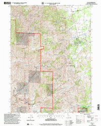 2001 Etna2004 Print · USGSSiskiyou County at the start of the 21st century reveals a mountain community defined by the Scott River and the high peaks of the Klamath Mountains. Researchers can locate the Deacon Lee Place (Site), local Cemeteries, and the high-altitude Ruffey Lakes within the forest.2 unique versions available
 - 2012 Map of Etna, 2012 Print
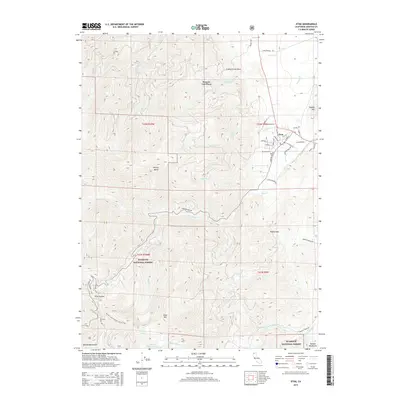
 2012 Etna2012 Print · USGSCovers Etna, including Deacon Lee Place, Siskiyou County, and other nearby areas
 - 2015 Map of Etna, 2015 Print
 2015 Etna2015 Print · USGSCovers Etna, including Deacon Lee Place, Siskiyou County, and other nearby areas
 - 2018 Map of Etna, 2018 Print
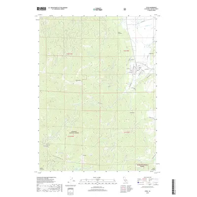 2018 Etna2018 Print · USGSCovers Etna, including Deacon Lee Place, Siskiyou County, and other nearby areas
 - 2022 Map of Etna, 2022 Print
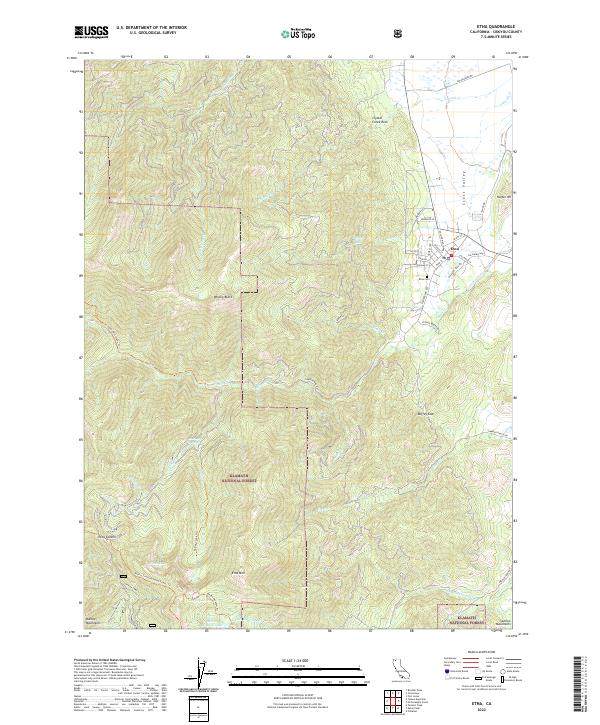 2022 Etna2022 Print · USGSThe mountain town of Etna sits at the threshold of the Klamath National Forest in the twenty-first century. Genealogists and hikers can trace the residential grid around Etna Cem, find Etna Summit, and follow the Pacific Crest National Scenic Trl through the peaks.
End of results
Showing maps 1-5 of 5
Top cities near Etna
Frequently asked questions
- What are the different types of historical maps available for Etna?
- What is the oldest map of Etna?
- Where can I purchase historical maps of Etna for my home or office?
- Where can I download high-res historical maps of Etna?
- Are there historical topographic maps available for Etna?
- Is there historical aerial imagery available for Etna?
- Where are historical maps of Etna sourced from?