Old Maps of Suisun City, California for Genealogy
Trace your family roots with 51 historic maps of Suisun City. These high-res maps reveal old neighborhoods, homesites, landmarks, and streets — helping you uncover where your ancestors lived and how the area evolved over time.
- Explore historic neighborhoods: Identify where your relatives may have lived in the 1800s or 1900s.
- Compare maps over time: Trace the changes in streets, buildings, and landmarks for multi-generational research.
- Perfect for genealogy & ancestry research: Used by family historians and researchers to map out lineage and migration.
These maps are an incredible resource for exploring your personal connection to Suisun City's past.
Suisun City, CA maps
(51)- 1896 Map of Carquinez Strait, 1954 Print
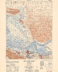
 1896 Carquinez Strait1954 Print · USGSThe industrial waterfront of the Carquinez Strait comes alive in the 1890s, where shipping channels meet the rails. Genealogists and historians can trace early bay settlements from the U.S. Arsenal at Benicia to the rail hubs of Vallejo and Martinez.
 - 1898 Map of Karquines
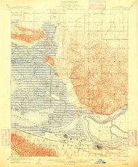
 1898 Karquines1898 Print · USGSThe Karquines Strait and Suisun Bay served as a bustling maritime and rail crossroads in the late nineteenth century. Researchers can trace the early layouts of Benicia, Vallejo, and Martinez, or locate vanished landmarks like Seal Bluff Landing and the U.S. Arsenal.
 - 1901 Map of Karquines
 1901 Karquines1901 Print · USGSNorthern California at the dawn of the twentieth century shows a landscape defined by the deep-water Karquines Strait and industrial rail hubs. Researchers can trace the waterfront activity of Benicia, Vallejo, and Martinez or the tidal marsh outposts at Drawbridge and Rush Landing.6 unique versions available
 - 1902 Map of Napa
 1902 Napa1902 Print · USGSThe Napa Valley and Carquinez Strait are captured at the turn of the century, showing a landscape defined by maritime military posts and early vineyards. Genealogists and historians can trace the Mare Island Navy Yard, the Insane Asylum, and rail stops at Zinfandel and Rutherford.6 unique versions available
 - 1907 Map of Antioch, 1955 Print
 1907 Antioch1955 Print · USGSThe Suisun Bay and Sacramento Delta regions are captured here in the early twentieth century during a period of agricultural and industrial expansion. Local historians can trace family-named river ports like Lingos Landing and rural landmarks such as Scandia School or the settlement of Birds Landing.
 - 1908 Map of Vacaville
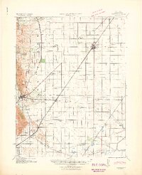
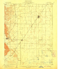 1908 Vacaville1908 Print · USGSNorthern California's agricultural heartland is captured here at the start of the century, centered on the rail corridors of the Southern Pacific. Genealogists can trace early homesteads and rail stops like Elmira, Maine Prairie, and the Cement Mill.3 unique versions available
 - 1908 Map of Antioch
 1908 Antioch1908 Print · USGSThe convergence of the great California rivers in the early twentieth century shows a landscape of busy water landings and growing rail towns. Trace the industrial roots of Antioch or locate vanished landings like Palmetto Landing and Duttons Landing along the sloughs.5 unique versions available
 - 1917 Map of Elmira
 1917 Elmira1917 Print · USGSCentral Solano County is shown at a time of significant rail and industrial development during the early twentieth century. Researchers can trace the Southern Pacific lines through Vacaville and Elmira, or locate the Cement Mill and Gas Well.
 - 1918 Map of Denverton
 1918 Denverton1918 Print · USGSSolano County delta lands are captured here in the early twentieth century, showing a world of marshy islands and hilltop settlements. Genealogists can trace family holdings and river commerce through locations like Denverton, Lingos Landing, and the Oakland Antioch and Eastern rail line.
 - 1921 Map of Mt. Vaca
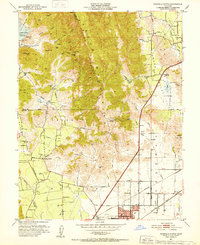
 1921 Mt. Vaca1921 Print · USGSFairfield and the surrounding highlands appear at a pivotal moment in the 1920s as early transportation networks began to define the region. Genealogists and historians can trace the early layout of Fairfield and locate remote settlements like Manka and Atlas.
 - 1940 Map of Carquinez Strait, 1963 Print
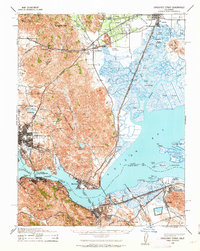 1940 Carquinez Strait1963 Print · USGSThe industrial waterfronts of Solano and Contra Costa counties are captured here just before the mid-century boom. Genealogists and historians can trace the rail-and-water networks of Port Costa, Benicia, and Vallejo, or locate landmarks like the Carquinez Cem and the Benicia Auto Ferry.2 unique versions available
 - 1941 Map of Vacaville
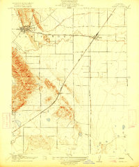
 1941 Vacaville1941 Print · USGSSolano County’s fertile ranching and orchard lands are documented in the early 1940s, just before significant regional growth. Local historians can trace family-named school districts like Tremont District School and rural rail stops including Batavia and Cannon.
 - 1942 Map of Carquinez
 1942 Carquinez1942 Print · USGSThe industrial waterfront of the Carquinez Strait is captured here during the early years of the war. Researchers can trace the complex rail networks of the Southern Pacific and locate established neighborhoods in Vallejo, Benicia, and Crockett.
 - 1942 Map of Mt. Vaca
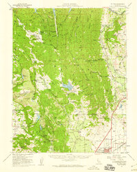
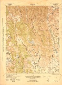 1942 Mt. Vaca1942 Print · USGSThe Vaca Mountains and eastern Napa County are captured during the early 1940s, showing a landscape of deep canyons and rising valley towns. Researchers can trace the rail corridors of the Southern Pacific near Fairfield or locate early water works like the Gordon Valley Dam.2 unique versions available
 - 1947 Map of Santa Rosa
 1947 Santa Rosa1947 Print · USGSNorthern California in the late 1940s was a landscape of agricultural valleys and vital rail hubs. Trace the historic routes of the Northwestern Pacific through Healdsburg or explore the mid-century waterfronts of Vallejo and Benicia near Mare Island.
 - 1947 Map of Sacramento, 1948 Print
 1947 Sacramento1948 Print · USGSThe Sacramento Valley meets the high Sierra during a period of post-war expansion. Trace the historic river delta islands like Grand Island or locate early airfield footprints at McClellan Air Force Base and Mather Air Force Base.2 unique versions available
 - 1948 Map of Sacramento, 1951 Print
 1948 Sacramento1951 Print · USGSPost-war Northern California comes alive in this regional survey, capturing the era of expansion between the Central Valley and the High Sierra. Researchers can trace the rail networks of the Central California Traction and Sacramento Northern RR or locate landmarks like the State Capitol and University of California Davis.
 - 1949 Map of Santa Rosa
 1949 Santa Rosa1949 Print · USGSThe North Bay and Wine Country appear here in the late 1940s, when the Northwestern Pacific RR still dominated regional transit. Genealogists and historians can trace old coastal outposts like Anchor Bay Settlement and the early layout of Santa Rosa.2 unique versions available
 - 1949 Map of Fairfield South, 1959 Print
 1949 Fairfield South1959 Print · USGSThe Suisun marshlands and California Delta transition from rail-and-ranch life to aviation and conservation at the end of the 1940s. Genealogists can trace family-named hunting clubs and old railroad sidings like Cygnus, Danielson, and the Armijo HS campus.7 unique versions available
 - 1950 Map of Fairfield
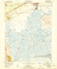 1950 Fairfield1950 Print · USGSMid-century Fairfield and Suisun City sit at the edge of a massive marshland network just before suburban expansion transformed the North Bay. Researchers can trace the era's hunting club culture and rail history at State Game Refuge, Armijo HS, and Sacramento Northern rail stops.
 - 1951 Map of Antioch
 1951 Antioch1951 Print · USGSThe Sacramento Delta comes alive in the early fifties as industrial growth meets a complex world of sloughs and islands. Trace family ties to Birds Landing, the Grizzly Island Ferry, or the sprawling grounds of Camp Stoneman.
 - 1951 Map of Fairfield North, 1952 Print
 1951 Fairfield North1952 Print · USGSNorthern Solano County in the early fifties shows a landscape of mountain ridges and valley farms. Genealogists and historians can trace old homesteads and landmarks like the Pena House, Mankas Corner, and Suisun School.7 unique versions available
 - 1951 Map of Mt. Vaca, 1959 Print
 1951 Mt. Vaca1959 Print · USGSNorthern California's agricultural valleys and ridges are captured here in the early fifties. Researchers can trace rural life through landmarks like Peña House, Mankas Corner, and schools such as Gordon Valley School.2 unique versions available
 - 1953 Map of Denverton, 1954 Print
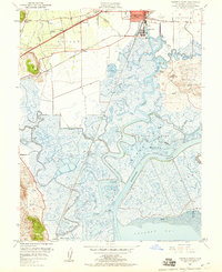
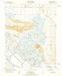 1953 Denverton1954 Print · USGSThe Suisun Marsh region in the early fifties shows a complex network of tidal sloughs and landings before modern development altered the Solano waterfront. Researchers can trace the Sacramento Northern rail line and locate old landmarks like Shilo Church and the Grizzly Island Ferry.9 unique versions available
 - 1953 Map of Elmira, 1955 Print
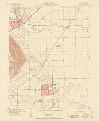 1953 Elmira1955 Print · USGSThe Solano County valley comes alive in the early 1950s as a burgeoning military and transit corridor. Researchers can trace the development of Travis Air Force Base alongside local landmarks like Cooper School and Vacaville Elmira Cemetery.9 unique versions available
Showing maps 1-25 of 51
Top cities near Suisun City
- Concord historical maps
- Vallejo historical maps
- Fairfield historical maps
- Antioch historical maps
- Vacaville historical maps
- Pittsburg historical maps
See more
Frequently asked questions
- What are the different types of historical maps available for Suisun City?
- What is the oldest map of Suisun City?
- Where can I purchase historical maps of Suisun City for my home or office?
- Where can I download high-res historical maps of Suisun City?
- Are there historical topographic maps available for Suisun City?
- Is there historical aerial imagery available for Suisun City?
- Where are historical maps of Suisun City sourced from?