Old Maps of Modesto, California for Hiking & Exploration
Hike through history with 37 historic maps of Modesto. Explore old trails, ghost towns, and forgotten backroads — perfect for outdoor adventurers and local explorers.
- Rediscover forgotten places: Map out old mining camps, roads, and footpaths that no longer exist on modern maps.
- Layer with modern tools: Combine with LiDAR or satellite views to plan hikes through historical terrain.
- Made for exploration: Popular among hikers, overlanders, and local history lovers.
Use these maps to find adventure and explore the hidden past of Modesto.
Modesto, CA maps
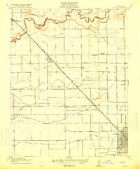
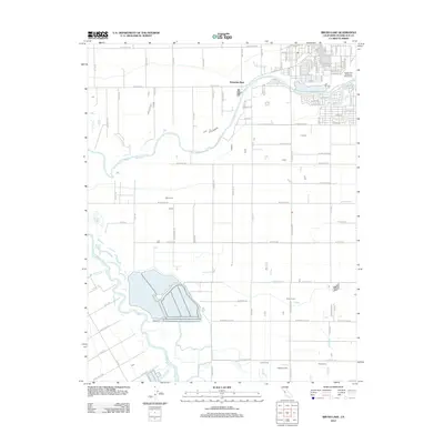
(37)- 1915 Map of Westport
 1915 Westport1915 Print · USGSThe Stanislaus County plains south of Modesto appear here as a patchwork of irrigation canals and early school districts before the Great War. Genealogists and local historians can trace the foundations of rural life at Westport Church, Shiloh School, and along the banks of the Tuolumne River.
 - 1915 Map of Salida
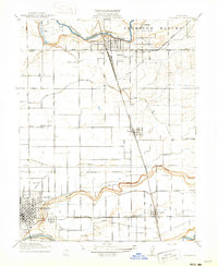
 1915 Salida1915 Print · USGSThe fertile plains north of Modesto are captured here just before the First World War, showing a landscape transformed by complex irrigation. Genealogists can locate family homesteads near rural landmarks like Wood Colony School or along the Southern Pacific tracks in Salida.2 unique versions available
 - 1916 Map of Riverbank
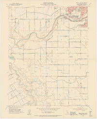
 1916 Riverbank1916 Print · USGSThe Stanislaus and Tuolumne Rivers frame this early twentieth-century survey of the California Central Valley. Researchers can trace the development of agricultural irrigation and rail transport through features like Burneyville Ferry, Riverbank, and McHenry School.2 unique versions available
 - 1916 Map of Ceres
 1916 Ceres1916 Print · USGSStanislaus County agriculture is in full bloom during the early twentieth century as a complex irrigation system takes hold. Genealogists can locate family lands near Riverside School or trace the early paths of the Southern Pacific and Keyes.2 unique versions available
 - 1939 Map of Modesto East, 1965 Print
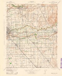
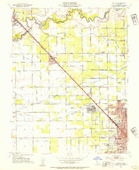
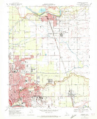
 1939 Modesto East1965 Print · USGSStanislaus County thrived as a rail and irrigation hub just before the Second World War. Genealogists can locate family-named landmarks like Thompson Rancho, rural schoolhouses such as Bellpassi School, and the Stanislaus Cem burial grounds.
 - 1941 Map of Modesto West
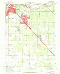
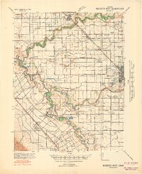 1941 Modesto West1941 Print · USGSThe Central Valley river system is captured here in the early 1940s, showing the complex web of irrigation canals and rural school districts. Genealogists can trace family footprints near Grayson or the Farm Security Administration Camp, and locate landmarks like Shiloh School or Tuolumne City.3 unique versions available
 - 1942 Map of Modesto East
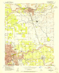
 1942 Modesto East1942 Print · USGSStanislaus County during the early war years shows an intricate landscape of irrigation canals and rural schoolhouses. Genealogists can locate family landmarks like St Stanislaus Cem, Robinson School, and the historic Thompson Rancho.
 - 1947 Map of San Jose, 1948 Print
 1947 San Jose1948 Print · USGSNorthern California's heartland is captured here just after the war, showing the rapid growth of the Santa Clara and Central Valleys. Researchers can trace the legacy of rail and water at Castle Air Force Base, Stockton, and the Hetch Hetchy Aqueduct.
 - 1953 Map of Ceres, 1954 Print
 1953 Ceres1954 Print · USGSStanislaus County thrived as an agricultural and rail hub in the early fifties, anchored by the Tuolumne River. Genealogists and local historians can trace rural school districts like Shackelford School and Monte Vista Sch or locate the sprawling Lakewood Memorial Park.2 unique versions available
 - 1953 Map of Brush Lake, 1954 Print
 1953 Brush Lake1954 Print · USGSModesto and the surrounding Central Valley agriculture come into focus in the mid-fifties as urban expansion meets the river bottoms. Genealogists can locate family-named landmarks like Shiloh School, Westport Union School, and the Rancho Del Puerto.2 unique versions available
 - 1953 Map of Riverbank, 1954 Print
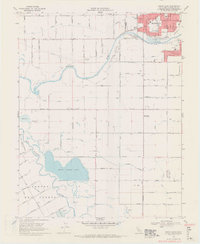
 1953 Riverbank1954 Print · USGSMid-century Modesto and Riverbank are shown here as the postwar agricultural economy is being joined by major industrial and aviation expansion. Researchers can find many family landmarks, including Belpassi School, the Riverbank Ordnance Plant, and the small settlement of D'Accardo.
 - 1953 Map of Salida, 1954 Print
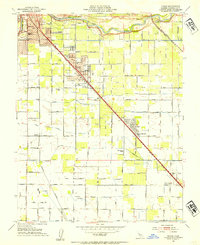
 1953 Salida1954 Print · USGSStanislaus County agriculture and early urbanization are captured here just as the post-war boom reached the Central Valley. Genealogists and local historians can locate several rural schoolhouses like Ransom Sch or trace the extensive irrigation works from Lateral No 8 to the Hetch Hetchy Aqueduct.2 unique versions available
 - 1956 Map of San Jose
 1956 San Jose1956 Print · USGSCentral California in the mid-fifties reveals the transition from sprawling orchards to growing urban hubs like San Jose and Stockton. Genealogists and historians can trace the rail-era landscape of the Mother Lode through Chinese Camp and Tuttletown, or follow the water through the Joaquin River and Calaveras Reservoir.
 - 1962 Map of San Jose
 1962 San Jose1962 Print · USGSCentral California in the early sixties showcases the expansion of the San Joaquin and Santa Clara valleys. Researchers can trace the rail-to-road transition along the Southern Pacific RR or locate landmarks like Castle USAF Base and Loma Prieta.4 unique versions available
 - 1966 Map of San Jose
 1966 San Jose1966 Print · USGSCentral California in the mid-1960s reveals a landscape of massive irrigation projects and expanding Cold War military footprints. Researchers can trace the rail-and-river network of the San Joaquin Valley or locate specialized sites like Castle Air Force Base and the Sharp General Depot (Military).
 - 1969 Map of Ceres, 1971 Print
 1969 Ceres1971 Print · USGSStanislaus County's agricultural heartland is documented here in the late sixties as the rail-side towns of Ceres and Keyes expanded. Genealogy and local history researchers can locate Lakewood Memorial Park (Cem), the Modesto Union Academy, and the Tidewater Southern rail line.5 unique versions available
 - 1969 Map of Brush Lake, 1971 Print
 1969 Brush Lake1971 Print · USGSThe agricultural outskirts of Modesto and the river bottoms of the San Joaquin Valley are captured here in the late sixties. Genealogists and researchers can trace rural school locations like Westport Union Sch and historic land grants including Rancho Del Puerto.4 unique versions available
 - 1969 Map of Salida, 1972 Print
 1969 Salida1972 Print · USGSThe Stanislaus River valley in the late sixties reveals a landscape balancing vast orchards with the rising institutional and suburban footprint of Modesto and Salida. Researchers can trace the legacy of the Modesto State Hospital, the route of the Hetch Hetchy Aqueduct, and numerous local landmarks like Woodcolony Cem.4 unique versions available
 - 1969 Map of Riverbank, 1972 Print
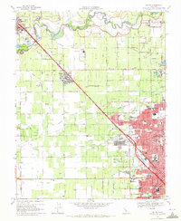
 1969 Riverbank1972 Print · USGSMid-century Stanislaus County comes to life as a bustling hub of rail transport, military industry, and irrigation. Genealogists and historians can trace family locations near Empire, Claus, and neighborhood landmarks like Cardoza Sch and the City County Airport.3 unique versions available
 - 1989 Map of Stockton
 1989 Stockton1989 Print · USGSDuring the late 1980s, the California Delta and San Joaquin Valley saw a massive convergence of water infrastructure and military logistics. Researchers can trace the sprawling Lawrence Livermore Laboratory (Univ of Calif) and Sharpe Army Depot alongside the complex waterways of Union Island and Victoria Island.2 unique versions available
 - 1994 Map of Oakdale, 1995 Print
 1994 Oakdale1995 Print · USGSThe San Joaquin Valley meets the Sierra foothills in the mid-1990s, where massive reservoirs and canal networks fueled California's agricultural heartland. Researchers can trace the Hetch Hetchy Aqueduct, find the Sierra RR, and locate the Riverbank Army Ammunition Plant.2 unique versions available
 - 2012 Map of Ceres, 2012 Print
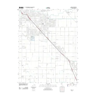 2012 Ceres2012 Print · USGSCovers Modesto, including Turlock, Ceres, and other nearby areas
 - 2012 Map of Riverbank, 2012 Print
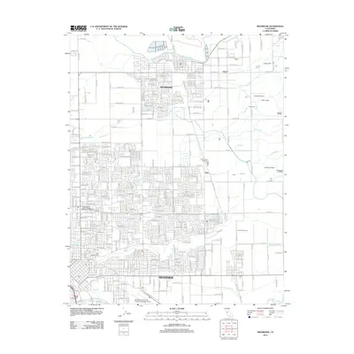 2012 Riverbank2012 Print · USGSCovers Modesto, including Riverbank, Oakdale, and other nearby areas
 - 2012 Map of Salida, 2012 Print
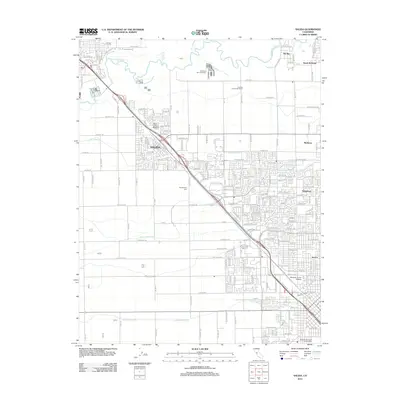 2012 Salida2012 Print · USGSCovers Modesto, including Ripon, Standiford, and other nearby areas
 - 2012 Map of Brush Lake, 2012 Print
 2012 Brush Lake2012 Print · USGSCovers Modesto, including Ceres, Patterson, and other nearby areas
Showing maps 1-25 of 37
Top cities near Modesto
- Manteca historical maps
- Turlock historical maps
- Ceres historical maps
- Riverbank historical maps
- Patterson historical maps
- Oakdale historical maps
See more
Top neighborhoods of Modesto
Frequently asked questions
- What are the different types of historical maps available for Modesto?
- What is the oldest map of Modesto?
- Where can I purchase historical maps of Modesto for my home or office?
- Where can I download high-res historical maps of Modesto?
- Are there historical topographic maps available for Modesto?
- Is there historical aerial imagery available for Modesto?
- Where are historical maps of Modesto sourced from?