1910s Maps of Patterson, California
Explore 4 historic maps of Patterson from the 1910s. These maps offer a rare glimpse into what life looked like during the 1910s — showing old roads, neighborhoods, homes, and landmarks that have changed or disappeared over time.
Whether you're researching your family's past, planning a metal detecting trip, or studying how Patterson's landscape evolved across the 1910s, these high-resolution maps are a powerful tool for exploring the history of this region.
- Focus on a specific era: All maps on this page are from the 1910s, giving you a focused view of this time period.
- See what’s changed: Compare century-old streets, trails, and buildings to today's modern landscape using overlays and satellite layers.
- Research with precision: Use these maps for genealogy, historical research, land use analysis, or educational projects.
- View, download, or print: Maps are fully viewable online in high resolution, and can be downloaded or printed for your own records.
Start exploring Patterson's history through authentic maps from the 1910s. This is your window into the past.
Patterson, CA maps
(4)- 1915 Map of Westport
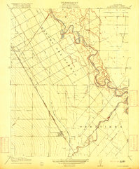
 1915 Westport1915 Print · USGSThe Stanislaus County plains south of Modesto appear here as a patchwork of irrigation canals and early school districts before the Great War. Genealogists and local historians can trace the foundations of rural life at Westport Church, Shiloh School, and along the banks of the Tuolumne River.
 - 1916 Map of Crows Landing
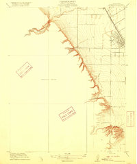
 1916 Crows Landing1916 Print · USGSStanislaus County was entering a new era of irrigated agriculture in the mid-1910s as traditional ranching gave way to rail-side settlements. Researchers can trace the early growth of Patterson and Crows Landing along the Southern Pacific and the complex Main Canal system.2 unique versions available
 - 1916 Map of Patterson
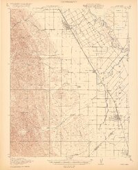
 1916 Patterson1916 Print · USGSStanislaus County agriculture and rail transport meet the Diablo Range foothills in this early twentieth-century survey. Trace the town grid of Patterson and find local landmarks like Haight School and the Southern Pacific rail line.3 unique versions available
 - 1919 Map of Orestimba
 1919 Orestimba1919 Print · USGSThe western San Joaquin Valley comes alive in the years following the Great War, showing a landscape defined by the growth of irrigation and rail. Genealogists and historians can locate early homesteads near Patterson, rural schoolhouses like Canal School, and the extensive MAIN CANAL system.3 unique versions available
End of results
Showing maps 1-4 of 4
Top cities near Patterson
- Modesto historical maps
- Ceres historical maps
- Newman historical maps
- Gustine historical maps
- Riverdale Park historical maps
- Riverdale Park historical maps
See more
Frequently asked questions
- What are the different types of historical maps available for Patterson?
- What is the oldest map of Patterson?
- Where can I purchase historical maps of Patterson for my home or office?
- Where can I download high-res historical maps of Patterson?
- Are there historical topographic maps available for Patterson?
- Is there historical aerial imagery available for Patterson?
- Where are historical maps of Patterson sourced from?