1980s Maps of Mineral, California
Explore 5 historic maps of Mineral from the 1980s. These maps offer a rare glimpse into what life looked like during the 1980s — showing old roads, neighborhoods, homes, and landmarks that have changed or disappeared over time.
Whether you're researching your family's past, planning a metal detecting trip, or studying how Mineral's landscape evolved across the 1980s, these high-resolution maps are a powerful tool for exploring the history of this region.
- Focus on a specific era: All maps on this page are from the 1980s, giving you a focused view of this time period.
- See what’s changed: Compare century-old streets, trails, and buildings to today's modern landscape using overlays and satellite layers.
- Research with precision: Use these maps for genealogy, historical research, land use analysis, or educational projects.
- View, download, or print: Maps are fully viewable online in high resolution, and can be downloaded or printed for your own records.
Start exploring Mineral's history through authentic maps from the 1980s. This is your window into the past.
Mineral, CA maps
(5)- 1985 Map of Lyonsville
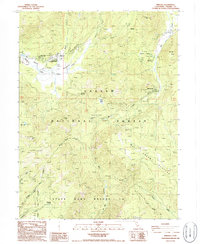
 1985 Lyonsville1985 Print · USGSTehama County's high timber country is captured here during the mid-eighties, showing the rugged ridge-and-canyon systems of the western Cascades. Researchers can trace the remote outposts of Lyonsville and Lassen Lodge or locate family landmarks like Wible Spring and Deadhorse Falls.
 - 1985 Map of Grays Peak
 1985 Grays Peak1985 Print · USGSLassen National Forest and the Shasta-Tehama county line are documented in the mid-1980s, showcasing a landscape of high ridges and deep gulches. Researchers can identify historic recreation sites and remote landmarks like Camp Forward, Grays Peak, and Sugarpine Flat.
 - 1985 Map of Lassen Peak
 1985 Lassen Peak1985 Print · USGSGeothermal activity and high-altitude lakes characterize this mid-1980s look at the Tehama County backcountry. Trace the trails leading to active thermal areas like Sulphur Works and Bumpass Hell Mud Pots, or locate recreation spots at Dry Lake Campground.
 - 1986 Map of Mineral
 1986 Mineral1986 Print · USGSThe high Sierra forests of Tehama County are captured here in the 1980s, centered on the Lassen Volcanic Nat Park Headquarters. Researchers can locate historic forest stations and unique landmarks like Mineral Meadows, the Hole in the Ground, and the small settlement of Mill Creek.2 unique versions available
 - 1989 Map of Lake Almanor, 1990 Print
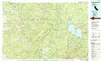 1989 Lake Almanor1990 Print · USGSUpper Plumas and Tehama counties appear here in the late eighties as a landscape of timber, volcanic peaks, and high-country reservoirs. Genealogists and historians can trace settlements from Chester and Westwood to mountain outposts like Mineral and Jonesville.2 unique versions available
End of results
Showing maps 1-5 of 5
Top neighborhoods of Mineral
Frequently asked questions
- What are the different types of historical maps available for Mineral?
- What is the oldest map of Mineral?
- Where can I purchase historical maps of Mineral for my home or office?
- Where can I download high-res historical maps of Mineral?
- Are there historical topographic maps available for Mineral?
- Is there historical aerial imagery available for Mineral?
- Where are historical maps of Mineral sourced from?