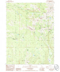
1985 Map of Lassen Peak
USGS Topo · Published 1985About this map
Lassen Volcanic National Park dominates this 1985 survey, revealing a landscape defined by its geothermal activity and high-altitude terrain. The map documents numerous thermal features concentrated in the central-east, including the famed Sulphur Works, Bumpass Hell Mud Pots, and several steam-emitting Fumaroles. These landmarks are situated along West Sulphur Creek and Sulphur Creek, illustrating the intersection of active geology with the park's hydrological system.
Find a feature on this map
65 named features on this map. Tap any name to fly to it.
Don’t see what you’re looking for? This feature index may not catch every label — zoom into the map to look around manually.
Map Details
Editions of this 1985 Lassen Peak Map
This is the sole edition of this map. No revisions or reprints were ever made.
Other maps of this area

1886 · Lassen Peak
USGS Topo · 1:250,000

1892 · Lassen Peak
USGS Topo · 1:250,000

1894 · Lassen Peak
USGS Topo · 1:250,000

1935 · Burney
USGS Topo · 1:96,000

1935 · Paynes Creek
USGS Topo · 1:96,000

1939 · Burney
USGS Topo · 1:125,000

1939 · Halls Flat
USGS Topo · 1:125,000

1941 · Mineral
USGS Topo · 1:125,000

1955 · Westwood
USGS Topo · 1:250,000

1956 · Lassen Peak
USGS Topo · 1:62,500