1935 Map of Paynes Creek
USGS Topo · Published 1935About this map
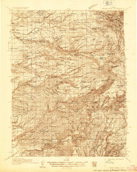
The Shasta Co Tehama Co boundary line cuts across a landscape defined by the hydro-electric and timber industries of the mid-1930s. Infrastructure for power generation is prominent along the forks of Battle Creek, including the Volta Power House, Inskip Power House, and South Power House. These facilities, coupled with the presence of Forward Mill Camp Forward and Lyonsville, reflect an era when the canyons were active corridors for utility development and logging operations.
Find a feature on this map
126 named features on this map. Tap any name to fly to it.
Don’t see what you’re looking for? This feature index may not catch every label — zoom into the map to look around manually.
Map Details
Editions of this 1935 Paynes Creek Map
This is the sole edition of this map. No revisions or reprints were ever made.
Historical Maps of Mineral Through Time
1 maps found