Old Maps of Three Rivers, California for Hiking & Exploration
Hike through history with 38 historic maps of Three Rivers. Explore old trails, ghost towns, and forgotten backroads — perfect for outdoor adventurers and local explorers.
- Rediscover forgotten places: Map out old mining camps, roads, and footpaths that no longer exist on modern maps.
- Layer with modern tools: Combine with LiDAR or satellite views to plan hikes through historical terrain.
- Made for exploration: Popular among hikers, overlanders, and local history lovers.
Use these maps to find adventure and explore the hidden past of Three Rivers.
Three Rivers, CA maps
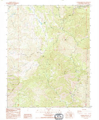
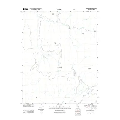
(38)- 1903 Map of Tehipite, 1953 Print
 1903 Tehipite1953 Print · USGSThe High Sierra backcountry in the early twentieth century shows a landscape of early timber works and newly formed preserves. Trace family roots and old park outposts near Hume, Kanawyers, and the historic Abbott Mill.
 - 1904 Map of Kaweah
 1904 Kaweah1904 Print · USGSThe southern Sierra Nevada comes alive in this 1904 survey, documenting the early development of Sequoia and the surrounding valleys. Researchers can trace historic irrigation networks like the Whitney Ditch and find early timber sites at Atwells Mill and Dillon Mill.
 - 1905 Map of Tehipite
 1905 Tehipite1905 Print · USGSThe High Sierra at the start of the twentieth century shows a landscape where early tourism and timber industry met. Researchers can trace the original footprint of General Grant National Park and find old lumber sites like Millwood and Harts Sawmill.8 unique versions available
 - 1909 Map of Kaweah
 1909 Kaweah1909 Print · USGSThe High Sierra and its foothills come to life in this early twentieth-century survey of the western parklands and river valleys. Genealogists and researchers can trace the early homesteads and irrigation systems of Springville, Three Rivers, and the Tule River Indian Res.7 unique versions available
 - 1937 Map of Kaweah, 1955 Print
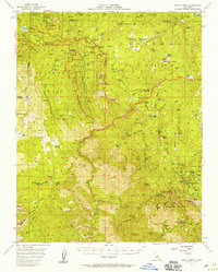
 1937 Kaweah1955 Print · USGSHigh Sierra peaks and the Kaweah foothills are captured here in the late 1930s as tourism and resource management shaped the landscape. Genealogists and historians can trace the early layout of Three Rivers, the remote outposts at Mineral King, and the boundaries of the Tule River Indian Reservation.
 - 1948 Map of Fresno
 1948 Fresno1948 Print · USGSThe San Joaquin Valley and the High Sierra met during a period of rapid post-war growth and industrial expansion. Genealogists and researchers can trace family lines through small rail towns like Calwa City, find early aviation sites at Fresno-Chandler, or locate the Fresno Copper Mine.
 - 1955 Map of Fresno
 1955 Fresno1955 Print · USGSThe Central Valley and High Sierra meet in this mid-fifties study of California’s agricultural and wilderness heart. Researchers can trace the rail-side growth of Sanger, Selma, and Reedley or locate high-altitude landmarks like Mt Whitney and Hume Lake.
 - 1956 Map of Fresno
 1956 Fresno1956 Print · USGSThe Central Valley and High Sierra meet in this mid-fifties survey of a rapidly developing California interior. Researchers can trace the rail-and-water networks of Visalia, the footprint of Tulare Lake, and the remote heights of Sequoia National Park.
 - 1956 Map of Giant Forest, 1958 Print
 1956 Giant Forest1958 Print · USGSThe High Sierra groves were transitioning into a major recreational destination in the late 1950s. Genealogists and historians can trace the early park infrastructure at Colony Mill Ranger Station, find the small community of Wilsonia, and locate the iconic General Sherman Tree.4 unique versions available
 - 1957 Map of Kaweah, 1958 Print
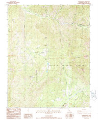
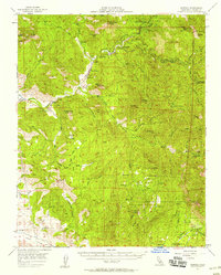 1957 Kaweah1958 Print · USGSIn the Sierra Nevada foothills during the late 1950s, Three Rivers sits at the gateway to the high country. Researchers can trace the early layout of Ash Mountain Natl Park Hdqrs, locate Blue Ridge School, and find remote outposts like Milk Ranch.5 unique versions available
 - 1958 Map of Fresno
 1958 Fresno1958 Print · USGSThe Central Valley and High Sierra meet in this mid-century survey of the California heartland. Researchers can trace the rail-and-road network connecting Fresno and Visalia or locate high-country landmarks like Mt Whitney and Sequoia National Park.
 - 1960 Map of Fresno
 1960 Fresno1960 Print · USGSThe San Joaquin Valley's mid-century agricultural boom meets the high peaks of the Sierra Nevada in this detailed survey. Genealogists and historians can trace the rail-driven growth of Fresno, Tulare, and Visalia or locate family roots in smaller towns like Raisin City and Calwa City.2 unique versions available
 - 1962 Map of Fresno, 1968 Print
 1962 Fresno1968 Print · USGSThe Central Valley and High Sierra meet in this mid-century survey, capturing the region's massive irrigation systems and mountain wilderness. Researchers can trace the rail corridors of the Southern Pacific and locate landmarks like the Tulare Lake Bed and Mount Whitney.3 unique versions available
 - 1966 Map of Fresno
 1966 Fresno1966 Print · USGSCentral California in the mid-1960s showcases a high-production agricultural valley rising into the granite peaks of the High Sierra. Researchers can trace irrigation networks, rail spurs like the Southern Pacific, and landmarks from Mount Whitney to the Lemoore Naval Air Station.
 - 1978 Map of Mount Whitney, 1992 Print
 1978 Mount Whitney1992 Print · USGSThe high Sierra and Owens Valley meet in the late 1970s, showcasing the transition from alpine wilderness to valley floor settlements. Trace historical mining operations like the Green Monster Mine or find early routes to the summit near Whitney Portal.
 - 1978 Map of Three Rivers, 1994 Print
 1978 Three Rivers1994 Print · USGSTulare County's dramatic ascent from the San Joaquin Valley to the High Sierra is captured here during the late seventies. Researchers can trace the layout of the Tule River Indian Reservation and locate early mountain outposts like Camp Nelson or Globe.2 unique versions available
 - 1986 Map of Dennison Peak
 1986 Dennison Peak1986 Print · USGSThe Tulare County high country comes into focus in the mid-1980s, bridging the gap between park and forest lands. Researchers can trace historic mountain sites like Peck Cabin, the Good Hope Mines, and subterranean landmarks such as Clough Cave.3 unique versions available
 - 1986 Map of Kaweah, 1987 Print
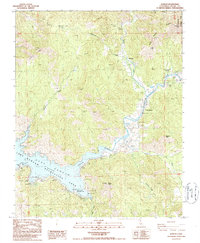 1986 Kaweah1987 Print · USGSThe foothills of the Sierra Nevada meet the reservoir waters in the mid-1980s, capturing the community of Three Rivers and the gateway to Sequoia National Park. Researchers can trace old family landmarks at Mankins Flat, locate a hillside Cem, or study the shoreline at Lake Kaweah.2 unique versions available
 - 1987 Map of Shadequarter Mtn
 1987 Shadequarter Mtn1987 Print · USGSTulare County's high Sierra foothills are mapped here in the late eighties, showing the meeting of major national parks and forests. Researchers can trace remote history through the Advance Ruins, the Shadequarter Lookout, and old 4WD tracks.
 - 1987 Map of Case Mountain
 1987 Case Mountain1987 Print · USGSThe gateway to the high Sierras comes into focus during the late 1980s, highlighting the administrative and natural landscape of Tulare County. Researchers can trace forest management sites like Lookout Point Ranger Station or the protected Sierra Redwoods Grove.2 unique versions available
 - 1993 Map of Shadequarter Mtn, 1995 Print
 1993 Shadequarter Mtn1995 Print · USGSThe Tulare County high country comes into focus in the early 1990s as the Sierra wilderness meets the edges of national park boundaries. Researchers can locate the Shadequarter Lookout, trace the Advance Ruins near the river, and explore the drainage of Eshom Creek.
 - 2012 Map of Case Mountain, 2012 Print
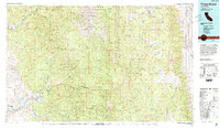
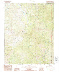
 2012 Case Mountain2012 Print · USGSCovers Three Rivers, including Oak Grove, Hammond, and other nearby areas
 - 2012 Map of Kaweah, 2012 Print
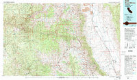
 2012 Kaweah2012 Print · USGSCovers Three Rivers, including Kaweah, Tulare County, and other nearby areas
 - 2012 Map of Shadequarter Mountain, 2012 Print
 2012 Shadequarter Mountain2012 Print · USGSCovers Three Rivers, including Advance, Tulare County, and other nearby areas
 - 2012 Map of Dennison Peak, 2012 Print
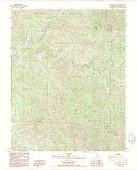
 2012 Dennison Peak2012 Print · USGSCovers Three Rivers, including Tulare County, United States, and other nearby areas
Showing maps 1-25 of 38
Top cities near Three Rivers
Top neighborhoods of Three Rivers
Frequently asked questions
- What are the different types of historical maps available for Three Rivers?
- What is the oldest map of Three Rivers?
- Where can I purchase historical maps of Three Rivers for my home or office?
- Where can I download high-res historical maps of Three Rivers?
- Are there historical topographic maps available for Three Rivers?
- Is there historical aerial imagery available for Three Rivers?
- Where are historical maps of Three Rivers sourced from?